Oklahoma Social Studies 6.C.3
Standard Cluster
Identify the characteristics, distribution, and demographic patterns of human populations and systems of the Western Hemisphere. Identify on a political map the major countries and population centers of each region, describing urban, rural, suburban, and metropolitan settlement patterns. Analyze how the characteristics of culture impact people and places. Identify and describe cultural traits (e.g., language, ethnic heritage, religion, traditions, the arts) which are unique to a people and region. Explain how culture provides individuals with a sense of identity and how it is transferred from one generation to the next. Compare major cultural groups of the Western Hemisphere (e.g., American Indian, Indigenous peoples of Canada and Amazonia, French-speaking Canadians, Hispanic Latin America). Define cultural diffusion by describing how cultural characteristics spread and impact contemporary regions (e.g., entertainment, fast foods, social media’s rapid spread of ideas, wide use of the smartphone). Examine the impact of geography on migration and population distribution. Define push factors of migration (e.g., instability, conflict, natural disasters) using historic or contemporary examples (e.g., European colonization, political or religious asylum seekers). Identify and provide examples of pull factors of migration (e.g., economic opportunity, religious freedom, family ties, education). Describe the ethnic heritage of Indigenous cultures of the Western Hemisphere. Explain that various complex societies, economic, and political systems developed on the North and South American continents, each known for unique achievements and contributions prior to the arrival of Europeans. Compare the cultures of Native peoples of the United States of America and Canada (e.g., Ancestral Puebloan, Mississippian, First Nations, Inuit, Metis). Explain how the Olmec and Maya adapted to and modified their environment to develop advanced civilizations in Mesoamerica, featuring advancements in science, architecture, the development of a writing system, and regional trade. Describe how the Aztec conquest of other Indigenous peoples created extensive trade networks and wealth. Explain how the Inca were able to control an expansive empire in the Andes, developing a strong central government and innovations in agriculture. Describe the cultural interactions between American Indian cultures and European settlers which impacted the heritage and history of major regions of the Western Hemisphere. Identify examples of cultural diffusion (e.g., Columbian Exchange: availability of new commodities and technology; assimilation of American Indian into colonial societies). Describe the impact of English and French settlement of North America on cultural characteristics such as language, customs, and principles of self-government. Examine Spanish colonialism of Latin America and its influence on language, religion, and customs, including the practices of privateering and mercantilism. Explain the effects of plantation agriculture and the importation of enslaved labor on the economic development and cultural heritage of regions. Identify the major regions of the Western Hemisphere that received enslaved Africans and explain how European imperial expansion, colonial labor demands, and Atlantic trade networks produced the trans-Atlantic slave trade.
Oklahoma Academic Standards for Social Studies (2026)
Cluster contents
Standards in This Cluster
6.C.3 is a cluster heading. These are the individual standards under it.
- 6.C.3.1
Identify on a political map the major countries and population centers of each region, describing urban, rural, suburban, and metropolitan settlement patterns.
- 6.C.3.2
Analyze how the characteristics of culture impact people and places.
- 6.C.3.2.A
Identify and describe cultural traits (e.g., language, ethnic heritage, religion, traditions, the arts) which are unique to a people and region.
- 6.C.3.2.B
Explain how culture provides individuals with a sense of identity and how it is transferred from one generation to the next.
- 6.C.3.2.C
Compare major cultural groups of the Western Hemisphere (e.g., American Indian, Indigenous peoples of Canada and Amazonia, French-speaking Canadians, Hispanic L...
- 6.C.3.3
Define cultural diffusion by describing how cultural characteristics spread and impact contemporary regions (e.g., entertainment, fast foods, social media’s rap...
- 6.C.3.4
Examine the impact of geography on migration and population distribution.
- 6.C.3.4.A
Define push factors of migration (e.g., instability, conflict, natural disasters) using historic or contemporary examples (e.g., European colonization, politica...
- 6.C.3.4.B
Identify and provide examples of pull factors of migration (e.g., economic opportunity, religious freedom, family ties, education).
- 6.C.3.5
Describe the ethnic heritage of Indigenous cultures of the Western Hemisphere.
- 6.C.3.5.A
Explain that various complex societies, economic, and political systems developed on the North and South American continents, each known for unique achievements...
- 6.C.3.5.B
Compare the cultures of Native peoples of the United States of America and Canada (e.g., Ancestral Puebloan, Mississippian, First Nations, Inuit, Metis).
- 6.C.3.5.C
Explain how the Olmec and Maya adapted to and modified their environment to develop advanced civilizations in Mesoamerica, featuring advancements in science, ar...
- 6.C.3.5.D
Describe how the Aztec conquest of other Indigenous peoples created extensive trade networks and wealth.
- 6.C.3.5.E
Explain how the Inca were able to control an expansive empire in the Andes, developing a strong central government and innovations in agriculture.
- 6.C.3.6
Describe the cultural interactions between American Indian cultures and European settlers which impacted the heritage and history of major regions of the Wester...
- 6.C.3.6.A
Identify examples of cultural diffusion (e.g., Columbian Exchange: availability of new commodities and technology; assimilation of American Indian into colonial...
- 6.C.3.6.B
Describe the impact of English and French settlement of North America on cultural characteristics such as language, customs, and principles of self-government.
- 6.C.3.6.C
Examine Spanish colonialism of Latin America and its influence on language, religion, and customs, including the practices of privateering and mercantilism.
- 6.C.3.6.D
Explain the effects of plantation agriculture and the importation of enslaved labor on the economic development and cultural heritage of regions.
- 6.C.3.6.E
Identify the major regions of the Western Hemisphere that received enslaved Africans and explain how European imperial expansion, colonial labor demands, and At...
Teacher's field guide
What This Cluster Means
What Students Need to Do
- Students locate major countries and population centers on maps and describe urban, suburban, rural, and metropolitan areas. They compare Indigenous societies, explain how culture passes between generations, and trace migration and cultural diffusion. They explain how geography, colonization, and the Atlantic slave trade changed populations and places.
What Mastery Looks Like
- Students label Canada, Mexico, Brazil, Mexico City, and São Paulo on a map and distinguish city centers from suburbs and rural areas. They compare Maya writing with Inca farming and explain how geography shaped each. They use examples to explain a migration push factor, a pull factor, and a lasting effect of colonization.
Common Misconceptions
- Students may treat Indigenous peoples as one culture or assume their cultures disappeared after European arrival. They may confuse push factors with pull factors or describe the forced movement of enslaved Africans as a choice. They may think a metropolitan area includes only the city center.
How to Assess It
- Give students a map showing Mexico City and nearby rural towns, plus this sentence: “A family leaves a drought-stricken farm for city jobs.” Ask them to label the rural and urban locations and name the push and pull factors.
Lesson moves
Ways to Teach It
Lay tracing paper over a population map; mark Mexico City, São Paulo, the Andes, and Amazon Basin, then compare settlement density.
Compare a colonial New Spain map with a current Mexico language map; ask, “Which languages spread, and which Indigenous languages remain?”
Give pairs cards labeled Maya writing, Inca terraces, Aztec trade routes, and Inuit sea-ice travel; have them match each to a map location.
Map a chocolate bar’s cacao and sugar; connect Indigenous cacao cultivation to enslaved labor on Caribbean and Brazilian sugar plantations.
Free download
Printable 6.C.3 Worksheet
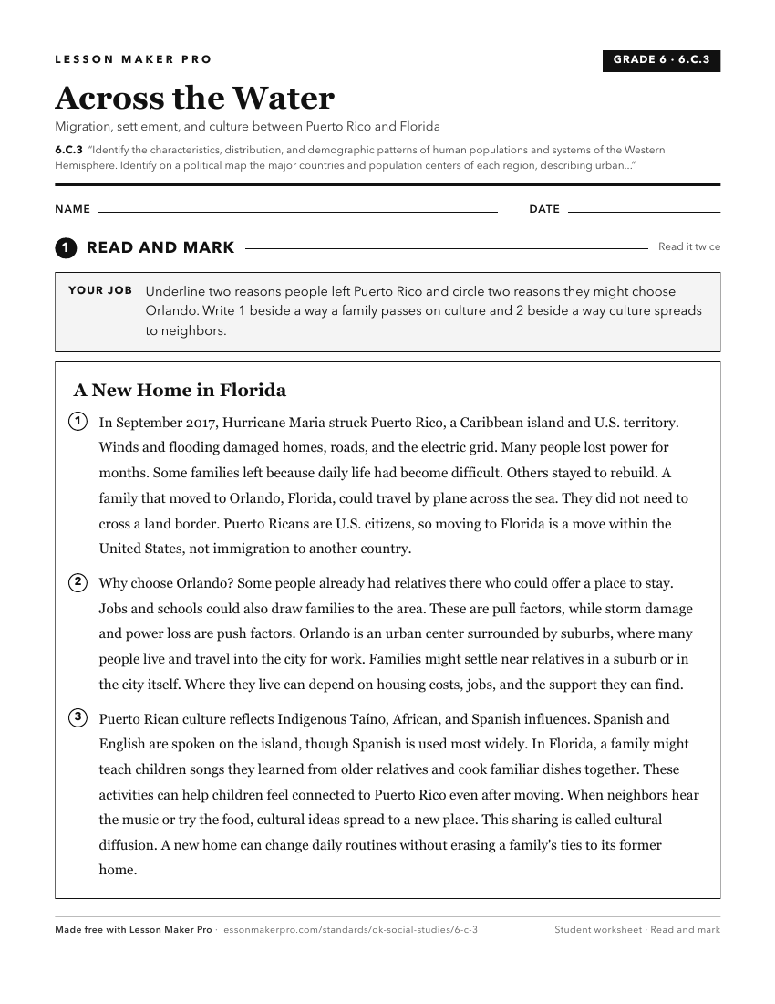
A ready-to-print activity worksheet aligned to 6.C.3, with an answer key for the teacher on its own page. No account needed.
PDF, US Letter, prints cleanly in black and white.
Download the worksheetKeep exploring
Related Standards
- 6.C.2
Analyze the physical systems of the major regions of the Western Hemisphere.
- 7.C.3
Identify the distribution and demographic patterns of human populations of the Eastern Hemisphere.
- 6.C.4
Analyze the interactions of humans and their environment in the Western Hemisphere.
- 6.C.7
Analyze the common characteristics of regions which create a sense of identity and unity, influencing the interactions among people and nations of the Western H...
Turn this cluster into a lesson
Grade, subject, topic, and the complete cluster are prefilled. Create one free, no account needed.
Also for this cluster:Make a WorksheetMake a QuizMake a Sub Lesson