Oklahoma Social Studies 6.C.1
Standard Cluster
Analyze data from a geographic perspective using the skills and tools of geography. Describe geography as a field of inquiry which answers “the why of where” by examining both physical and human geography using spatial thinking skills. Integrate visual information to organize understandings about the people and environments of the Western Hemisphere. Apply the concepts of scale, distance, and direction to explain the relative location of physical and human places using maps and globes; explain how various map projections are distorted. Use the system of latitude and longitude to identify the absolute location of a place on maps and globes. Use different types of maps, graphs, charts, and geographic tools, such as satellite imagery and Geographic Information System (GIS) technology to draw conclusions and make predictions from geographic data. Compare characteristics of major regions of the Western Hemisphere through the regular use of strategies, such as the Five Themes of Geography (location, place, human-environment-interaction, movement, regions) which utilize critical thinking about geographic concepts. Describe and analyze the role of geographic factors on events that impact the people and places of the Western Hemisphere, using both primary and secondary sources.
Oklahoma Academic Standards for Social Studies (2026)
Cluster contents
Standards in This Cluster
6.C.1 is a cluster heading. These are the individual standards under it.
- 6.C.1.1
Describe geography as a field of inquiry which answers “the why of where” by examining both physical and human geography using spatial thinking skills.
- 6.C.1.2
Integrate visual information to organize understandings about the people and environments of the Western Hemisphere.
- 6.C.1.2.A
Apply the concepts of scale, distance, and direction to explain the relative location of physical and human places using maps and globes; explain how various ma...
- 6.C.1.2.B
Use the system of latitude and longitude to identify the absolute location of a place on maps and globes.
- 6.C.1.2.C
Use different types of maps, graphs, charts, and geographic tools, such as satellite imagery and Geographic Information System (GIS) technology to draw conclusi...
- 6.C.1.3
Compare characteristics of major regions of the Western Hemisphere through the regular use of strategies, such as the Five Themes of Geography (location, place,...
- 6.C.1.4
Describe and analyze the role of geographic factors on events that impact the people and places of the Western Hemisphere, using both primary and secondary sour...
Teacher's field guide
What This Cluster Means
What Students Need to Do
- Students locate places in the Western Hemisphere with coordinates, direction, and map scale. They read maps, graphs, and satellite images to explain where people live and why. They compare regions and check how map projections can mislead.
What Mastery Looks Like
- A student plots a city from coordinates and uses a scale bar to estimate its distance from another city. They compare regions using landform and population maps. They use a firsthand account and a satellite image to explain a flood, and spot size distortion on a Mercator map.
Common Misconceptions
- Students may switch latitude and longitude or forget that west longitudes need a W. They may treat Greenland's size on a Mercator map as its actual size. They may assume a landform alone explains where people live, without checking other evidence.
How to Assess It
- Give students a gridded map of Mexico with elevation, population dots, and a scale bar. Ask for Mexico City's approximate coordinates, Veracruz's direction and distance from it, and one map-based reason people cluster near Mexico City.
Lesson moves
Ways to Teach It
Give pairs a globe, string, and scaled map to compare the distance and direction from Miami to Havana on each.
Show a Mercator map and a globe; ask, "Why does Greenland look bigger than South America on the map?"
Run a coordinate relay: call out 23° N, 82° W and 0°, 78° W for teams to find on a gridded map.
Show a Caribbean hurricane track map and satellite image; have students mark two coastal cities at risk and explain why.
Free download
Printable 6.C.1 Worksheet
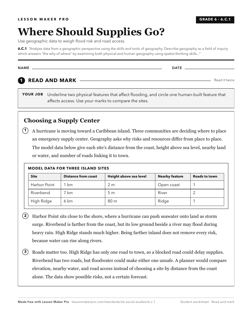
A ready-to-print activity worksheet aligned to 6.C.1, with an answer key for the teacher on its own page. No account needed.
PDF, US Letter, prints cleanly in black and white.
Download the worksheetKeep exploring
Related Standards
- WG.C.1.4
Utilize geographic technologies and geographical data including census data and imagery to draw conclusions about the influence of geography on the world’s peop...
- 4.C.2.1
Use geographic tools to acquire and process information from a spatial perspective.
- WG.C.1.2
Utilize geographic skills to understand and analyze the spatial organization of people, places, and environments on the Earth’s surface.
- 7.C.1
The 7th Grade version of this standard.
Turn this cluster into a lesson
Grade, subject, topic, and the complete cluster are prefilled. Create one free, no account needed.
Also for this cluster:Make a WorksheetMake a QuizMake a Sub Lesson