Oklahoma Social Studies WG.C.1.4
The Standard
- WG.C.1
- Use maps and other geographic representations, tools and technologies to acquire, process, and solve problems from a spatial perspective.
Utilize geographic technologies and geographical data including census data and imagery to draw conclusions about the influence of geography on the world’s people and places.
Oklahoma Academic Standards for Social Studies (2026) · WG.C.1
Teacher's field guide
What This Standard Means
What Students Need to Do
- Students read census maps and satellite images together. They identify where people live and explain how features such as rivers or mountains may help shape those patterns.
What Mastery Looks Like
- A student finds a population pattern and a geographic feature on maps of the same area. They use details from both maps to explain a possible connection without claiming the maps prove its cause.
Common Misconceptions
- Students may confuse population density with total population, or assume a satellite image shows how many people live in a building. They may treat a nearby river as the sole reason people settled there, ignoring roads or land use.
How to Assess It
- Give students a census density map and satellite image of the same town. Ask: “Where is housing most concentrated, and which visible feature might help explain that pattern? Cite one detail from each source.”
Lesson moves
Ways to Teach It
Give pairs census density maps and satellite images of two local tracts; have them mark waterways, roads, and clusters of buildings.
Ask, “Would a river or a highway better explain this housing cluster?” Have students cite one map detail for each possibility.
Play map match: students pair four census density maps with four satellite images, then explain each match using building patterns.
Use floodplain, satellite, and census density maps to pick one neighborhood for a flood warning drill and explain the choice.
Free download
Printable WG.C.1.4 Worksheet
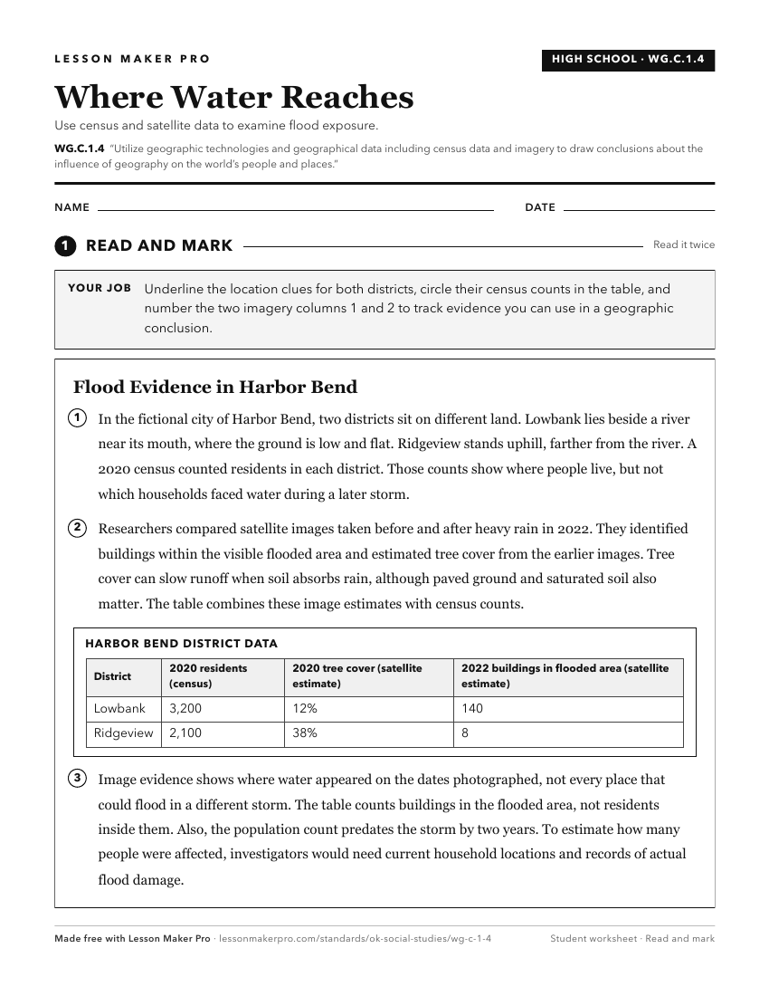
A ready-to-print activity worksheet aligned to WG.C.1.4, with an answer key for the teacher on its own page. No account needed.
PDF, US Letter, prints cleanly in black and white.
Download the worksheetKeep exploring
Related Standards
- 4.C.2.1.B
Use maps and other geographic representations (e.g., globes, charts, graphs) and geographic technologies to draw conclusions (e.g., settlement patterns, populat...
- 6.C.1
Analyze data from a geographic perspective using the skills and tools of geography.
- 6.C.1.2.C
Use different types of maps, graphs, charts, and geographic tools, such as satellite imagery and Geographic Information System (GIS) technology to draw conclusi...
- 7.C.1
Analyze data from a geographic perspective using the skills and tools of geography.
Turn this exact standard into a lesson
Grade, subject, topic, and the complete standard are prefilled. Create one free, no account needed.
Also for this standard:Make a WorksheetMake a QuizMake a Sub Lesson