Oklahoma Social Studies 4.C.2.1
Standard Cluster
- 4.C.2
- Apply the tools and concepts of geography to examine the physical and human geography of the United States of America.
Use geographic tools to acquire and process information from a spatial perspective. Use and describe various elements of maps (e.g., key/legend, scale, cardinal and intermediate directions) to examine the physical and human features of the nation. Use maps and other geographic representations (e.g., globes, charts, graphs) and geographic technologies to draw conclusions (e.g., settlement patterns, population trends, population density, relative location of natural resources to manufacturing centers). Use the system of latitude and longitude to identify the absolute location of physical and human features of the United States of America. Interpret aerial photographs, satellite images, and thematic maps to locate and identify physical and human features of the United States of America and North America. Analyze the human and physical characteristics of the United States of America using the Five Themes of Geography (location, place, human-environment-interaction, movement, region) as a strategy to organize and compare each major region of the United States of America.
Oklahoma Academic Standards for Social Studies (2026) · 4.C.2
Cluster contents
Standards in This Cluster
4.C.2.1 is a cluster heading. These are the individual standards under it.
- 4.C.2.1.A
Use and describe various elements of maps (e.g., key/legend, scale, cardinal and intermediate directions) to examine the physical and human features of the nati...
- 4.C.2.1.B
Use maps and other geographic representations (e.g., globes, charts, graphs) and geographic technologies to draw conclusions (e.g., settlement patterns, populat...
- 4.C.2.1.C
Use the system of latitude and longitude to identify the absolute location of physical and human features of the United States of America.
- 4.C.2.1.D
Interpret aerial photographs, satellite images, and thematic maps to locate and identify physical and human features of the United States of America and North A...
- 4.C.2.1.E
Analyze the human and physical characteristics of the United States of America using the Five Themes of Geography (location, place, human-environment-interactio...
Teacher's field guide
What This Cluster Means
What Students Need to Do
- Students use map keys, scales, directions, and coordinates to locate U.S. features. They compare population and resource maps, aerial photos, and satellite images to explain settlement and industry patterns. They describe regions by location, land, travel, and how people use the environment.
What Mastery Looks Like
- A student finds a city by latitude and longitude, then uses the map scale to estimate its distance from another city. They use map evidence to explain why cities or factories cluster in certain places. They compare two regions by climate, jobs, travel, and land use.
Common Misconceptions
- Students often reverse latitude and longitude or skip the map key. They may mistake a dense cluster of dots for a large land area. They may assume factories must sit right next to the resources they use.
How to Assess It
- Give students a gridded U.S. population map with a key and compass rose. Ask: "Mark 40°N, 75°W, name a city northeast of it, and describe the population shading nearby."
Lesson moves
Ways to Teach It
Give pairs a paper U.S. map, string, and ruler; have them use the scale and compass rose to plan a route from Denver to Chicago.
Show maps of the Great Plains and Northeast; ask, "How do land, jobs, and travel differ, and how have people changed each region?"
Play coordinate bingo with a gridded U.S. map: call out coordinates, and have students mark the matching squares.
Compare a satellite image of a nearby town with a road map; have students identify buildings, open land, and a route people travel.
Free download
Printable 4.C.2.1 Worksheet
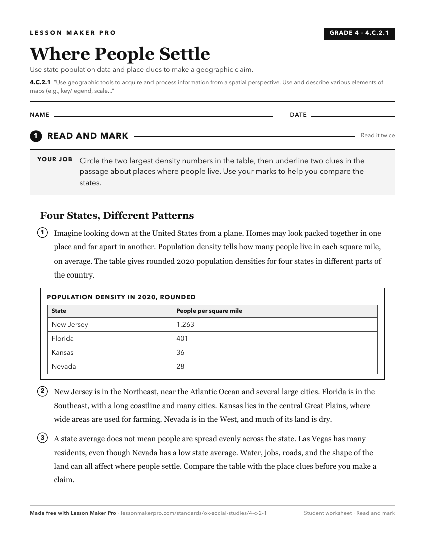
A ready-to-print activity worksheet aligned to 4.C.2.1, with an answer key for the teacher on its own page. No account needed.
PDF, US Letter, prints cleanly in black and white.
Download the worksheetKeep exploring
Related Standards
- 6.C.1
Analyze data from a geographic perspective using the skills and tools of geography.
- WG.C.1
Use maps and other geographic representations, tools and technologies to acquire, process, and solve problems from a spatial perspective.
- WG.C.1.2
Utilize geographic skills to understand and analyze the spatial organization of people, places, and environments on the Earth’s surface.
- 7.C.1
Analyze data from a geographic perspective using the skills and tools of geography.
Turn this cluster into a lesson
Grade, subject, topic, and the complete cluster are prefilled. Create one free, no account needed.
Also for this cluster:Make a WorksheetMake a QuizMake a Sub Lesson