Oklahoma Social Studies 4.C.2.1.C
The Standard
- 4.C.2
- Apply the tools and concepts of geography to examine the physical and human geography of the United States of America.
- 4.C.2.1
- Use geographic tools to acquire and process information from a spatial perspective.
Use the system of latitude and longitude to identify the absolute location of physical and human features of the United States of America.
Oklahoma Academic Standards for Social Studies (2026) · 4.C.2.1
Teacher's field guide
What This Standard Means
What Students Need to Do
- Students read latitude and longitude on a U.S. map. They use coordinates to find landforms and places people built, such as the Grand Canyon and Denver. They also write coordinates for places marked on a map.
What Mastery Looks Like
- A student can find the Grand Canyon area near 36°N, 112°W on a gridded map. They can give Denver’s approximate location as 40°N, 105°W and identify which number is latitude.
Common Misconceptions
- Students may swap latitude and longitude or use N for both coordinates. Some find the right latitude line but forget to follow it to the longitude line.
How to Assess It
- Give students a U.S. map with one-degree gridlines and labels for Denver and the Grand Canyon. Ask them to plot 36°N, 112°W, name the nearby feature, and write Denver’s approximate coordinates.
Lesson moves
Ways to Teach It
Lay a clear grid over a U.S. map, then trace the latitude and longitude lines that meet near Denver and the Grand Canyon.
Ask partners to explain why 36°N, 112°W and 36°N, 105°W mark different places.
Play coordinate bingo: call 40°N, 105°W, and have students find the point on a gridded map before covering Denver.
Right-click a local hospital on Google Maps, copy its coordinates, and have a partner search those coordinates to check the location.
Free download
Printable 4.C.2.1.C Worksheet
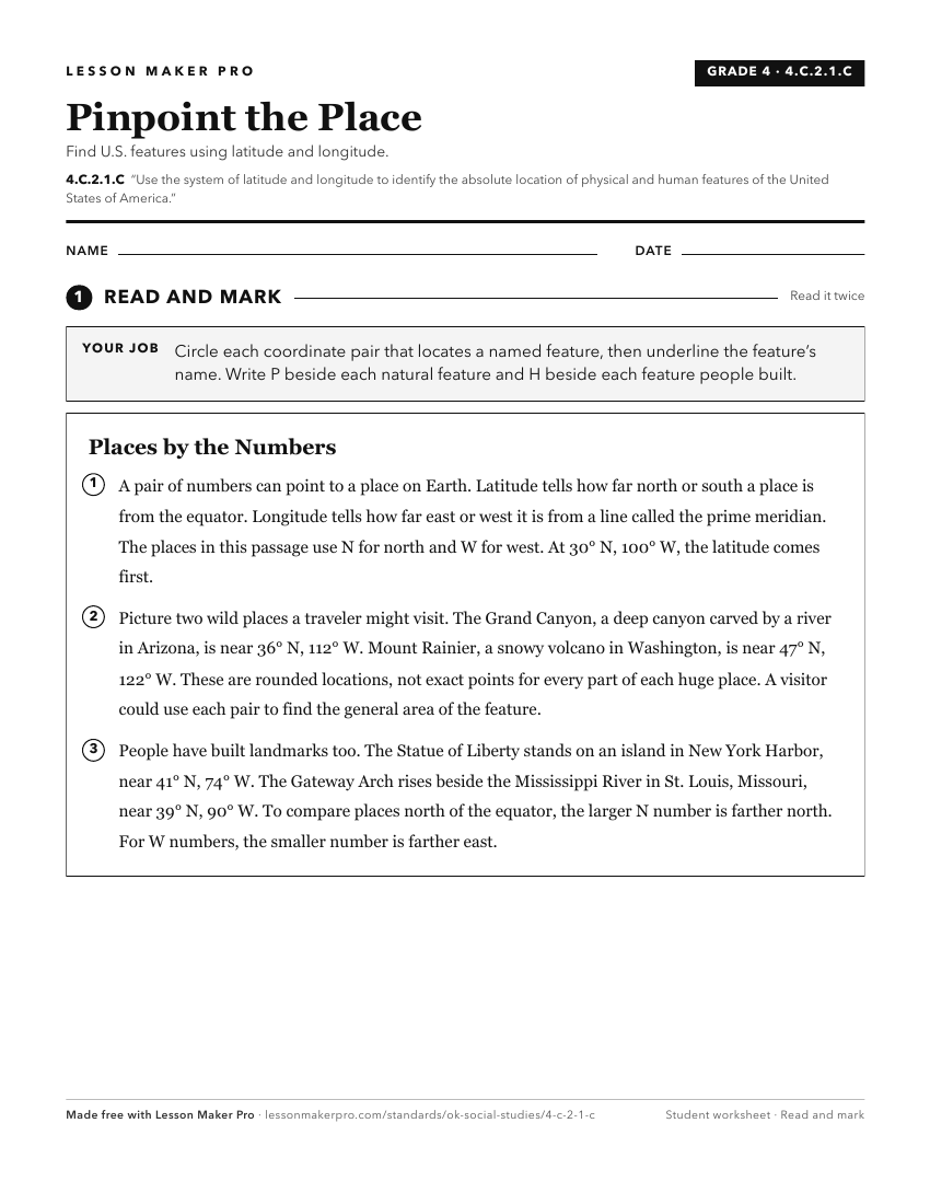
A ready-to-print activity worksheet aligned to 4.C.2.1.C, with an answer key for the teacher on its own page. No account needed.
PDF, US Letter, prints cleanly in black and white.
Download the worksheetKeep exploring
Related Standards
- 4.C.2.1.D
Interpret aerial photographs, satellite images, and thematic maps to locate and identify physical and human features of the United States of America and North A...
- 6.C.1.2.B
Use the system of latitude and longitude to identify the absolute location of a place on maps and globes.
- 4.C.2.2.A
Identify the location and the physical characteristics of the major landforms and bodies of water in the United States of America.
- 4.C.2
Apply the tools and concepts of geography to examine the physical and human geography of the United States of America.
Turn this exact standard into a lesson
Grade, subject, topic, and the complete standard are prefilled. Create one free, no account needed.
Also for this standard:Make a WorksheetMake a QuizMake a Sub Lesson