Florida SS.8.A.4
Florida Standard (Benchmark Cluster)
Demonstrate an understanding of the domestic and international causes, course, and consequences of westward expansion.
Florida Next Generation Sunshine State Standards for Social Studies
Cluster contents
Benchmarks in This Standard
SS.8.A.4 is a Florida social studies standard. These are the benchmarks under it.
- SS.8.A.4.1
Examine the causes, course, and consequences of United States westward expansion and its growing diplomatic assertiveness (i.e., War of 1812, Convention of 1818...
- SS.8.A.4.2
Describe the debate surrounding the spread of slavery into western territories and Florida.
- SS.8.A.4.3
Examine the experiences and perspectives of significant individuals and groups during this era of American History.
- SS.8.A.4.4
Discuss the impact of westward expansion on cultural practices and migration patterns of Native Americans, African slave populations, and other minority groups.
- SS.8.A.4.5
Explain the causes, course, and consequences of the 19th century transportation revolution on the growth of the nation's economy.
- SS.8.A.4.6
Identify technological improvements (including inventions and inventors) that contributed to industrial growth.
- SS.8.A.4.7
Explain the causes, course, and consequences (e.g., industrial growth, subsequent effect on children and women) of New England's textile industry.
- SS.8.A.4.8
Describe the influence of individuals on social and political developments of this era in American History.
- SS.8.A.4.9
Analyze the causes, course, and consequences of the Second Great Awakening on social reform movements.
- SS.8.A.4.10
Analyze the impact of technological advancements on the agricultural economy and slave labor.
- SS.8.A.4.11
Examine the aspects of slave culture including plantation life, resistance efforts, and the role of the slaves' spiritual system.
- SS.8.A.4.12
Examine the effects of the 1804 Haitian Revolution on the United States acquisition of the Louisiana Territory.
- SS.8.A.4.13
Explain the consequences of landmark Supreme Court decisions (McCulloch v. Maryland [1819], Gibbons v. Ogden [1824], Cherokee Nation v. Georgia [1831], and Worc...
- SS.8.A.4.14
Examine the causes, course, and consequences of the women's suffrage movement (e.g., 1848 Seneca Falls Convention, Declaration of Sentiments).
- SS.8.A.4.15
Examine the causes, course, and consequences of literature movements (e.g., Transcendentalism) significant to this era of American history.
- SS.8.A.4.16
Identify key ideas and influences of Jacksonian democracy.
- SS.8.A.4.17
Examine key events and peoples in Florida history as each impacts this era of American history.
- SS.8.A.4.18
Examine the experiences and perspectives of different ethnic, national, and religious groups in Florida, explaining their contributions to Florida's and America...
Teacher's field guide
What This Cluster Means
What Students Need to Do
- Students trace how land purchases from France, diplomacy with Britain, war with Mexico, migration, economic goals, and Manifest Destiny changed U.S. borders. They connect key events to effects on settlers, Native nations, Mexican residents, and the slavery debate. They support causal claims with maps, timelines, and primary sources.
What Mastery Looks Like
- A student can sequence major territorial gains and locate them on a map. The student can explain domestic and international factors behind expansion. The student can compare short-term and long-term effects on different groups.
Common Misconceptions
- Students often picture western lands as empty and expansion as peaceful or inevitable. They may treat Manifest Destiny as an event, or confuse Texas annexation with the Mexican Cession. They may overlook Native removal, changes for Mexican residents, and growing conflict over slavery.
How to Assess It
- Exit ticket: Explain one domestic cause and one international cause of the Mexican-American War, then name one consequence for each country or affected group.
Lesson moves
Ways to Teach It
Give pairs a blank map and event cards for the Louisiana Purchase, Texas annexation, Oregon settlement, and Mexican Cession to place and connect.
Write from one event's viewpoints: a migrant family, a Native leader, and a Mexican resident; explain who gained, who lost, and why.
Run a cause, event, consequence card sort, then have teams defend one disputed match with evidence from a source excerpt.
Compare a historic railroad route with a current interstate map, then discuss how transportation corridors still shape settlement, trade, and land use.
Free download
Printable SS.8.A.4 Worksheet
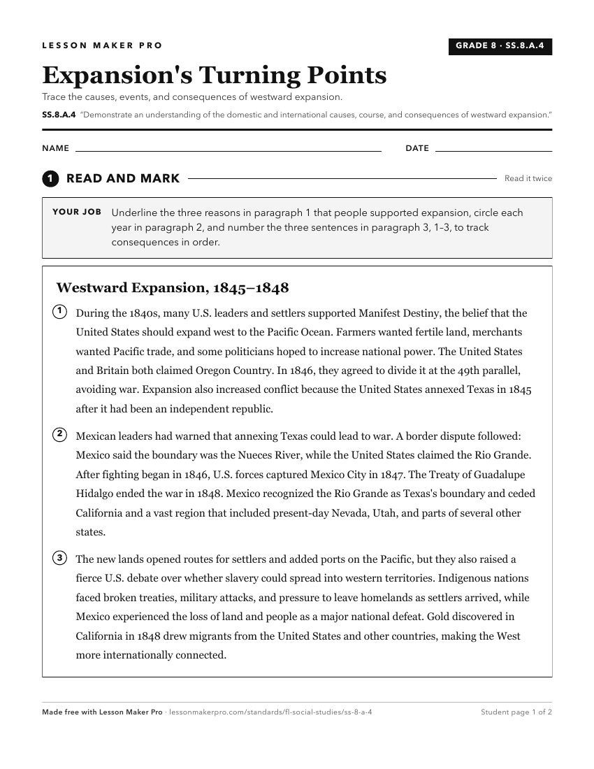
A ready-to-print activity worksheet aligned to SS.8.A.4, with an answer key for the teacher on its own page. No account needed.
PDF, US Letter, prints cleanly in black and white.
Download the worksheetKeep exploring
Related Standards
Turn this cluster into a lesson
Grade, subject, topic, and the complete cluster are prefilled. Create one free, no account needed.
Also for this cluster:Make a WorksheetMake a QuizMake a Sub Lesson