Texas TEKS 7.8
TEKS Knowledge Statement (Expectation Cluster)
Geography. The student understands the location and characteristics of places and regions of Texas. The student is expected to: locate and compare the Mountains and Basins, Great Plains, North Central Plains, and Coastal Plains regions; locate and compare places of importance in Texas in terms of physical and human characteristics such as major cities, waterways, natural and historic landmarks, political and cultural regions, and local points of interest; and analyze the effects of physical and human factors such as climate, weather, landforms, irrigation, transportation, and communication on major events in Texas.
Texas Essential Knowledge and Skills for Social Studies
Cluster contents
Student Expectations in This Statement
7.8 is a TEKS knowledge and skills statement. These are the student expectations under it.
- 7.8.A
locate and compare the Mountains and Basins, Great Plains, North Central Plains, and Coastal Plains regions
- 7.8.B
locate and compare places of importance in Texas in terms of physical and human characteristics such as major cities, waterways, natural and historic landmarks,...
- 7.8.C
analyze the effects of physical and human factors such as climate, weather, landforms, irrigation, transportation, and communication on major events in Texas.
Teacher's field guide
What This Cluster Means
What Students Need to Do
- Students locate Texas regions, cities, waterways, landmarks, and cultural areas on maps. They compare physical and human features, then explain how geography and infrastructure shaped Texas events.
What Mastery Looks Like
- Students accurately label the four major regions and support comparisons with specific evidence. They can connect an event to factors such as drought, terrain, irrigation, railroads, or communication systems.
Common Misconceptions
- Students often confuse the Great Plains with the North Central Plains or treat all of West Texas as desert. They may name a geographic factor without explaining how it influenced settlement, trade, conflict, or growth.
How to Assess It
- Give students a blank Texas map and ask them to label the four regions, one city, and one waterway. Then have them explain how one mapped feature affected a Texas event.
Lesson moves
Ways to Teach It
Build a raised Texas region map with clay, then add yarn rivers, city markers, and labels for landforms and climate.
Write a claim explaining which Texas region best supports farming, using evidence about rainfall, soil, landforms, and irrigation.
Play a map relay where teams place region, city, river, and landmark cards correctly, then state one comparison.
Plan a Texas road trip with three stops, naming the regions crossed and explaining how terrain and transportation affect the route.
Free download
Printable 7.8 Worksheet
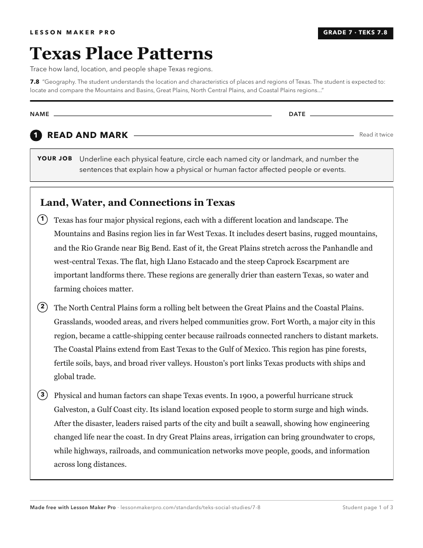
A ready-to-print activity worksheet aligned to 7.8, with an answer key for the teacher on its own page. No account needed.
PDF, US Letter, prints cleanly in black and white.
Download the worksheetKeep exploring
Related Standards
- 2.4
Geography. The student understands the location of places in their community, state, country, and the world. The student is expected to:
- 8.10
Geography. The student understands the location and characteristics of places and regions of the United States, past and present. The student is expected to:
- 5.6
Geography. The student understands places and regions in the United States. The student is expected to:
- 1.3
Geography. The student understands the relative location of places. The student is expected to:
Turn this cluster into a lesson
Grade, subject, topic, and the complete cluster are prefilled. Create one free, no account needed.
Also for this cluster:Make a WorksheetMake a QuizMake a Sub Lesson