Texas TEKS 5.6
TEKS Knowledge Statement (Expectation Cluster)
Geography. The student understands places and regions in the United States. The student is expected to: describe political and economic regions in the United States that result from patterns of human activity; describe regions in the United States based on physical characteristics such as landform, climate, and vegetation; locate on a map important political features such as the five largest cities by population in the United States and the 50 states; and create a map of important physical features such as the Appalachian Mountains, Great Lakes, Mississippi River, Great Plains, and Rocky Mountains.
Texas Essential Knowledge and Skills for Social Studies
Cluster contents
Student Expectations in This Statement
5.6 is a TEKS knowledge and skills statement. These are the student expectations under it.
- 5.6.A
describe political and economic regions in the United States that result from patterns of human activity
- 5.6.B
describe regions in the United States based on physical characteristics such as landform, climate, and vegetation
- 5.6.C
locate on a map important political features such as the five largest cities by population in the United States and the 50 states
- 5.6.D
create a map of important physical features such as the Appalachian Mountains, Great Lakes, Mississippi River, Great Plains, and Rocky Mountains.
Teacher's field guide
What This Cluster Means
What Students Need to Do
- Students explain how settlement, work, trade, and government boundaries shape political and economic regions. They compare regions using landforms, climate, and plant life. They locate every state and the five most populous cities, then map major land and water features.
What Mastery Looks Like
- Students sort places into physical, political, and economic regions and support each choice with map evidence. They accurately locate all states and the five most populous cities using current population data. Their maps place and label major mountains, plains, lakes, and rivers correctly.
Common Misconceptions
- Students often treat every region as an official boundary, even though physical and economic regions can overlap or have fuzzy edges. They may confuse landforms with climate or vegetation. They also mix up city population with metropolitan population or rank cities by land area.
How to Assess It
- Give each student a blank U.S. map with five states and two current top-five cities listed beside it. Students label those places and the Appalachians, Great Lakes, Mississippi River, Great Plains, and Rockies, then shade one economic region and justify its boundary.
Lesson moves
Ways to Teach It
On a blank U.S. map, use yarn, clay, and blue paper to build mountains, plains, lakes, and the Mississippi River.
Write: How can jobs, trade, settlement, and government boundaries make two regions different even when their land is similar?
Run a map relay where teams place state, major city, and physical feature cards in the correct locations.
Compare crop, climate, and landform maps, then explain why corn, citrus, or cattle production clusters in certain regions.
Free download
Printable 5.6 Worksheet
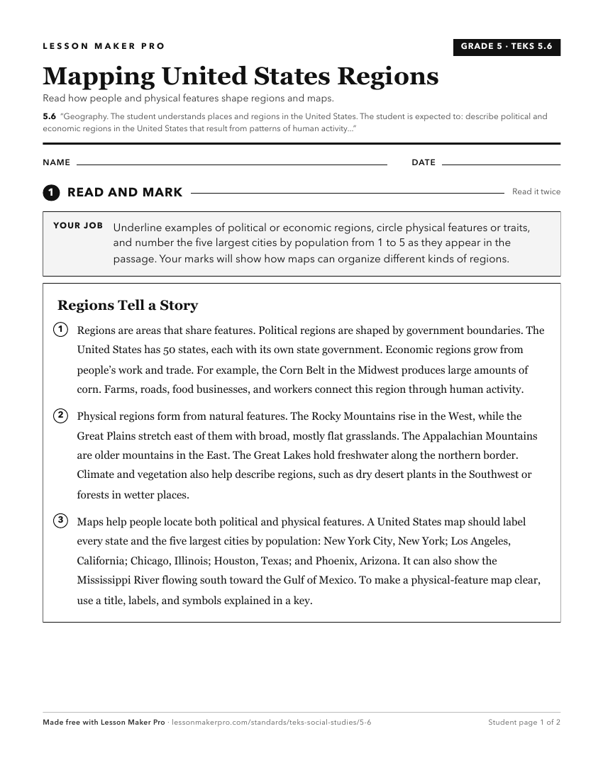
A ready-to-print activity worksheet aligned to 5.6, with an answer key for the teacher on its own page. No account needed.
PDF, US Letter, prints cleanly in black and white.
Download the worksheetKeep exploring
Related Standards
- 2.4
Geography. The student understands the location of places in their community, state, country, and the world. The student is expected to:
- 8.10
Geography. The student understands the location and characteristics of places and regions of the United States, past and present. The student is expected to:
- 4.6
Geography. The student understands the concept of regions. The student is expected to:
- 1.3
Geography. The student understands the relative location of places. The student is expected to:
Turn this cluster into a lesson
Grade, subject, topic, and the complete cluster are prefilled. Create one free, no account needed.
Also for this cluster:Make a WorksheetMake a QuizMake a Sub Lesson