Texas TEKS 5.6.C
The Standard
- 5.6
- Geography. The student understands places and regions in the United States. The student is expected to:
locate on a map important political features such as the five largest cities by population in the United States and the 50 states
Texas Essential Knowledge and Skills for Social Studies
Teacher's field guide
What This Standard Means
What Students Need to Do
- Students identify each state by its shape, name, and position on a United States map. They also place the five most populous cities in the correct states.
What Mastery Looks Like
- On an unlabeled map, students correctly label all 50 states. They place New York City, Los Angeles, Chicago, Houston, and Phoenix in reasonable locations.
Common Misconceptions
- Students may confuse Washington state with Washington, D.C., or place New York City as a separate state. They may mix up city population with metropolitan area population.
How to Assess It
- Give students a blank map and ask them to label 10 selected states and place dots for the five largest cities. Check state names and approximate locations.
Lesson moves
Ways to Teach It
Have pairs assemble a state puzzle, then place labeled counters on the five largest cities.
Ask students to write which regions contain the largest cities and suggest one geographic reason for the pattern.
Play map bingo using state shapes, state names, capitals, and clues about neighboring states.
Plan a pretend cross-country trip that visits each large city and list the states crossed between stops.
Free download
Printable 5.6.C Worksheet
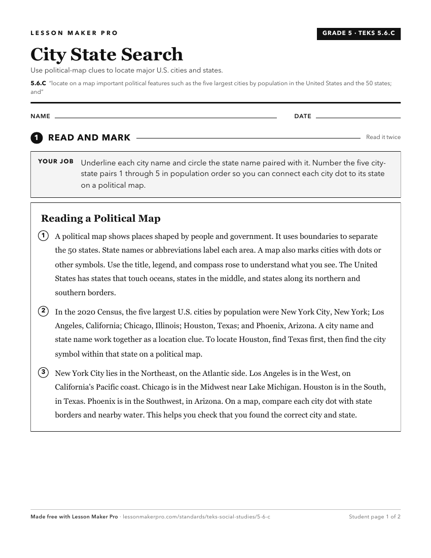
A ready-to-print activity worksheet aligned to 5.6.C, with an answer key for the teacher on its own page. No account needed.
PDF, US Letter, prints cleanly in black and white.
Download the worksheetKeep exploring
Related Standards
- 5.7.C
analyze the geographic factors that influence the location of the five largest urban areas in the United States and explain their distribution.
- 7.8.B
locate and compare places of importance in Texas in terms of physical and human characteristics such as major cities, waterways, natural and historic landmarks,...
- 2.4.B
locate places, including the local community, Texas, the United States, the state capital, the U.S. capital, and the bordering countries of Canada and Mexico on...
- 6.3.C
identify and locate major physical and human geographic features such as landforms, water bodies, and urban centers of various places and regions
Turn this exact standard into a lesson
Grade, subject, topic, and the complete standard are prefilled. Create one free, no account needed.
Also for this standard:Make a WorksheetMake a QuizMake a Sub Lesson