NGSS MS-ESS2-2
The Standard
Construct an explanation based on evidence for how geoscience processes have changed Earth's surface at varying time and spatial scales.
Next Generation Science Standards
Teacher's field guide
What This Standard Means
What Students Need to Do
- Students use maps, images, models, or data to explain how a geologic process changed a landform. They compare changes by duration and area, including gradual changes and sudden events.
What Mastery Looks Like
- A student makes a clear claim about which process shaped a landform. They use observations or data as evidence and explain the process across both time and area.
Common Misconceptions
- Students may think large landforms always form quickly or that small changes always happen slowly. They may also confuse weathering with erosion or treat one dramatic event as the only cause of a feature.
How to Assess It
- Show before-and-after images of a landslide. Ask students to name the process, cite two visible changes, and compare its scale with mountain uplift.
Lesson moves
Ways to Teach It
Use a tray of sand and flowing water to model erosion and deposition, then label where sediment moved and collected.
Write: How can a slow process create a large landform, while a sudden event changes only a small area? Use evidence.
Sort process cards by duration and area, then defend placements for weathering, landslides, earthquakes, glaciers, volcanoes, and plate movement.
Compare old and recent photos of a local riverbank or hillside, then identify the process, evidence, and likely timescale.
Free download
Printable MS-ESS2-2 Worksheet
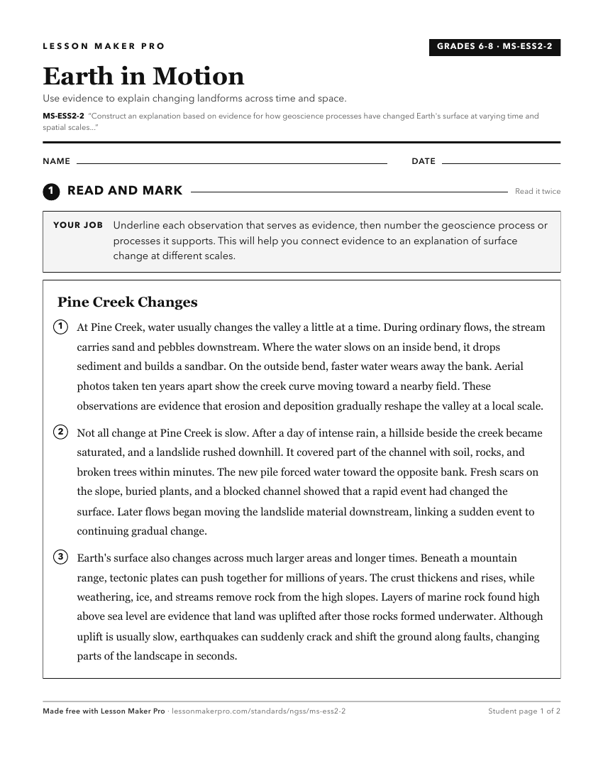
A ready-to-print activity worksheet aligned to MS-ESS2-2, with an answer key for the teacher on its own page. No account needed.
PDF, US Letter, prints cleanly in black and white.
Download the worksheetLearning progression
Where This Standard Sits
See the whole path on the Earth & Space Science progression map.
Before This Standard
If students are struggling here, check these first.
- 5-ESS2-1
Understanding how Earth systems interact helps students explain how processes like erosion, volcanism, and deposition reshape surfaces across scales.
- 4-ESS2-1
Observing weathering and erosion gives evidence students use to explain how geoscience processes reshape Earth across different scales.
What This Unlocks
Mastery here sets students up for these next.
- HS-ESS2-5
Students extend explaining surface changes across scales to investigating how water drives weathering, erosion, and other surface processes.
- HS-ESS2-4
Understanding Earth processes across time and space supports modeling how changing energy flows alter Earth systems and climate.
- HS-ESS2-3
Middle school explanations of geoscience processes and scale support modeling how interior convection cycles matter in Earth systems.
- HS-ESS2-1
Explaining how geoscience processes change surfaces across scales supports modeling how internal and surface processes form major Earth features.
- HS-ESS2-2
Middle school links surface changes to geoscience processes, which supports high school analysis of data showing feedbacks among Earth systems.
Keep exploring
Related Standards
- HS-ESS3-1
Construct an explanation based on evidence for how the availability of natural resources, occurrence of natural hazards, and changes in climate have influenced ...
- MS-ESS3-1
Construct a scientific explanation based on evidence for how the uneven distributions of Earth's mineral, energy, and groundwater resources are the result of pa...
- MS-ESS1-4
Construct a scientific explanation based on evidence from rock strata for how the geologic time scale is used to organize Earth's 4.6-billion-year-old history.
Turn this exact standard into a lesson
Grade, subject, topic, and the complete standard are prefilled. Create one free, no account needed.
Also for this standard:Make a WorksheetMake a QuizMake a Sub Lesson