Alabama Science ESS.7
Standard Cluster
Obtain, evaluate, and communicate information about the role of energy transfer in wind, precipitation, cloud formation, and front formation. a. Obtain and communicate information to explain how water cycles through the atmosphere, including condensation, evaporation, clouds, types of precipitation, relative humidity, and dew point. b. Plan and carry out an investigation to determine the differential heating of land and water and explain how these differences create changes in local and global weather. c. Construct an explanation of how air masses, source regions, fronts, weather changes associated with frontal passage (including cold, warm, occluded, and stationary fronts), air pressure, air density, temperature, cloud types, and precipitation are related to each other. d. Use data to construct an explanation of the role of pressure differences in the development of wind systems. e. Analyze and interpret data to create a surface map, including high-pressure and low-pressure systems, isobars, wind barbs, cloud types, precipitation, and fronts.
2023 Alabama Course of Study: Science · Earth’s Systems
Cluster contents
Standards in This Cluster
ESS.7 is a cluster heading. These are the individual standards under it.
- ESS.7.a
Obtain and communicate information to explain how water cycles through the atmosphere, including condensation, evaporation, clouds, types of precipitation, rela...
- ESS.7.b
Plan and carry out an investigation to determine the differential heating of land and water and explain how these differences create changes in local and global...
- ESS.7.c
Construct an explanation of how air masses, source regions, fronts, weather changes associated with frontal passage (including cold, warm, occluded, and station...
- ESS.7.d
Use data to construct an explanation of the role of pressure differences in the development of wind systems.
- ESS.7.e
Analyze and interpret data to create a surface map, including high-pressure and low-pressure systems, isobars, wind barbs, cloud types, precipitation, and front...
Teacher's field guide
What This Cluster Means
What Students Need to Do
- Students explain evaporation, condensation, clouds, and types of precipitation using relative humidity and dew point. They measure how quickly soil and water warm. They use pressure and weather-map data to explain winds, air masses, fronts, and weather patterns.
What Mastery Looks Like
- Given temperature, dew point, and pressure data, students explain likely clouds, precipitation, and wind. They connect an air mass's source region to its temperature and moisture, then predict weather near cold, warm, stationary, and occluded fronts. They plot isobars, wind barbs, clouds, precipitation, highs, lows, and fronts on a surface map.
Common Misconceptions
- Students may confuse evaporation with condensation or think high relative humidity always means a high dew point. They often expect soil and water to warm at the same rate, or think wind moves from low pressure to high pressure. They may expect every type of front to bring the same clouds and precipitation.
How to Assess It
- Show a station map with a marked cold front, high and low centers, isobars, and wind barbs. Ask students to predict a town's wind, clouds, and precipitation after the front passes, citing two map clues.
Lesson moves
Ways to Teach It
Place equal cups of soil and water under one lamp; record temperatures every two minutes, then explain a daytime sea breeze.
Ask, 'Why can a humid day have no rain?' Have pairs use dew point, rising air, and condensation in a written answer.
Give teams station cards with temperature, pressure, wind barbs, clouds, and precipitation; race to plot isobars and identify fronts.
Compare today's local weather map with yesterday's; mark the nearest front and explain any change in wind, temperature, or rain.
Free download
Printable ESS.7 Worksheet
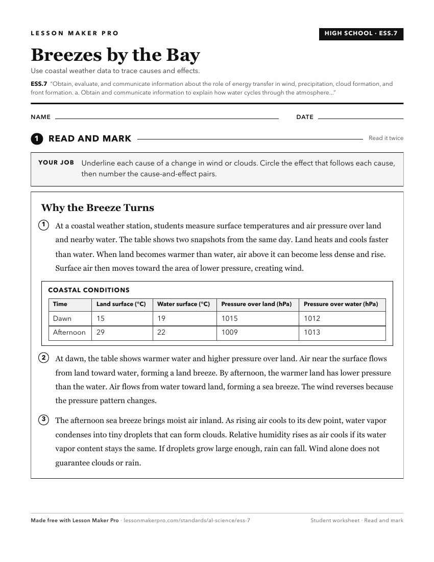
A ready-to-print activity worksheet aligned to ESS.7, with an answer key for the teacher on its own page. No account needed.
PDF, US Letter, prints cleanly in black and white.
Download the worksheetKeep exploring
Related Standards
- ESS.8
Obtain and communicate information to explain different climate regions and their impact on patterns of severe weather.
- 6.9.a
Obtain, evaluate, and communicate data that describes characteristics of air masses, including temperature, pressure, and humidity.
- ES.6
Obtain, evaluate, and communicate information to describe the use of renewable and nonrenewable energy sources.
Turn this cluster into a lesson
Grade, subject, topic, and the complete cluster are prefilled. Create one free, no account needed.
Also for this cluster:Make a WorksheetMake a QuizMake a Sub Lesson