Alabama Science ESS.7.e
The Standard
- ESS.7
- Obtain, evaluate, and communicate information about the role of energy transfer in wind, precipitation, cloud formation, and front formation.
Analyze and interpret data to create a surface map, including high-pressure and low-pressure systems, isobars, wind barbs, cloud types, precipitation, and fronts.
2023 Alabama Course of Study: Science · Earth’s Systems
Teacher's field guide
What This Standard Means
What Students Need to Do
- Students turn weather station reports into a surface map. They plot pressure, wind, clouds, and precipitation, then use the data to draw isobars and fronts.
What Mastery Looks Like
- Students place high and low centers near the right pressure readings and connect equal pressures with isobars that do not cross. Their wind barbs show the reported speed and direction. They place fronts where temperature and weather observations show a boundary.
Common Misconceptions
- Students may connect different pressure readings with one isobar or let isobars cross. They may read a wind barb as where wind goes, not where it comes from. Some draw a front wherever rain appears, without checking nearby temperatures.
How to Assess It
- Exit ticket: On a four-station map, use W (1020 mb, 10°C), N and S (1012 mb, 15°C), and E (1004 mb, 23°C, rain) to draw the 1012 mb isobar and label high and low. At E, plot a south wind at 10 knots, cumulonimbus clouds, and rain, then mark a cold front between W and E.
Lesson moves
Ways to Teach It
Give pairs a blank regional map and six station report cards; have them plot each report, draw isobars, and mark a likely front.
Show two nearby station reports with different temperatures and rain at one station; ask, “Where would you draw a front, and why?”
Play map relay: teams match wind barb cards to speed and direction reports, then place them at labeled stations on a blank map.
Print today's NOAA surface map; students find the nearest front and compare its location with rain on a local radar image.
Free download
Printable ESS.7.e Worksheet
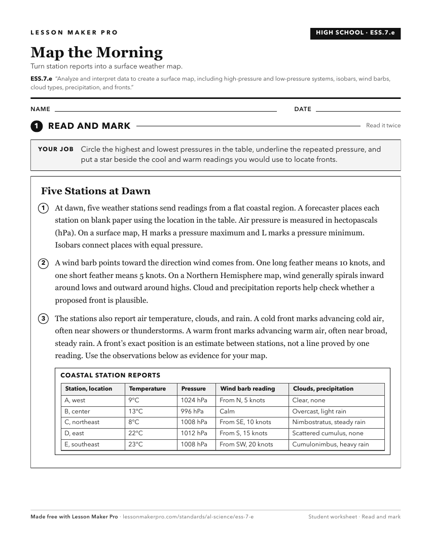
A ready-to-print activity worksheet aligned to ESS.7.e, with an answer key for the teacher on its own page. No account needed.
PDF, US Letter, prints cleanly in black and white.
Download the worksheetKeep exploring
Related Standards
- 6.9.a
Obtain, evaluate, and communicate data that describes characteristics of air masses, including temperature, pressure, and humidity.
- ESS.8.b
Analyze and interpret data to develop predictions about the formation of meteorological events.
- 4.13
Analyze and interpret data from maps to describe patterns of Earth’s features on land and in the ocean.
- ESS.8.a
Analyze temperature and precipitation patterns related to factors that influence climate, including proximity to water, topography, elevation, latitude, and oro...
Turn this exact standard into a lesson
Grade, subject, topic, and the complete standard are prefilled. Create one free, no account needed.
Also for this standard:Make a WorksheetMake a QuizMake a Sub Lesson