Alabama Science ESS.8
Standard Cluster
Obtain and communicate information to explain different climate regions and their impact on patterns of severe weather. a. Analyze temperature and precipitation patterns related to factors that influence climate, including proximity to water, topography, elevation, latitude, and orographic effect. b. Analyze and interpret data to develop predictions about the formation of meteorological events. c. Communicate scientific information to explain the personal, local, and statewide implications of severe weather events in Alabama.
2023 Alabama Course of Study: Science · Earth’s Systems
Cluster contents
Standards in This Cluster
ESS.8 is a cluster heading. These are the individual standards under it.
- ESS.8.a
Analyze temperature and precipitation patterns related to factors that influence climate, including proximity to water, topography, elevation, latitude, and oro...
- ESS.8.b
Analyze and interpret data to develop predictions about the formation of meteorological events.
- ESS.8.c
Communicate scientific information to explain the personal, local, and statewide implications of severe weather events in Alabama.
Teacher's field guide
What This Cluster Means
What Students Need to Do
- Students compare temperature and rainfall across regions using latitude, elevation, distance from water, and mountain slopes. They use weather data to predict severe storms and explain effects on people and communities in Alabama.
What Mastery Looks Like
- Given climate maps, students explain why Alabama's coast and mountains differ in temperature and rainfall. They use humidity and front data to explain how rising moist air can produce storms, then name a safety step and a possible effect across the state.
Common Misconceptions
- Students may treat one hot day as proof of a region's climate. They may think both sides of a mountain get equal rain, or that humid air alone guarantees a severe storm.
How to Assess It
- Exit ticket: “Moist Gulf air flows toward a south-facing Alabama mountain slope as a cold front arrives. Which slope is more likely to get heavy rain, why, and what should a nearby household do if flash flooding is warned?”
Lesson moves
Ways to Teach It
Shape a clay mountain, draw arrows for moist Gulf air, and place blue beads where rising air is likely to produce rain.
Ask pairs why Mobile can face storm surge while Mentone faces hillside flash floods, using a coastline map and an elevation map.
Give pairs two weather cards, humid 29°C air ahead of a cold front and dry 18°C air under high pressure, then compare thunderstorm risk.
Read a National Weather Service Alabama storm warning and write three sentences naming a personal safety step, a local risk, and a possible statewide effect.
Free download
Printable ESS.8 Worksheet
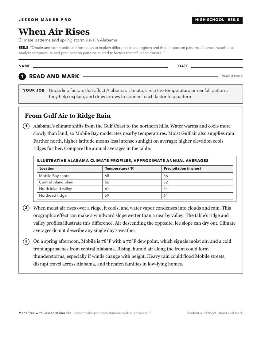
A ready-to-print activity worksheet aligned to ESS.8, with an answer key for the teacher on its own page. No account needed.
PDF, US Letter, prints cleanly in black and white.
Download the worksheetKeep exploring
Related Standards
Turn this cluster into a lesson
Grade, subject, topic, and the complete cluster are prefilled. Create one free, no account needed.
Also for this cluster:Make a WorksheetMake a QuizMake a Sub Lesson