Oklahoma Social Studies 7.C.2
Standard Cluster
Analyze the physical systems of the major regions of the Eastern Hemisphere. Identify on a physical map the major landforms and bodies of water of each region and compare climatic conditions, vegetation, and biomes using thematic maps and other geographic tools. Describe how the physical environment can influence human population distribution, population growth, settlement patterns, land use, and economic activities. Compare the characteristics and distribution of major renewable and nonrenewable resources of each region, identifying major nations in which natural resources (e.g., fossil fuels, minerals, agricultural crops) are the primary source of economic activities. Identify examples of scarcity and how the availability of natural resources impacts regional economies, potentially leading to both conflict and cooperation.
Oklahoma Academic Standards for Social Studies (2026)
Cluster contents
Standards in This Cluster
7.C.2 is a cluster heading. These are the individual standards under it.
- 7.C.2.1
Identify on a physical map the major landforms and bodies of water of each region and compare climatic conditions, vegetation, and biomes using thematic maps an...
- 7.C.2.2
Describe how the physical environment can influence human population distribution, population growth, settlement patterns, land use, and economic activities.
- 7.C.2.3
Compare the characteristics and distribution of major renewable and nonrenewable resources of each region, identifying major nations in which natural resources ...
- 7.C.2.4
Identify examples of scarcity and how the availability of natural resources impacts regional economies, potentially leading to both conflict and cooperation.
Teacher's field guide
What This Cluster Means
What Students Need to Do
- Students locate major landforms and bodies of water across Africa, Europe, Asia, and Oceania. They compare climate, vegetation, and biomes on maps, then explain how those conditions shape where people settle, farm, and work. They compare renewable and nonrenewable resources and explain how scarcity affects economies and relationships between countries.
What Mastery Looks Like
- A student can locate the Sahara, Himalayas, Nile, and Mediterranean Sea on an unlabeled map. They use climate, vegetation, and population maps to explain why settlements cluster along the Nile rather than in the surrounding desert. They can compare Kenyan tea with Saudi oil and explain how scarce water may lead neighboring countries to disagree or cooperate.
Common Misconceptions
- Students may think deserts have no settlements, missing towns along rivers and coasts. They may assume a country with oil also has plenty of water, or call oil renewable because people still extract it. They may read a climate map as a forecast for this week's weather.
How to Assess It
- Give students physical, rainfall, and population maps of North Africa. Ask them to label the Sahara and Nile, then explain why many settlements cluster near the river.
Lesson moves
Ways to Teach It
Place transparent population maps over physical maps of North Africa; students circle Nile settlements and label the nearby desert and farmland.
Ask: How could Ethiopia's Nile dam affect Egyptian farms? Use a river map to explain one risk and one possible water-sharing agreement.
Run a map relay: teams locate the Himalayas, Mediterranean Sea, and Congo Basin, then match nearby land areas to climate and biome cards.
Show Saudi oil and Kenyan tea export maps; students label renewable and nonrenewable resources and explain how each shapes jobs and trade.
Free download
Printable 7.C.2 Worksheet
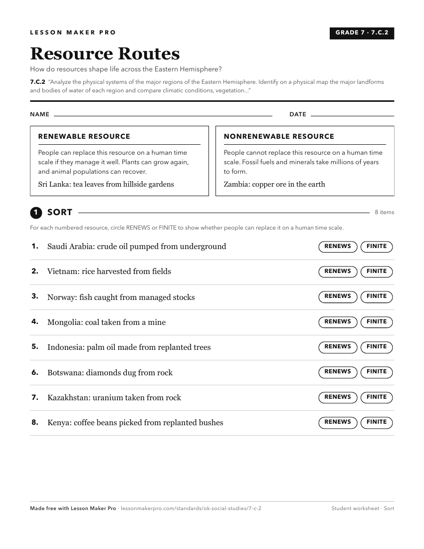
A ready-to-print activity worksheet aligned to 7.C.2, with an answer key for the teacher on its own page. No account needed.
PDF, US Letter, prints cleanly in black and white.
Download the worksheetKeep exploring
Related Standards
- 7.C.8
Analyze the physical and human characteristics of regions which create uniqueness and influence people’s perceptions of the Eastern Hemisphere.
- 6.C.2
Analyze the physical systems of the major regions of the Western Hemisphere.
- 7.C.3
Identify the distribution and demographic patterns of human populations of the Eastern Hemisphere.
- 7.C.5
Evaluate the development and impact of culture on the major regions and peoples of the Eastern Hemisphere.
Turn this cluster into a lesson
Grade, subject, topic, and the complete cluster are prefilled. Create one free, no account needed.
Also for this cluster:Make a WorksheetMake a QuizMake a Sub Lesson