NGSS MS-ESS2-6
The Standard
Develop and use a model to describe how unequal heating and rotation of the Earth cause patterns of atmospheric and oceanic circulation that determine regional climates.
Next Generation Science Standards
Teacher's field guide
What This Standard Means
What Students Need to Do
- Students create and read models showing where Earth receives more and less solar energy. They connect Earth’s spin to curved wind and current paths, then trace how air and water move heat. They use latitude, elevation, and land and ocean patterns to explain climate differences.
What Mastery Looks Like
- A student can label a global model with heating zones, major wind belts, and warm and cold current paths. The student can compare two regional climates and explain how elevation, winds, coastlines, or currents cause differences.
Common Misconceptions
- Students often assume places at the same latitude have the same climate and that ocean currents follow straight paths. They may say Earth’s spin creates winds and currents, rather than deflecting moving air and water, and may ignore elevation or continents.
How to Assess It
- Exit ticket: On a blank world map, draw one prevailing wind belt and one major current. Label solar heating and rotational deflection, then explain one effect on a coastal climate.
Lesson moves
Ways to Teach It
Use a lamp, globe, and sticky arrows to model solar intensity, wind belts, and current paths at different latitudes.
Ask students to write: Why is western Europe milder than eastern Canada at similar latitudes? Require evidence from wind and current maps.
Give teams climate cards and world-map clues, then have them match each region to its latitude, elevation, prevailing wind, and nearby current.
Compare local monthly temperatures with a same-latitude city, then use elevation, coastlines, winds, and currents to explain the differences.
Free download
Printable MS-ESS2-6 Worksheet
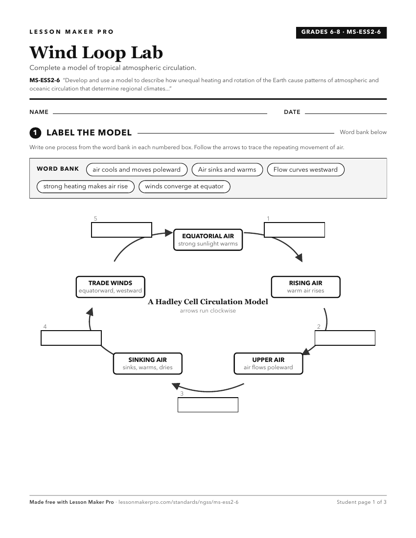
A ready-to-print activity worksheet aligned to MS-ESS2-6, with an answer key for the teacher on its own page. No account needed.
PDF, US Letter, prints cleanly in black and white.
Download the worksheetLearning progression
Where This Standard Sits
See the whole path on the Earth & Space Science progression map.
Before This Standard
If students are struggling here, check these first.
- 3-ESS2-2
Regional climate descriptions carry forward into explaining climate patterns through unequal heating, Earth’s rotation, and circulation models.
- 3-ESS2-1
Reading seasonal weather data supports understanding climate as long-term patterns later explained by heating, rotation, and circulation models.
What This Unlocks
Mastery here sets students up for these next.
- HS-ESS2-4
Middle school circulation models carry into high school modeling of energy flow changes that drive climate patterns and change.
- HS-ESS2-5
Ideas about water moving heat in oceans support investigating how water’s properties affect Earth materials and surface processes.
- HS-ESS2-2
Understanding how heating and circulation shape climate supports analyzing how surface changes trigger feedbacks across Earth systems.
Keep exploring
Related Standards
Turn this exact standard into a lesson
Grade, subject, topic, and the complete standard are prefilled. Create one free, no account needed.
Also for this standard:Make a WorksheetMake a QuizMake a Sub Lesson