NGSS 3-ESS2-2
The Standard
Obtain and combine information to describe climates in different regions of the world.
Next Generation Science Standards
Teacher's field guide
What This Standard Means
What Students Need to Do
- Students gather temperature and precipitation information from maps, charts, photos, and short texts. They combine evidence from more than one source to describe and compare long-term patterns across world regions.
What Mastery Looks Like
- Students can describe a region as generally hot, cold, wet, dry, or seasonal and cite matching data. They can compare two regions using evidence from at least two sources.
Common Misconceptions
- Students may use one day’s weather to describe a region’s climate. They may think climate means only temperature and ignore rainfall or seasonal patterns. They may assume every place within a large region has the same climate.
How to Assess It
- Give students a temperature chart, rainfall graph, and short paragraph for two regions. Ask, “Describe each climate and cite one fact from each source.”
Lesson moves
Ways to Teach It
Give groups climate cards with monthly temperature and rainfall data, then have them sort the cards into hot, cold, wet, and dry regions.
Ask students to compare coastal Alaska and the Amazon: What evidence shows how their climates differ?
Play Climate Detective: teams match region photos, rainfall graphs, and temperature tables, then explain each match with two clues.
Use monthly climate averages for two familiar cities, then have students write packing lists and justify each item with data.
Free download
Printable 3-ESS2-2 Worksheet
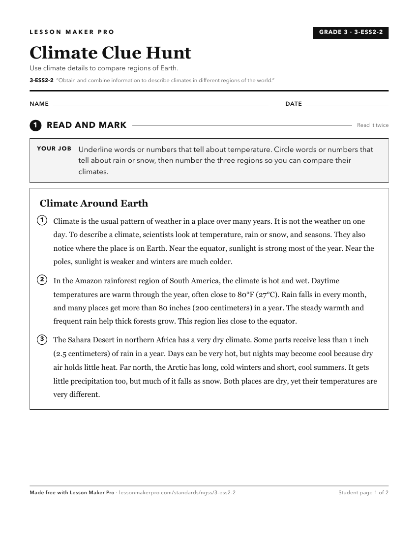
A ready-to-print activity worksheet aligned to 3-ESS2-2, with an answer key for the teacher on its own page. No account needed.
PDF, US Letter, prints cleanly in black and white.
Download the worksheetLearning progression
Where This Standard Sits
See the whole path on the Earth & Space Science progression map.
What This Unlocks
Mastery here sets students up for these next.
- MS-ESS2-6
Regional climate descriptions carry forward into explaining climate patterns through unequal heating, Earth’s rotation, and circulation models.
- MS-ESS2-5
Describing regional climates prepares students to compare weather patterns, which helps them interpret data on changing air masses and conditions.
Keep exploring
Related Standards
Turn this exact standard into a lesson
Grade, subject, topic, and the complete standard are prefilled. Create one free, no account needed.
Also for this standard:Make a WorksheetMake a QuizMake a Sub Lesson