Mississippi Science ESS.2B
Standard Cluster
Students will develop an understanding of the history and evolution of the earth. Research, analyze, and evaluate the contributions of William Smith, James Hutton, Nicolaus Steno, Charles Lyell, and others to physical geology. Apply different techniques (e.g., superposition, original horizontality, cross-cutting relationships, lateral continuity, principle of inclusions, fossil succession, and unconformities) to analyze and interpret the relative age of actual sequences, models, or photographs. Use mathematical concepts to calculate the absolute age of Earth materials using actual or simulated isotope ratios. Research, analyze, and explain the origin of geologic features and processes that result from plate tectonics, including sea floor spreading, earthquake activity, volcanic activity, mountain building, and location of natural resources. Use mathematical representations to interpret seismic graphs to triangulate the location of an earthquake’s epicenter and magnitude and to correlate the frequency and magnitude of an earthquake. Plan and conduct a scientific investigation to determine how factors (e.g., wind velocity, water velocity, ice, and temperature) may affect the rate of weathering. Enrichment: Use an engineering design process to design a model to simulate the formation of caves and karst topography by groundwater. *
2026 Mississippi College- and Career-Readiness Standards for Science · Earth Structure and History
Cluster contents
Standards in This Cluster
ESS.2B is a cluster heading. These are the individual standards under it.
- ESS.2B.1
Research, analyze, and evaluate the contributions of William Smith, James Hutton, Nicolaus Steno, Charles Lyell, and others to physical geology.
- ESS.2B.2
Apply different techniques (e.g., superposition, original horizontality, cross-cutting relationships, lateral continuity, principle of inclusions, fossil succes...
- ESS.2B.3
Use mathematical concepts to calculate the absolute age of Earth materials using actual or simulated isotope ratios.
- ESS.2B.4
Research, analyze, and explain the origin of geologic features and processes that result from plate tectonics, including sea floor spreading, earthquake activit...
- ESS.2B.5
Use mathematical representations to interpret seismic graphs to triangulate the location of an earthquake’s epicenter and magnitude and to correlate the frequen...
- ESS.2B.6
Plan and conduct a scientific investigation to determine how factors (e.g., wind velocity, water velocity, ice, and temperature) may affect the rate of weatheri...
- ESS.2B.7
Enrichment: Use an engineering design process to design a model to simulate the formation of caves and karst topography by groundwater. *
Teacher's field guide
What This Cluster Means
What Students Need to Do
- Students order rock layers and date rocks using fossils and isotope ratios. They connect early geologists' ideas to the methods they use. They use maps and seismic data to study plate movement, then test what changes the rate of weathering.
What Mastery Looks Like
- A student can order layers and a fault, then calculate a rock's age from an isotope ratio and half-life. They can locate an epicenter with three seismic records and read a graph showing how earthquake frequency changes with magnitude. They can use a plate map to explain where volcanoes and mountains form.
Common Misconceptions
- Students may think a deeper feature is always older, even when an intrusion cuts across the layers. They may treat an isotope percentage as an age instead of counting half-lives. They may confuse weathering with erosion or think one seismic station can pinpoint an epicenter.
How to Assess It
- Show three sediment layers cut by a dike labeled “25% parent isotope left, half-life 10 million years.” Ask students for the dike's age and whether it formed before or after the layers, with one reason.
Lesson moves
Ways to Teach It
Put equal chalk pieces in two jars of water; swirl one slowly and one quickly for two minutes, then compare water cloudiness.
Give pairs cards showing tilted strata, matching fossils, an unconformity, and slow erosion; ask them to match each clue to Steno, Smith, Hutton, or Lyell.
Give teams rock-layer sketches and isotope cards with a half-life and 25% parent remaining; score each correct event order and age.
Use three seismic records to plot an epicenter on a map, then compare its location with a plate boundary.
Free download
Printable ESS.2B Worksheet
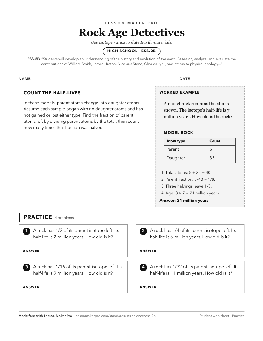
A ready-to-print activity worksheet aligned to ESS.2B, with an answer key for the teacher on its own page. No account needed.
PDF, US Letter, prints cleanly in black and white.
Download the worksheetKeep exploring
Related Standards
- ESS.2A
Students will develop an understanding of the structure and composition of Earth and its materials.
- E.8.7
Students will demonstrate an understanding of geological evidence to analyze patterns in Earth’s major events, processes, and evolution in history.
- ESS.3
Students will develop an understanding of Earth’s systems and cycles.
- FB.5
Students will demonstrate an understanding of Earth’s fossil record and its indication of the diversity of life over time.
Turn this cluster into a lesson
Grade, subject, topic, and the complete cluster are prefilled. Create one free, no account needed.
Also for this cluster:Make a WorksheetMake a QuizMake a Sub Lesson