Mississippi Science E.3.7B
Standard Cluster
Students will demonstrate an understanding of the composition of Earth and the processes which change Earth’s landforms. Obtain and evaluate scientific information (e.g., using technology) to describe the four major layers of Earth and the varying compositions of each layer. Develop and use models to describe the characteristics of Earth's continental landforms and classify landforms as volcanoes, mountains, valleys, canyons, plains, and islands. Develop and use models of weathering, erosion, and deposition processes which explain the appearance of various Earth features (e.g., the Grand Canyon, Arches National Park in Utah, Plymouth Bluff in Columbus, or Red Bluff in Marion County, Mississippi). Compare and contrast constructive (e.g., deposition, volcano) and destructive (e.g., weathering, erosion, earthquake) processes of the Earth.
2026 Mississippi College- and Career-Readiness Standards for Science · Earth’s Structure and History
Cluster contents
Standards in This Cluster
E.3.7B is a cluster heading. These are the individual standards under it.
- E.3.7B.1
Obtain and evaluate scientific information (e.g. using technology) to describe the four major layers of Earth and the varying compositions of each layer.
- E.3.7B.2
Develop and use models to describe the characteristics of Earth's continental landforms and classify landforms as volcanoes, mountains, valleys, canyons, plains...
- E.3.7B.3
Develop and use models of weathering, erosion, and deposition processes which explain the appearance of various Earth features (e.g., the Grand Canyon, Arches N...
- E.3.7B.4
Compare and contrast constructive (e.g., deposition, volcano) and destructive (e.g., weathering, erosion, earthquake) processes of the Earth.
Teacher's field guide
What This Cluster Means
What Students Need to Do
- Students use diagrams to identify Earth's four layers and what each is made of. They use models and photos to tell six landforms apart. They model how rock breaks, sediment moves, and sediment settles, then sort changes that build land from those that wear it away.
What Mastery Looks Like
- A student labels the crust and mantle as solid rock, the outer core as liquid metal, and the inner core as solid metal. They identify volcanoes, mountains, valleys, canyons, plains, and islands in photos. They explain weathering, erosion, and deposition with a model, and describe how volcanoes build land while earthquakes can reshape it.
Common Misconceptions
- Students often think the mantle is liquid magma or mix up the liquid outer core and solid inner core. They may call any steep hill a volcano or any valley a canyon. They also confuse weathering with erosion and think deposition removes sediment rather than leaving it behind.
How to Assess It
- Show a sketch of a stream cutting a canyon and leaving a sandbar. Ask, “Where is erosion, where is deposition, and which place loses or gains land?”
Lesson moves
Ways to Teach It
Use four colors of clay to build a cutaway Earth; label each layer's material and whether it is solid or liquid.
Show a cracked rock, the Grand Canyon, and a sandbar; ask students to explain where rock breaks, moves, and settles.
Give pairs photo cards of six landforms; have them sort volcanoes, mountains, valleys, canyons, plains, and islands and defend one tricky choice.
Display an aerial photo of a river bend; have students mark where the river cuts the bank and where sand collects.
Free download
Printable E.3.7B Worksheet
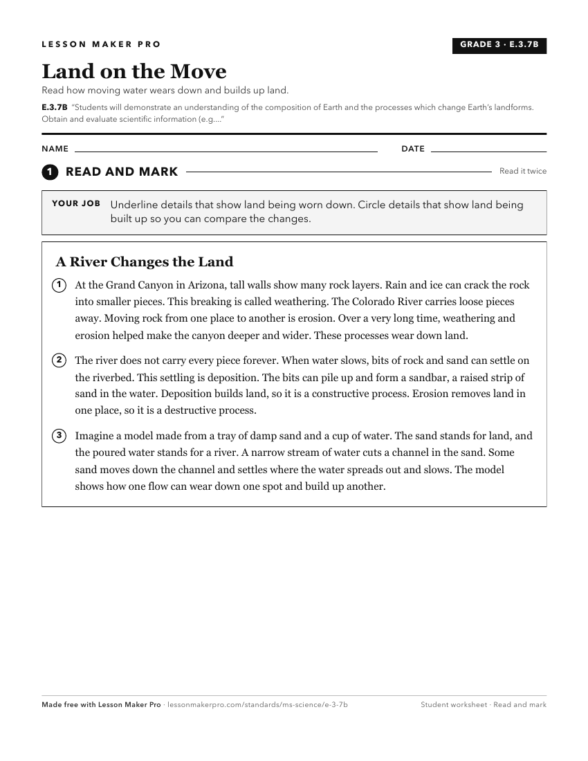
A ready-to-print activity worksheet aligned to E.3.7B, with an answer key for the teacher on its own page. No account needed.
PDF, US Letter, prints cleanly in black and white.
Download the worksheetKeep exploring
Related Standards
- E.3.9
Students will demonstrate an understanding of how the Earth’s systems (i.e., geosphere, hydrosphere, atmosphere, and biosphere) interact in multiple ways to aff...
- E.4.9C
Students will demonstrate an understanding of how natural processes and human activities affect the features of Earth's landforms and oceans.
- ESS.2A
Students will develop an understanding of the structure and composition of Earth and its materials.
- E.3.7A
Students will demonstrate an understanding of the various processes involved in the rock cycle, superposition of rock layers, and fossil formation.
Turn this cluster into a lesson
Grade, subject, topic, and the complete cluster are prefilled. Create one free, no account needed.
Also for this cluster:Make a WorksheetMake a QuizMake a Sub Lesson