Florida SS.5.A.3
Florida Standard (Benchmark Cluster)
Exploration and Settlement of North America
Florida Next Generation Sunshine State Standards for Social Studies
Cluster contents
Benchmarks in This Standard
SS.5.A.3 is a Florida social studies standard. These are the benchmarks under it.
- SS.5.A.3.1
Describe technological developments that shaped European exploration.
- SS.5.A.3.2
Investigate (nationality, sponsoring country, motives, dates and routes of travel, accomplishments) the European explorers.
- SS.5.A.3.3
Describe interactions among Native Americans, Africans, English, French, Dutch, and Spanish for control of North America.
Teacher's field guide
What This Cluster Means
What Students Need to Do
- Students explain why European nations sent expeditions and built colonies, then trace routes, trade, conflict, and settlement on maps and timelines. They compare colonial regions and describe effects on Native peoples and enslaved Africans using evidence.
What Mastery Looks Like
- A student can connect a nation, expedition, motive, route, and colonial claim without mixing them up. The student can compare colonial regions and explain one cause and one effect of trade, conflict, or forced labor.
Common Misconceptions
- Students may describe the continent as empty before Europeans arrived or treat Native nations as one group. They may confuse an explorer's birthplace with the sponsoring nation, assume every colony had the same purpose, or describe enslaved Africans as voluntary settlers.
How to Assess It
- Give students a blank Atlantic map. Ask them to draw one expedition route, name the sponsoring nation and motive, and write one effect on people already living there.
Lesson moves
Ways to Teach It
Give groups string, a world map, and explorer cards, then have them trace routes and attach motive and consequence labels.
Ask, "How did one European settlement change life for nearby Native peoples?" Students cite two details from short paired sources.
Play colony sort with climate, economy, religion, and labor cards placed under New England, Middle, or Southern colonies.
Compare a colonial port map with a modern port map, then explain how geography still shapes trade and settlement.
Free download
Printable SS.5.A.3 Worksheet
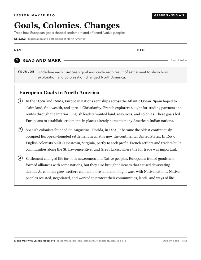
A ready-to-print activity worksheet aligned to SS.5.A.3, with an answer key for the teacher on its own page. No account needed.
PDF, US Letter, prints cleanly in black and white.
Download the worksheetKeep exploring
Related Standards
Turn this cluster into a lesson
Grade, subject, and topic are prefilled; the lesson picks the standards under this heading. Create one free, no account needed.
Also for this cluster:Make a WorksheetMake a QuizMake a Sub Lesson