Florida SS.7.G.2.3
The Standard
- SS.7.G.2
- Understand physical and cultural characteristics of places.
Explain how major physical characteristics, natural resources, climate, and absolute and relative location have influenced settlement, economies, and inter-governmental relations in North America.
Florida Next Generation Sunshine State Standards for Social Studies
Teacher's field guide
What This Standard Means
What Students Need to Do
- Students use physical, resource, climate, and location maps to explain why settlements and economic activities developed in particular places. They connect those conditions to trade, border disputes, water agreements, and other relations among North American governments.
What Mastery Looks Like
- Students can use map evidence to build a clear cause and effect explanation. They can compare two regions, such as the Great Lakes and northern Mexico, and explain how geography led to different outcomes.
Common Misconceptions
- Students often confuse absolute location coordinates with relative location descriptions. They may treat climate as daily weather or assume one physical feature completely determines human choices. They may also assume natural resources always bring wealth or cooperation.
How to Assess It
- Give students a map showing the Rocky Mountains, Mississippi River, oil fields, and national borders. Ask them to choose one feature and explain one effect on settlement, economies, or government relations.
Lesson moves
Ways to Teach It
Layer tracing paper maps of population, climate, rivers, and resources, then mark three places where the patterns overlap.
Write a claim explaining why cities developed along the Great Lakes, using two details from a physical map.
Sort cause and effect cards linking features such as rivers, mountains, oil, and dry climate to settlement, trade, or conflict.
Read a short report on Colorado River water sharing, then identify how climate and location shape agreements between governments.
Free download
Printable SS.7.G.2.3 Worksheet
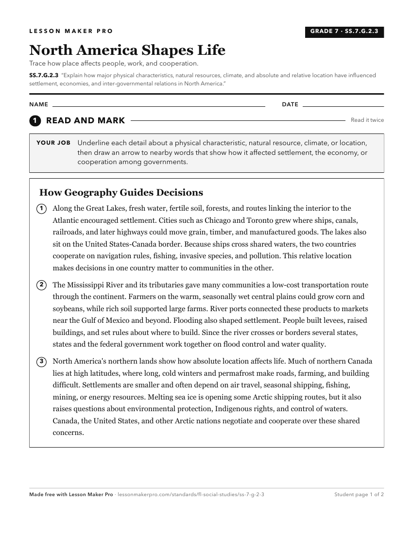
A ready-to-print activity worksheet aligned to SS.7.G.2.3, with an answer key for the teacher on its own page. No account needed.
PDF, US Letter, prints cleanly in black and white.
Download the worksheetKeep exploring
Related Standards
- SS.3.G.4.1
Explain how the environment influences settlement patterns in the United States, Canada, Mexico, and the Caribbean.
- SS.7.G.2.4
Describe current major cultural regions of North America.
- SS.7.G.3.1
Use maps to describe the location, abundance, and variety of natural resources in North America.
- SS.6.G.2.1
Explain how major physical characteristics, natural resources, climate, and absolute and relative locations have influenced settlement, interactions, and the ec...
Turn this exact standard into a lesson
Grade, subject, topic, and the complete standard are prefilled. Create one free, no account needed.
Also for this standard:Make a WorksheetMake a QuizMake a Sub Lesson