Mississippi Science MAQ.3
Standard Cluster
Students will understand the principles of plate tectonics, sea floor spreading, and physical features of oceanic zones. Use geospatial data to analyze, explain, and communicate differences among the major geological features of specific aquatic ecosystems (e.g., plate tectonics, continental rise, continental slope, abyssal plain, trenches, sea mounts, island formation, and watersheds). Develop an understanding of plate tectonics to predict certain geological features (e.g., sea floor spreading, paleomagnetic measurements, and orogenesis). Classify zones of the ocean based on distance from shorelines (i.e., intertidal, neritic, oceanic, and benthic zones), temperature, and light availability (i.e., epipelagic, mesopelagic, bathypelagic, abyssopelagic, and hadopelagic). Classify zones of freshwater sources based on the velocity of current, depth, and temperature.
2026 Mississippi College- and Career-Readiness Standards for Science · Geological Features
Cluster contents
Standards in This Cluster
MAQ.3 is a cluster heading. These are the individual standards under it.
- MAQ.3.1
Use geospatial data to analyze, explain, and communicate differences among the major geological features of specific aquatic ecosystems (e.g., plate tectonics, ...
- MAQ.3.2
Develop an understanding of plate tectonics to predict certain geological features (e.g., sea floor spreading, paleomagnetic measurements, and orogenesis).
- MAQ.3.3
Classify zones of the ocean based on distance from shorelines (i.e., intertidal, neritic, oceanic, and benthic zones), temperature, and light availability (i.e....
- MAQ.3.4
Classify zones of freshwater sources based on the velocity of current, depth, and temperature.
Teacher's field guide
What This Cluster Means
What Students Need to Do
- Students read seafloor maps to explain ridges, trenches, seamounts, islands, and continental margins. They use plate movement and magnetic patterns to predict where new seafloor forms. They classify ocean and freshwater zones using location, depth, light, temperature, and current speed.
What Mastery Looks Like
- A student can use matching magnetic bands to locate a spreading ridge and predict where older seafloor lies. On a depth profile, they can distinguish a continental slope, rise, abyssal plain, and trench. They can classify ocean and freshwater samples using the measurements provided.
Common Misconceptions
- Students may think the oldest seafloor is at a spreading ridge, when the youngest rock is there. They may treat benthic as a shore-distance zone instead of the bottom, or assume light reaches every ocean depth. Some treat all freshwater as still water and overlook river currents.
How to Assess It
- Give students a ridge-to-trench depth sketch with matching magnetic bands and points at 20 m and 2,000 m. Ask them to mark where new crust forms, circle the trench, and label the light zone at each point.
Lesson moves
Ways to Teach It
Slide two paper strips with matching magnetic bands away from a drawn ridge to model seafloor spreading.
Compare two NOAA seafloor depth profiles, one passive margin and one subduction margin, and explain why only one has a trench.
Sort ocean zone cards by shore distance, depth, and light, then sort river and lake cards by current speed, depth, and temperature.
Draw a watershed boundary on a local topographic map, then trace where rain carries sediment toward a river, estuary, or coast.
Free download
Printable MAQ.3 Worksheet
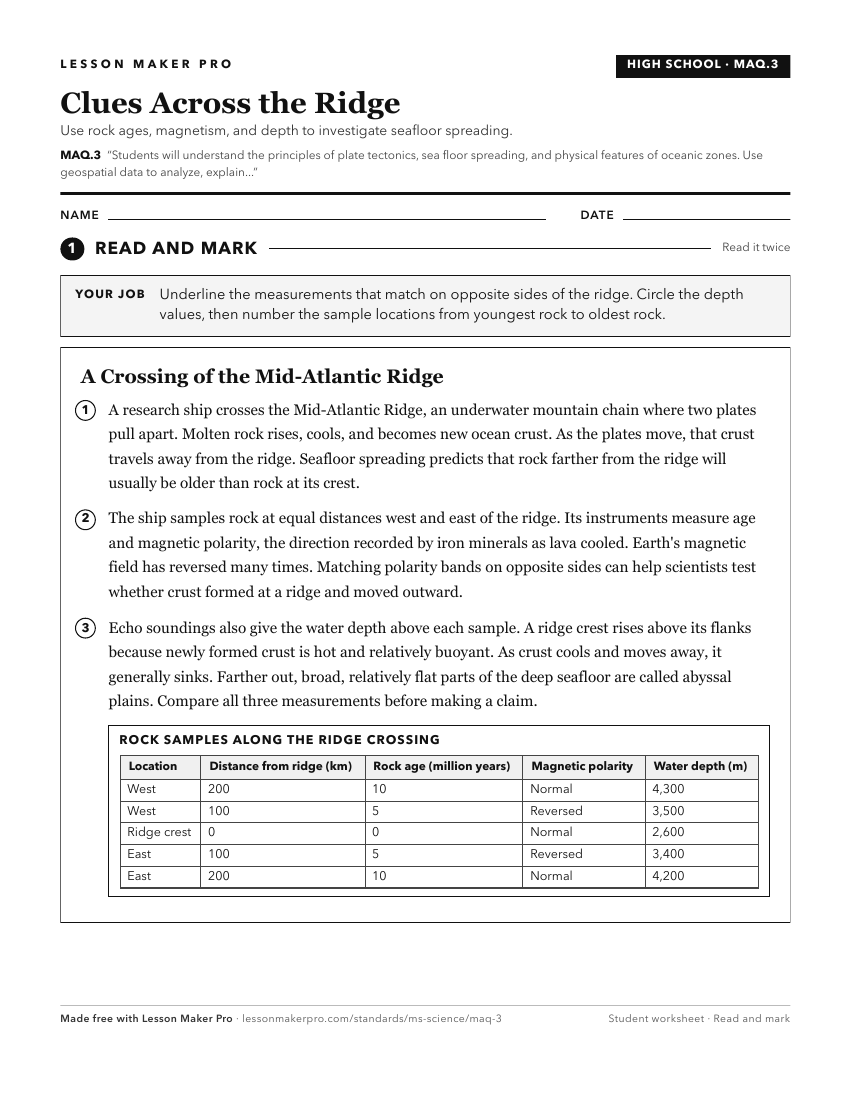
A ready-to-print activity worksheet aligned to MAQ.3, with an answer key for the teacher on its own page. No account needed.
PDF, US Letter, prints cleanly in black and white.
Download the worksheetKeep exploring
Related Standards
- E.4.9C
Students will demonstrate an understanding of how natural processes and human activities affect the features of Earth's landforms and oceans.
- ESS.2A
Students will develop an understanding of the structure and composition of Earth and its materials.
- E.3.7B
Students will demonstrate an understanding of the composition of Earth and the processes which change Earth's landforms.
Turn this cluster into a lesson
Grade, subject, topic, and the complete cluster are prefilled. Create one free, no account needed.
Also for this cluster:Make a WorksheetMake a QuizMake a Sub Lesson