Mississippi Science MAQ.3.1
The Standard
- MAQ.3
- Students will understand the principles of plate tectonics, sea floor spreading, and physical features of oceanic zones.
Use geospatial data to analyze, explain, and communicate differences among the major geological features of specific aquatic ecosystems (e.g., plate tectonics, continental rise, continental slope, abyssal plain, trenches, sea mounts, island formation, and watersheds).
2026 Mississippi College- and Career-Readiness Standards for Science · Geological Features
Teacher's field guide
What This Standard Means
What Students Need to Do
- Students use bathymetry, land elevation, and plate-boundary maps to identify features in specific ocean regions and watersheds. They compare depth, shape, and location. They use plate motion, volcanism, sediment, and drainage patterns to explain what they see.
What Mastery Looks Like
- On maps, students distinguish a continental slope, rise, abyssal plain, trench, seamount, and watershed. They use depth and plate boundaries to explain their choices. They can explain how a volcanic seamount can grow into an island.
Common Misconceptions
- Students may call any deep ocean floor a trench or mistake an underwater seamount for an island. They may confuse the steep continental slope with the gentler rise. Some think a watershed is just the river, not the land that drains into it.
How to Assess It
- Show a bathymetry map with the Atlantic continental margin and Mariana Trench, plus plate boundaries. Ask students to mark the rise and trench, give a map clue for each, and explain how the trench formed.
Lesson moves
Ways to Teach It
Give pairs a printed Atlantic bathymetry map; have them draw a coast-to-ocean profile and label the slope, rise, and abyssal plain.
Show Pacific bathymetry and plate-boundary maps; ask students why the Mariana Trench is deep while a nearby abyssal plain is flat.
Run a map-match round: students pair feature cards with marked spots on Atlantic and Pacific bathymetry maps, citing one depth clue each.
Use a Mississippi River watershed map to trace rain falling in Memphis to the Gulf, then mark the river mouth on a bathymetry map.
Free download
Printable MAQ.3.1 Worksheet
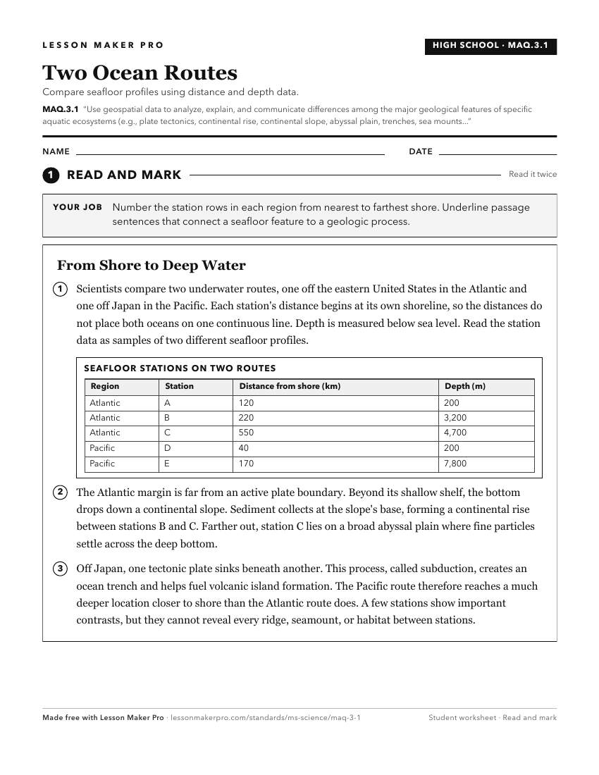
A ready-to-print activity worksheet aligned to MAQ.3.1, with an answer key for the teacher on its own page. No account needed.
PDF, US Letter, prints cleanly in black and white.
Download the worksheetKeep exploring
Related Standards
- E.1.9B.2
Generate and answer questions to explain the patterns and location of frozen and liquid bodies of water on earth using maps, globes, or other media.
- ESS.2B.4
Research, analyze, and explain the origin of geologic features and processes that result from plate tectonics, including sea floor spreading, earthquake activit...
- E.3.9.3
Use graphical representations to communicate the distribution of freshwater and saltwater on Earth (e.g., oceans, lakes, rivers, glaciers, groundwater, or polar...
- E.4.9C.1
Analyze and interpret data to describe (i.e., NASA, NOAA, USGS) and predict how natural processes (e.g., weathering, erosion, deposition, earthquakes, tsunamis,...
Turn this exact standard into a lesson
Grade, subject, topic, and the complete standard are prefilled. Create one free, no account needed.
Also for this standard:Make a WorksheetMake a QuizMake a Sub Lesson