Mississippi Science E.3.9.3
The Standard
- E.3.9
- Students will demonstrate an understanding of how the Earth’s systems (i.e., geosphere, hydrosphere, atmosphere, and biosphere) interact in multiple ways to affect Earth's surface materials and processes.
Use graphical representations to communicate the distribution of freshwater and saltwater on Earth (e.g., oceans, lakes, rivers, glaciers, groundwater, or polar ice caps).
2026 Mississippi College- and Career-Readiness Standards for Science · Earth’s Systems and Cycles
Teacher's field guide
What This Standard Means
What Students Need to Do
- Students make and read graphs showing how much of Earth's water is saltwater and how much is freshwater. They use a second graph to show where freshwater is found.
What Mastery Looks Like
- A student can show about 97 parts saltwater and 3 parts freshwater on a 100-square grid. They can explain that most freshwater is frozen or underground, while lakes and rivers hold very little.
Common Misconceptions
- Students may think lakes and rivers hold most freshwater because those are the sources they see. Some leave glaciers off the graph or picture groundwater as a river flowing underground.
How to Assess It
- Exit ticket: Shade 97 squares for saltwater and 3 for freshwater on a 100-square grid. Then name the largest freshwater source and one source that holds much less.
Lesson moves
Ways to Teach It
Give pairs a 100-square grid to color, with 97 squares for saltwater and 3 for freshwater, then have them add a key.
Show a graph of freshwater sources and ask, "Why are lakes and rivers barely visible, even though we see them often?"
Teams draw ocean, glacier, well, lake, and river cards, then place each beside its matching section on a class water graph.
Use a nearby town's water report to find its drinking-water source, then mark that source on a graph of freshwater locations.
Free download
Printable E.3.9.3 Worksheet
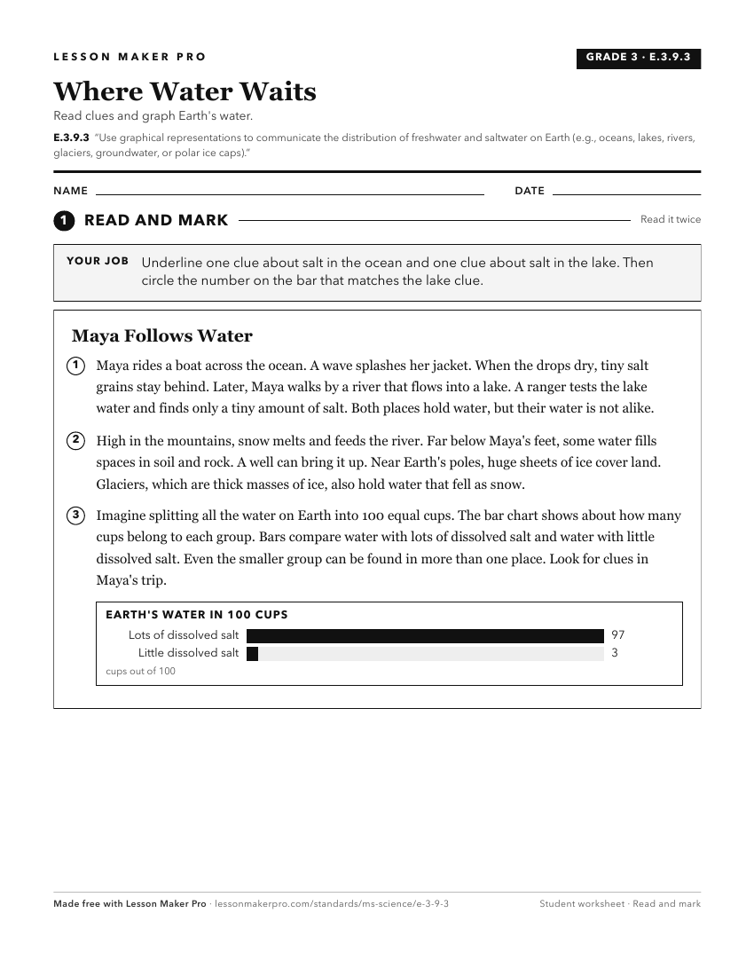
A ready-to-print activity worksheet aligned to E.3.9.3, with an answer key for the teacher on its own page. No account needed.
PDF, US Letter, prints cleanly in black and white.
Download the worksheetKeep exploring
Related Standards
- E.1.9B
Students will demonstrate an understanding of models (drawings or maps) to describe how water and land are distributed on Earth.
- E.1.9B.2
Generate and answer questions to explain the patterns and location of frozen and liquid bodies of water on earth using maps, globes, or other media.
- E.1.9B.1
Locate, classify, and describe bodies of water (oceans, rivers, lakes, and ponds) on the Earth's surface using maps, globes, or other media.
- MAQ.3.1
Use geospatial data to analyze, explain, and communicate differences among the major geological features of specific aquatic ecosystems (e.g., plate tectonics, ...
Turn this exact standard into a lesson
Grade, subject, topic, and the complete standard are prefilled. Create one free, no account needed.
Also for this standard:Make a WorksheetMake a QuizMake a Sub Lesson