Georgia SS2G2
Georgia Standard (Element Cluster)
Describe the cultural and geographic systems associated with the historical figures in SS2H1 and Georgia's Muscogee (Creek) and Cherokee in SS2H2.
Georgia Standards of Excellence for Social Studies
Cluster contents
Elements in This Standard
SS2G2 is a Georgia social studies standard. These are the elements under it.
- SS2G2.a
Identify specific locations significant to the life and times of each historic figure, and the Muscogee (Creek) and Cherokee, on a political or physical map.
- SS2G2.b
Describe how each historic figure and the Muscogee (Creek) and Cherokee adapted to and were influenced by their environments.
- SS2G2.c
Describe how the region in which these historic figures lived affected their lives and compare these regions to the region in which students live.
- SS2G2.d
Describe the regions in Georgia where the Muscogee (Creek) and Cherokee lived and how the people used their local resources.
Teacher's field guide
What This Cluster Means
What Students Need to Do
- Students locate places tied to each studied person and to the Muscogee and Cherokee on political and physical maps. They describe how land, water, climate, and resources shaped homes, work, travel, and choices. They compare those regions with their own region.
What Mastery Looks Like
- Students correctly identify significant locations for each studied person and nation. They explain a clear link between the environment and how people lived or acted. They can name a similarity and difference between that region and their own.
Common Misconceptions
- Students may place every person only in Georgia, even when other locations shaped that person's life. They may treat the Muscogee and Cherokee as one culture. They may name a landform without explaining how it affected people.
How to Assess It
- On an outline map, have students mark one significant place for a named person or nation. Ask them to explain one environmental influence and one comparison with their own region.
Lesson moves
Ways to Teach It
Give pairs Georgia and U.S. maps, person cards, and resource cards; students place each card and explain one connection.
Write three sentences answering: How did the land or water in one person's region shape what that person did?
Play Map Match: teams match location, landform, and person or nation cards, then earn a point by explaining the link.
Use a local map to compare nearby land and water with a studied region, then name one way daily life differs.
Free download
Printable SS2G2 Worksheet
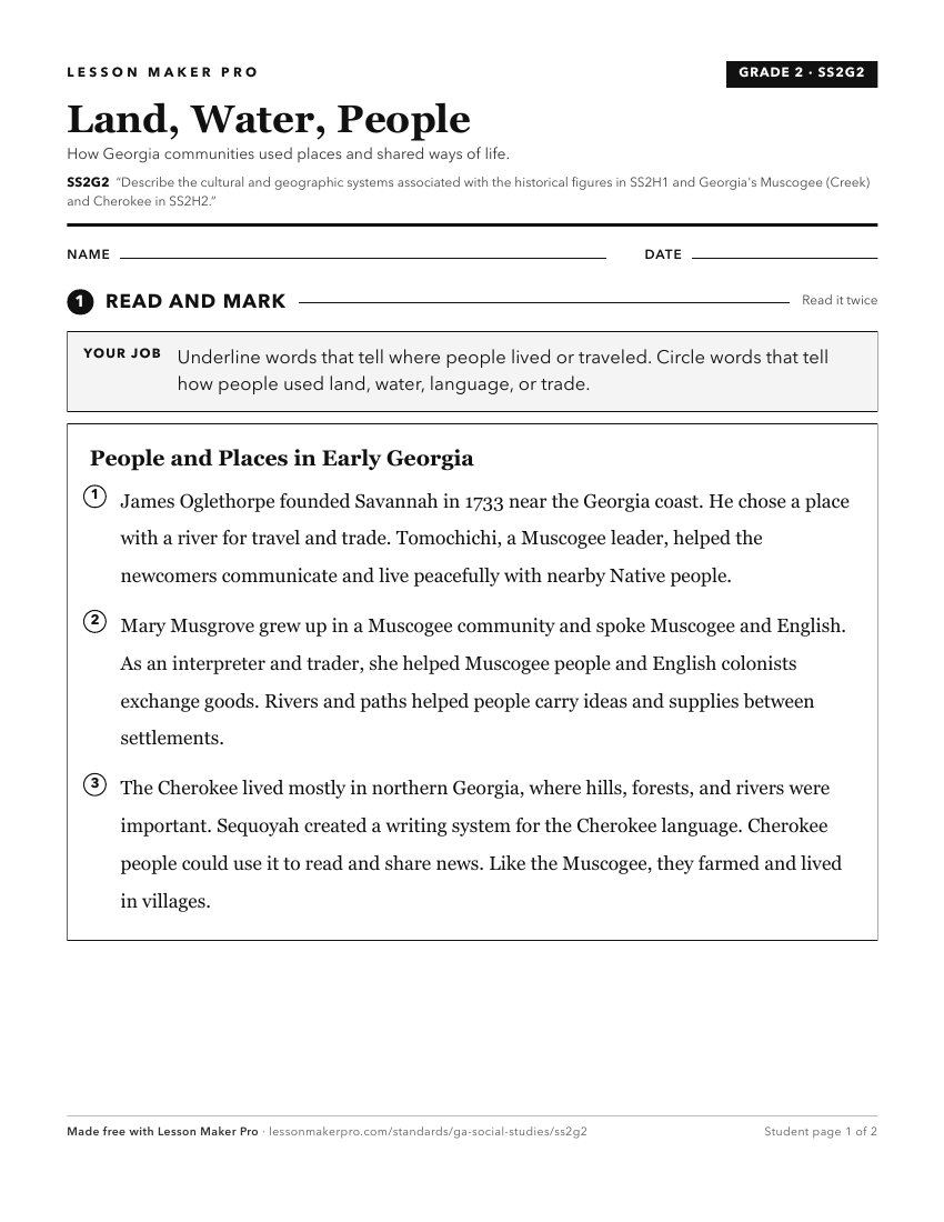
A ready-to-print activity worksheet aligned to SS2G2, with an answer key for the teacher on its own page. No account needed.
PDF, US Letter, prints cleanly in black and white.
Download the worksheetKeep exploring
Related Standards
Turn this cluster into a lesson
Grade, subject, topic, and the complete cluster are prefilled. Create one free, no account needed.
Also for this cluster:Make a WorksheetMake a QuizMake a Sub Lesson