Alabama Social Studies SS24.3.1
Standard Cluster
Locate map features, using geographic terminology to describe them. 1a Identify the Equator, International Date Line, Prime Meridian, Tropic of Capricorn, and Tropic of Cancer, using cardinal and intermediate directions. 1b Locate points on a grid using latitude and longitude coordinates. 1c Use the map scale to calculate the distance between two locations.
2024 Alabama Course of Study: Social Studies
Cluster contents
Standards in This Cluster
SS24.3.1 is a cluster heading. These are the individual standards under it.
- SS24.3.1a
Identify the Equator, International Date Line, Prime Meridian, Tropic of Capricorn, and Tropic of Cancer, using cardinal and intermediate directions.
- SS24.3.1b
Locate points on a grid using latitude and longitude coordinates.
- SS24.3.1c
Use the map scale to calculate the distance between two locations.
Teacher's field guide
What This Cluster Means
What Students Need to Do
- Students find five major reference lines on a world map and describe locations using compass directions. They use latitude and longitude to find points on a grid. They measure between places on a map and use its scale to calculate distance.
What Mastery Looks Like
- A student labels the Equator, Prime Meridian, International Date Line, and both tropics in the right places. Given coordinates, they mark the correct grid intersection and describe its direction from another point. They measure a map distance and give the scaled distance with units.
Common Misconceptions
- Students may swap latitude and longitude or mark a point on just one line instead of at an intersection. They may confuse the Prime Meridian with the International Date Line or put the Tropic of Capricorn north of the Equator. Some use the scale without measuring between the places first.
How to Assess It
- Give students a world map with a grid, scale, and two marked cities. Ask them to label the five reference lines, plot 20°N, 30°E, state its direction from 10°S, 10°W, and calculate the straight-line distance between the cities.
Lesson moves
Ways to Teach It
Give pairs blank world maps and colored pencils to trace and name the five reference lines, then describe two marked points using compass directions.
Ask students to explain in two sentences why 20°S, 60°W is southwest of 10°N, 30°E.
Call out coordinates on a printed grid; partners race to mark each intersection, then check their points against an answer key.
Give students a local map with a scale; have them measure the straight-line distance from school to the library and calculate miles.
Free download
Printable SS24.3.1 Worksheet
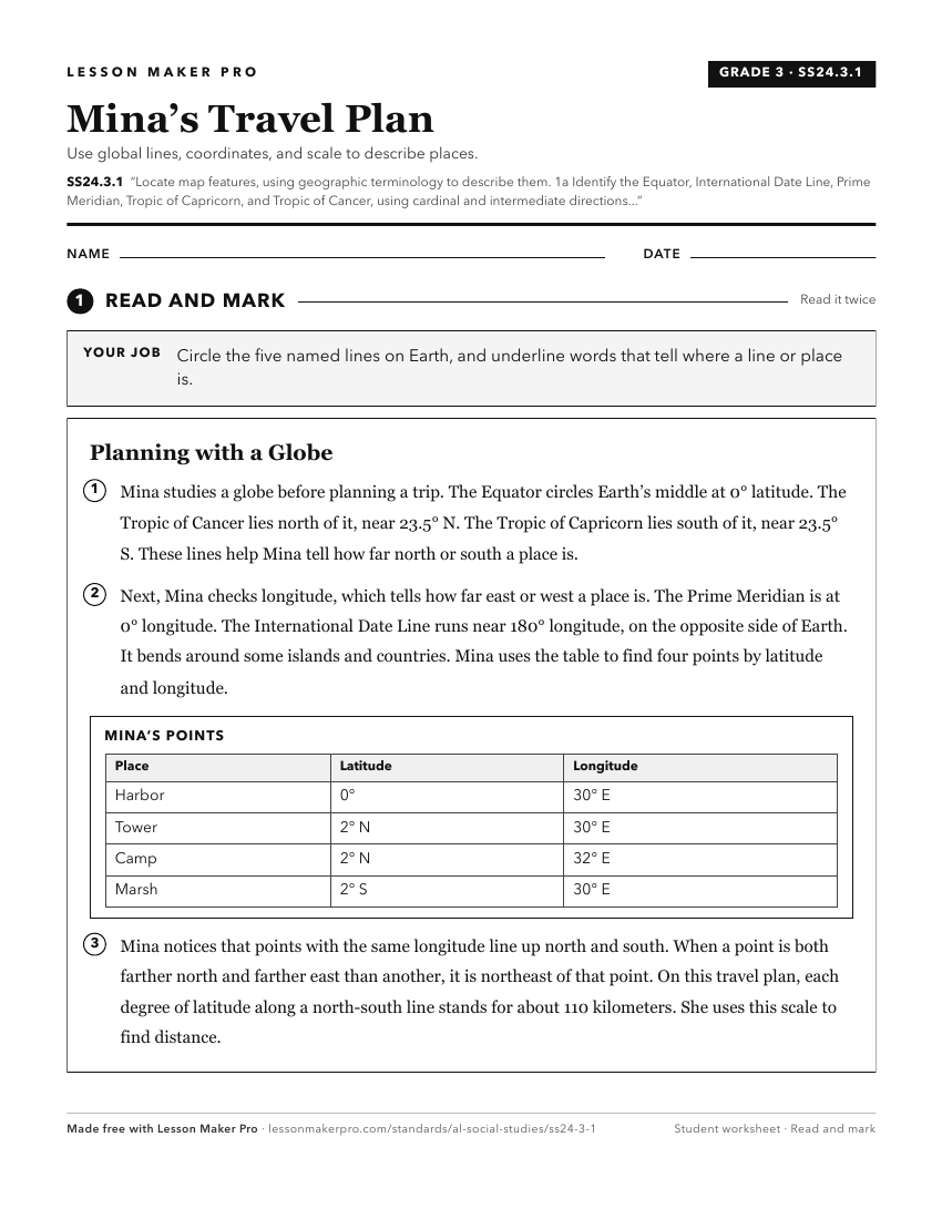
A ready-to-print activity worksheet aligned to SS24.3.1, with an answer key for the teacher on its own page. No account needed.
PDF, US Letter, prints cleanly in black and white.
Download the worksheetKeep exploring
Related Standards
- SS24.1.8a
Identify map features, including title, cardinal directions, and key.
- SS24.K.8
Identify landforms and bodies of water on maps, globes, and satellite and digital images.
- SS24.1.9
Differentiate among landforms, bodies of water, and other physical features on maps, globes, and satellite and digital images.
- SS24.7.1b
Use physical, political, and special-purpose maps to identify the distribution of people, location of places, and classification of physical features.
Turn this cluster into a lesson
Grade, subject, topic, and the complete cluster are prefilled. Create one free, no account needed.
Also for this cluster:Make a WorksheetMake a QuizMake a Sub Lesson