Texas TEKS 8.10.A
The Standard
- 8.10
- Geography. The student understands the location and characteristics of places and regions of the United States, past and present. The student is expected to:
locate places and regions directly related to major eras and turning points in the United States during the 17th, 18th, and 19th centuries
Texas Essential Knowledge and Skills for Social Studies
Teacher's field guide
What This Standard Means
What Students Need to Do
- Students identify and label places tied to colonization, independence, westward expansion, and the Civil War on historical maps. They connect each location or region to the event that happened there.
What Mastery Looks Like
- Given a blank map, students can accurately place key settlements, battle sites, territories, and regions. They describe locations using direction, nearby landmarks, boundaries, and regional names.
Common Misconceptions
- Students may treat the Louisiana Purchase as one state or place all thirteen colonies across the entire East Coast. They may also use current state borders when reading maps from earlier periods.
How to Assess It
- Give students a blank outline map. Ask them to label Jamestown, Yorktown, the Louisiana Purchase, and Gettysburg, then name the event or era linked to each.
Lesson moves
Ways to Teach It
Build a floor map with masking tape, then place labeled cards for Jamestown, Yorktown, the Louisiana Purchase, and Gettysburg.
Write three sentences explaining how geography affected either colonial settlement, westward expansion, or a Civil War campaign.
Run a map relay where teams draw event cards and place matching location markers on a blank United States map.
Use a current road map to plan a route between three historic sites, then compare modern state borders with historical boundaries.
Free download
Printable 8.10.A Worksheet
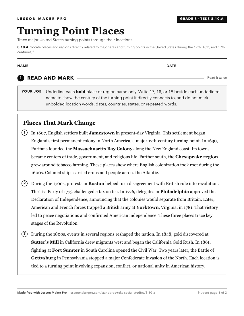
A ready-to-print activity worksheet aligned to 8.10.A, with an answer key for the teacher on its own page. No account needed.
PDF, US Letter, prints cleanly in black and white.
Download the worksheetKeep exploring
Related Standards
- 5.6.C
locate on a map important political features such as the five largest cities by population in the United States and the 50 states
- 8.10.B
compare places and regions of the United States in terms of physical and human characteristics
- 8.10.C
analyze the effects of physical and human geographic factors such as weather, landforms, waterways, transportation, and communication on major historical events...
- 8.1.A
identify the major eras in U.S. history through 1877, including colonization, revolution, creation and ratification of the Constitution, early republic, the Age...
Turn this exact standard into a lesson
Grade, subject, topic, and the complete standard are prefilled. Create one free, no account needed.
Also for this standard:Make a WorksheetMake a QuizMake a Sub Lesson