Texas TEKS 8.10.B
The Standard
- 8.10
- Geography. The student understands the location and characteristics of places and regions of the United States, past and present. The student is expected to:
compare places and regions of the United States in terms of physical and human characteristics
Texas Essential Knowledge and Skills for Social Studies
Teacher's field guide
What This Standard Means
What Students Need to Do
- Students use maps, images, and data to identify landforms, climate, resources, population, settlement, culture, and economic activity. They compare two United States places or regions using clear evidence.
What Mastery Looks Like
- Students can name accurate similarities and differences between two regions. They explain how physical features relate to settlement, work, transportation, or culture, using map or data evidence.
Common Misconceptions
- Students may confuse physical features, such as rivers, with human features, such as cities and highways. They may also treat every state within a region as identical or make comparisons without evidence.
How to Assess It
- Give students maps of the Northeast and Southwest. Ask them to write one physical difference, one human difference, and one evidence-based explanation.
Lesson moves
Ways to Teach It
Give pairs region cards with maps, climate graphs, city data, and photos, then have them sort details into physical and human features.
Ask students to write which region would support a large farming community best, using two physical features and one human feature.
Play a region comparison relay where teams draw two cards and state an accurate similarity or difference supported by a classroom map.
Have students compare their Texas community with another United States city using census data, climate records, transportation maps, and local industry information.
Free download
Printable 8.10.B Worksheet
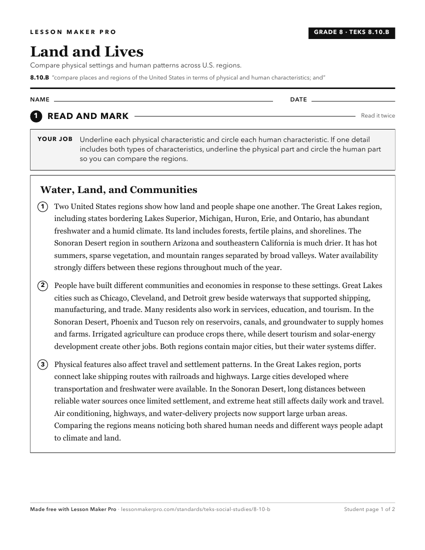
A ready-to-print activity worksheet aligned to 8.10.B, with an answer key for the teacher on its own page. No account needed.
PDF, US Letter, prints cleanly in black and white.
Download the worksheetKeep exploring
Related Standards
- 8.12.A
identify economic differences among different regions of the United States
- 7.8.B
locate and compare places of importance in Texas in terms of physical and human characteristics such as major cities, waterways, natural and historic landmarks,...
- 8.11.A
analyze how physical characteristics of the environment influenced population distribution, settlement patterns, and economic activities in the United States
- 5.6.B
describe regions in the United States based on physical characteristics such as landform, climate, and vegetation
Turn this exact standard into a lesson
Grade, subject, topic, and the complete standard are prefilled. Create one free, no account needed.
Also for this standard:Make a WorksheetMake a QuizMake a Sub Lesson