Oklahoma Social Studies WG.C.5
Standard Cluster
Analyze patterns of land use among the world’s people. Analyze settlement patterns associated with major agricultural regions and linkages among regions of food production and consumption. Describe the characteristics of modern commercial agriculture including major production regions, variations within major zones, and the effects of markets. Examine the impact of agricultural practices (e.g., irrigation, levees, terraced farming, crop rotation, conservation, and deforestation) on the environment and quality of life. Explain how transportation improvements (e.g., aqueducts, canals, railroad systems, airports) impacted human development through modification of the environment. Analyze the influence of geography on current issues to consider decisions regarding future land use, including the costs and benefits of environmental regulation.
Oklahoma Academic Standards for Social Studies (2026)
Cluster contents
Standards in This Cluster
WG.C.5 is a cluster heading. These are the individual standards under it.
- WG.C.5.1
Analyze settlement patterns associated with major agricultural regions and linkages among regions of food production and consumption.
- WG.C.5.2
Describe the characteristics of modern commercial agriculture including major production regions, variations within major zones, and the effects of markets.
- WG.C.5.3
Examine the impact of agricultural practices (e.g., irrigation, levees, terraced farming, crop rotation, conservation, and deforestation) on the environment and...
- WG.C.5.4
Explain how transportation improvements (e.g., aqueducts, canals, railroad systems, airports) impacted human development through modification of the environment...
- WG.C.5.5
Analyze the influence of geography on current issues to consider decisions regarding future land use, including the costs and benefits of environmental regulati...
Teacher's field guide
What This Cluster Means
What Students Need to Do
- Students map where people farm and live, then trace how food reaches buyers. They compare farming regions and explain how markets, farming methods, and transport change land and water. They weigh those effects when choosing future land uses.
What Mastery Looks Like
- Students use maps to explain why farms and towns cluster in certain places. They compare how markets shape two farming regions. They predict how irrigation or a new rail line could affect people and the environment, then defend a land-use choice.
Common Misconceptions
- Students may assume food is grown near the people who eat it, or that every farm in a region uses the same methods. They may see irrigation and transport as pure gains, missing water shortages and habitat damage.
How to Assess It
- Show a map with farms, a city, a river, and a proposed canal. Ask: Where might farms expand, who would benefit, and what environmental cost should a land-use rule address?
Lesson moves
Ways to Teach It
Give groups a blank world map and rice, wheat, and cattle cards; have them place production regions and draw routes to buyers.
Ask students to write a claim: Should a county allow new irrigated farms near its river? Use evidence about jobs, water, and habitat.
Give pairs crop, climate, market, and transport cards; have them match likely farm locations and explain each match.
Use a grocery-store banana label to map its route from farm to store, then mark where roads and ports affect land and jobs.
Free download
Printable WG.C.5 Worksheet
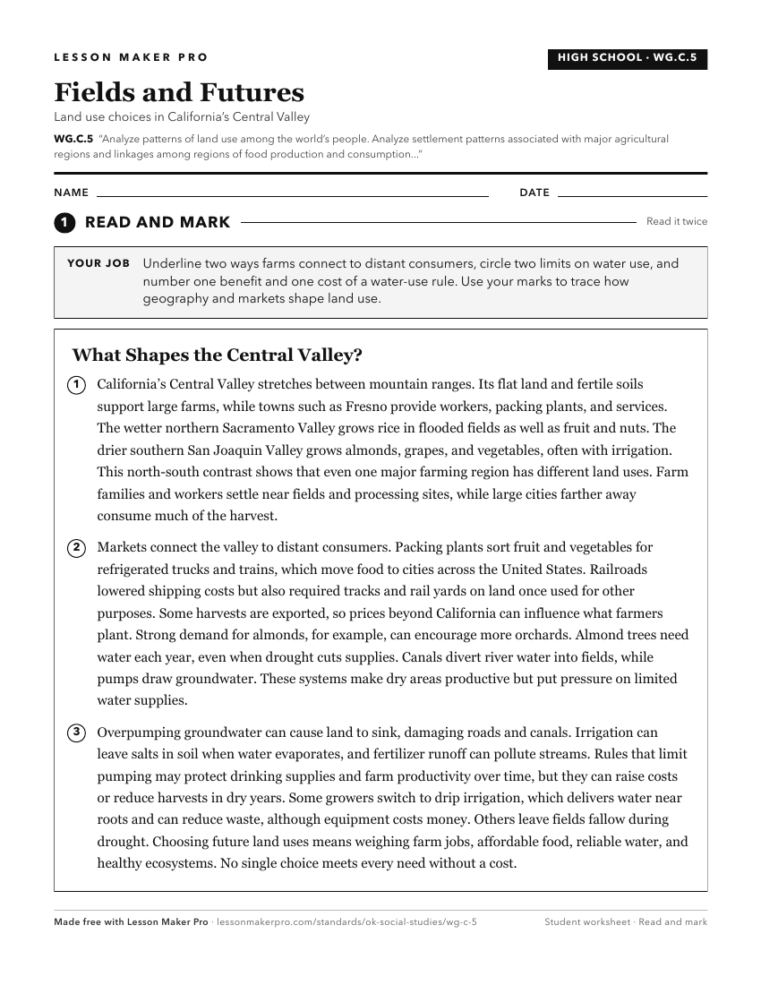
A ready-to-print activity worksheet aligned to WG.C.5, with an answer key for the teacher on its own page. No account needed.
PDF, US Letter, prints cleanly in black and white.
Download the worksheetKeep exploring
Related Standards
- WG.C.2
Analyze how the human population is organized geographically in order to understand how change affects human systems.
- 2.C.3.8
Compare the characteristics of land use in urban and rural environments (e.g., agricultural and recreational purposes, manufacturing, shopping, community buildi...
- MWH.C.1
Analyze the impact of the patterns of ancient political, economic, and cultural development.
Turn this cluster into a lesson
Grade, subject, topic, and the complete cluster are prefilled. Create one free, no account needed.
Also for this cluster:Make a WorksheetMake a QuizMake a Sub Lesson