Oklahoma Social Studies 6.P.2.3
Standard Cluster
- 6.P.2
- Use interdisciplinary tools to acquire, apply, and evaluate content understanding of the four strands of social studies.
Demonstrate a mastery of geographic concepts and the use of geographic tools to understand the impact of geography on the past and present. Answer geographic questions and conduct investigations by acquiring, organizing, and interpreting information about the modern world and historical events. Use multiple mapping techniques, data visuals, satellite images, and geographic technology to analyze spatial patterns of physical and human characteristics, making connections between regions. Explain how the environment affects cultural patterns and historical events, providing opportunities and challenges for human development.
Oklahoma Academic Standards for Social Studies (2026) · 6.P.2
Cluster contents
Standards in This Cluster
6.P.2.3 is a cluster heading. These are the individual standards under it.
- 6.P.2.3.A
Answer geographic questions and conduct investigations by acquiring, organizing, and interpreting information about the modern world and historical events.
- 6.P.2.3.B
Use multiple mapping techniques, data visuals, satellite images, and geographic technology to analyze spatial patterns of physical and human characteristics, ma...
- 6.P.2.3.C
Explain how the environment affects cultural patterns and historical events, providing opportunities and challenges for human development.
Teacher's field guide
What This Cluster Means
What Students Need to Do
- Students use maps, satellite images, and data charts to find patterns in where people live. They use evidence to explain how land, water, and climate shaped choices in the past and affect people today.
What Mastery Looks Like
- A student can compare ancient and current maps and point out a shared settlement pattern near a river. They explain how the river supports farming and travel but also brings flood risk, using details from the maps.
Common Misconceptions
- Students may mistake a large shaded area for a large population when a map shows population density. They may assume rivers only help people, or that climate makes every community live the same way.
How to Assess It
- Hand out a physical map of Egypt, an ancient settlement map, and a current population density map. Ask: "Where do people cluster along the Nile, then and now? Use two map details to explain why."
Lesson moves
Ways to Teach It
Give pairs satellite images of the Nile Delta and Indus Valley; have them trace rivers, fields, and settlements on each image.
Show ancient and current Egypt settlement maps; ask students to write what stayed near the Nile and what changed.
Post four maps showing rainfall, rivers, ancient cities, and current population; teams match location claims to the map that best supports each one.
Use Google Earth to compare Cairo and Siwa Oasis; have students mark fields, roads, and water, then explain the settlement patterns.
Free download
Printable 6.P.2.3 Worksheet
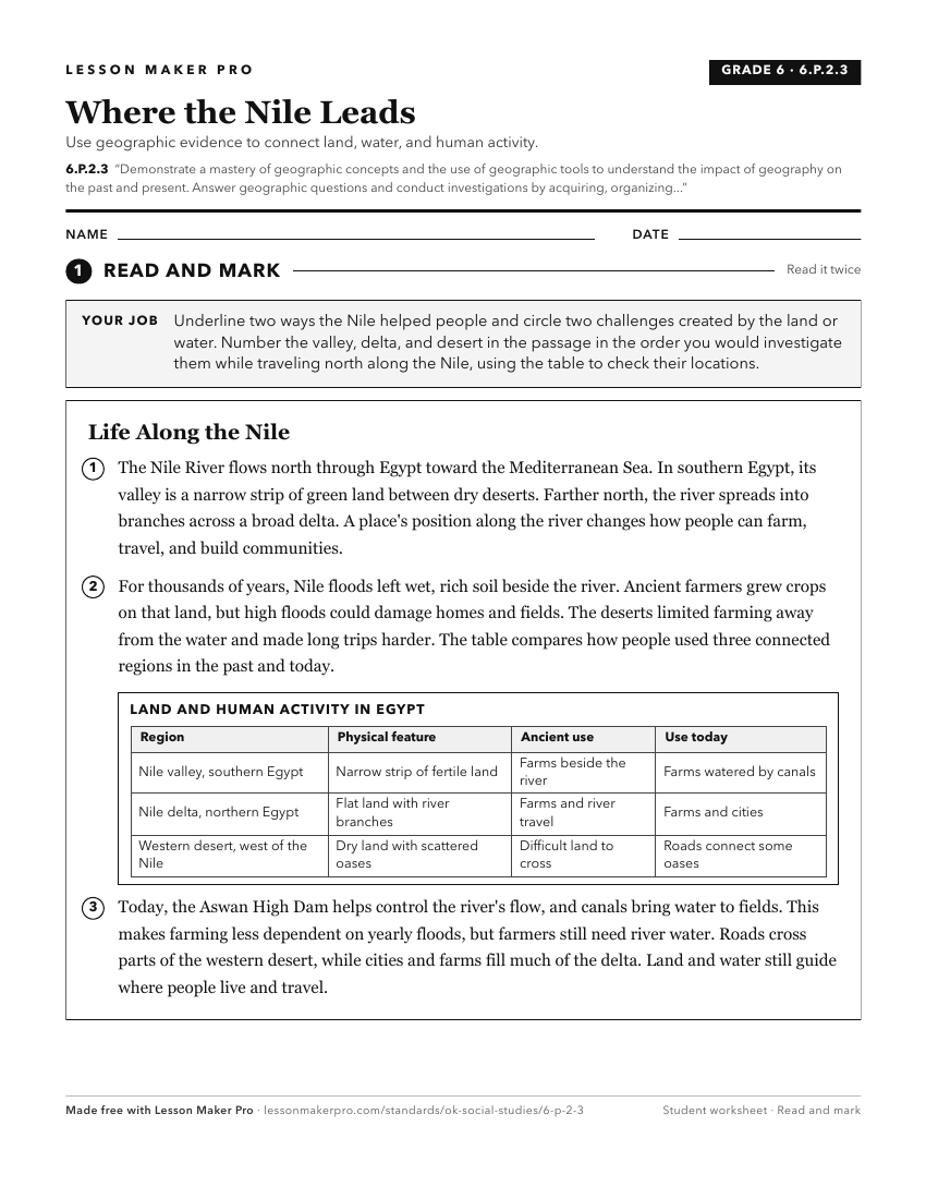
A ready-to-print activity worksheet aligned to 6.P.2.3, with an answer key for the teacher on its own page. No account needed.
PDF, US Letter, prints cleanly in black and white.
Download the worksheetKeep exploring
Related Standards
Turn this cluster into a lesson
Grade, subject, topic, and the complete cluster are prefilled. Create one free, no account needed.
Also for this cluster:Make a WorksheetMake a QuizMake a Sub Lesson