Oklahoma Social Studies 1.P.2.3
Standard Cluster
- 1.P.2
- Use interdisciplinary tools to acquire, apply, and evaluate content understanding of the four strands of social studies.
Demonstrate a mastery of geographic concepts and the use of geographic tools to understand the impact of geography on the past and present. Answer geographic questions using geographic information about the student’s own community. Identify and describe the community’s human and physical environment through the use and creation of simple maps and photographs of the community. Identify how the physical environment impacts our daily lives and affects human activities.
Oklahoma Academic Standards for Social Studies (2026) · 1.P.2
Cluster contents
Standards in This Cluster
1.P.2.3 is a cluster heading. These are the individual standards under it.
- 1.P.2.3.A
Answer geographic questions using geographic information about the student’s own community.
- 1.P.2.3.B
Identify and describe the community’s human and physical environment through the use and creation of simple maps and photographs of the community.
- 1.P.2.3.C
Identify how the physical environment impacts our daily lives and affects human activities.
Teacher's field guide
What This Cluster Means
What Students Need to Do
- Students use simple maps and photos to answer questions about places in their community. They identify natural features and things people built. They explain how a feature, such as a hill or tree, affects where people walk, build, or play.
What Mastery Looks Like
- A student can draw a simple map of the schoolyard and use it to find the playground. They can point out a tree and a sidewalk, then explain how the tree gives people shade.
Common Misconceptions
- Students may think a map shows a place from the same view as a photo. They may call a sidewalk a natural feature or miss how a hill changes the route people take.
How to Assess It
- Show a photo of the schoolyard. Ask students to name one natural feature, one thing people built, and one way either affects what people do there.
Lesson moves
Ways to Teach It
Walk the schoolyard, then have students draw a map with the school building, playground, and two natural features they saw.
Show a schoolyard photo and ask, “Where would you play for shade, and what in the photo helps you decide?”
Give pairs a schoolyard map and photo cards of its features; have them match each card to a spot on the map.
On a school map, have students plan a route from the entrance to the playground after rain and explain their choice.
Free download
Printable 1.P.2.3 Worksheet
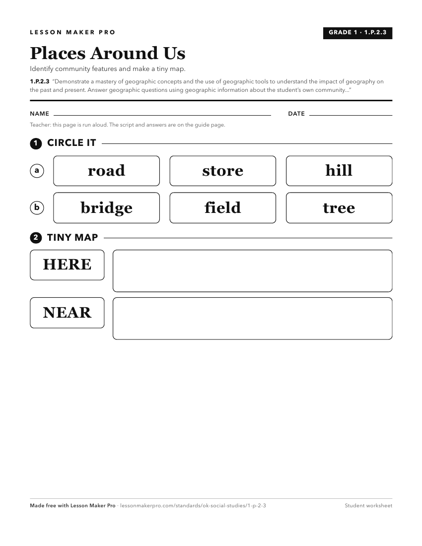
A ready-to-print activity worksheet aligned to 1.P.2.3, with an answer key for the teacher on its own page. No account needed.
PDF, US Letter, prints cleanly in black and white.
Download the worksheetKeep exploring
Related Standards
Turn this cluster into a lesson
Grade, subject, topic, and the complete cluster are prefilled. Create one free, no account needed.
Also for this cluster:Make a WorksheetMake a QuizMake a Sub Lesson