Oklahoma Social Studies 5.P.2.3
Standard Cluster
- 5.P.2
- Use interdisciplinary tools to acquire, apply, and evaluate content understanding of the four strands of social studies.
Demonstrate a mastery of geographic concepts and the use of geographic tools to understand the impact of geography on the past and present. Answer geographic questions by organizing geographic information from historical as well as contemporary perspectives. Analyze human and physical features of the nation by drawing conclusions and explaining spatial relationships of physical and human places from geographic representations. Explain how environmental factors affected historical events and continue to impact contemporary human activities.
Oklahoma Academic Standards for Social Studies (2026) · 5.P.2
Cluster contents
Standards in This Cluster
5.P.2.3 is a cluster heading. These are the individual standards under it.
- 5.P.2.3.A
Answer geographic questions by organizing geographic information from historical as well as contemporary perspectives.
- 5.P.2.3.B
Analyze human and physical features of the nation by drawing conclusions and explaining spatial relationships of physical and human places from geographic repre...
- 5.P.2.3.C
Explain how environmental factors affected historical events and continue to impact contemporary human activities.
Teacher's field guide
What This Cluster Means
What Students Need to Do
- Read older and current maps using their keys. Sort rivers and landforms from roads and towns, then use their locations to explain how the land affected people in the past and affects them now.
What Mastery Looks Like
- A student can locate a river and nearby towns on two maps of the same area. They can explain why people settled near the river and name a flood risk people face there today.
Common Misconceptions
- Students may call a road a physical feature or a river a human feature. They may see towns near a river but overlook both the benefits of river travel and the risk of flooding.
How to Assess It
- Show an 1800s settlement map and a current flood-risk map of the same Mississippi River area. Ask students to circle one riverside town and write why people settled there and what risk residents face now.
Lesson moves
Ways to Teach It
Trace the Mississippi River on two maps of the same area, one from the 1800s and one current, then dot nearby settlements and cities.
Ask: Why did towns grow near the Mississippi River in the 1800s, and what problem can that location cause today?
Give pairs map cards showing rivers, hills, roads, and towns; have them sort physical from human features and explain each choice.
Use a New Orleans flood-risk map to pick a site for a new school, then write two map-based reasons for the choice.
Free download
Printable 5.P.2.3 Worksheet
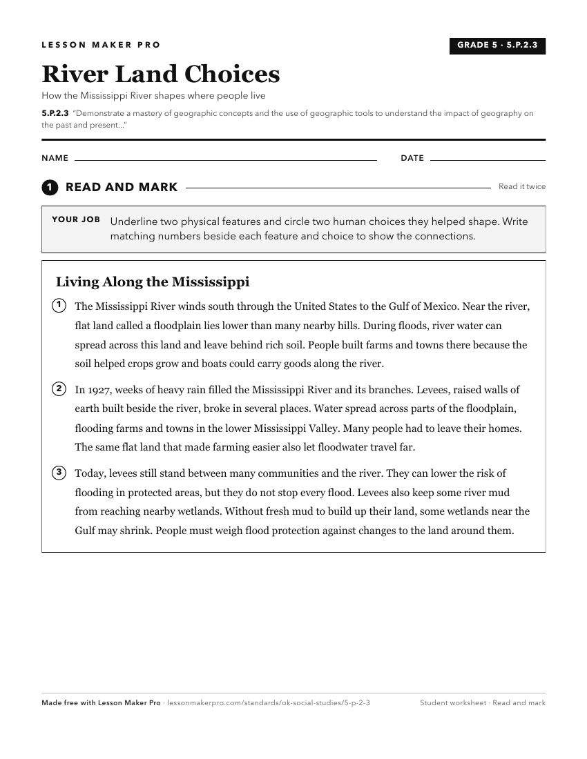
A ready-to-print activity worksheet aligned to 5.P.2.3, with an answer key for the teacher on its own page. No account needed.
PDF, US Letter, prints cleanly in black and white.
Download the worksheetKeep exploring
Related Standards
Turn this cluster into a lesson
Grade, subject, topic, and the complete cluster are prefilled. Create one free, no account needed.
Also for this cluster:Make a WorksheetMake a QuizMake a Sub Lesson