Oklahoma Social Studies 6.C.2.2
The Standard
- 6.C.2
- Analyze the physical systems of the major regions of the Western Hemisphere.
Use visual information to describe on a physical map the major climate and vegetation zones, drawing conclusions about their impact on human development.
Oklahoma Academic Standards for Social Studies (2026) · 6.C.2
Teacher's field guide
What This Standard Means
What Students Need to Do
- Students use map legends to locate major climate and vegetation zones on a physical map. They use those zones to explain where farming or settlements might develop and why.
What Mastery Looks Like
- A student can locate a desert, grassland, rainforest, and tundra on a map and describe the conditions in each. They can explain why access to water might shape settlement in a desert.
Common Misconceptions
- Students may mistake green shading for vegetation when a physical map uses green to show low elevation. They may think all deserts are hot or that people cannot farm in them.
How to Assess It
- Give students a physical map and a climate and vegetation map. Ask them to mark one desert and one grassland, then write where farming is more likely and what map clues support their answer.
Lesson moves
Ways to Teach It
Use tracing paper to transfer rainforest, desert, grassland, and tundra zones from an atlas onto a physical world map.
Ask: Why might a desert town grow near a river? Have students use two map clues in their answer.
Play map match: students place zone cards on a physical map and name one likely use of the land.
Compare a satellite image of Nile farms with a physical map of Egypt, then mark where river water supports farming.
Free download
Printable 6.C.2.2 Worksheet
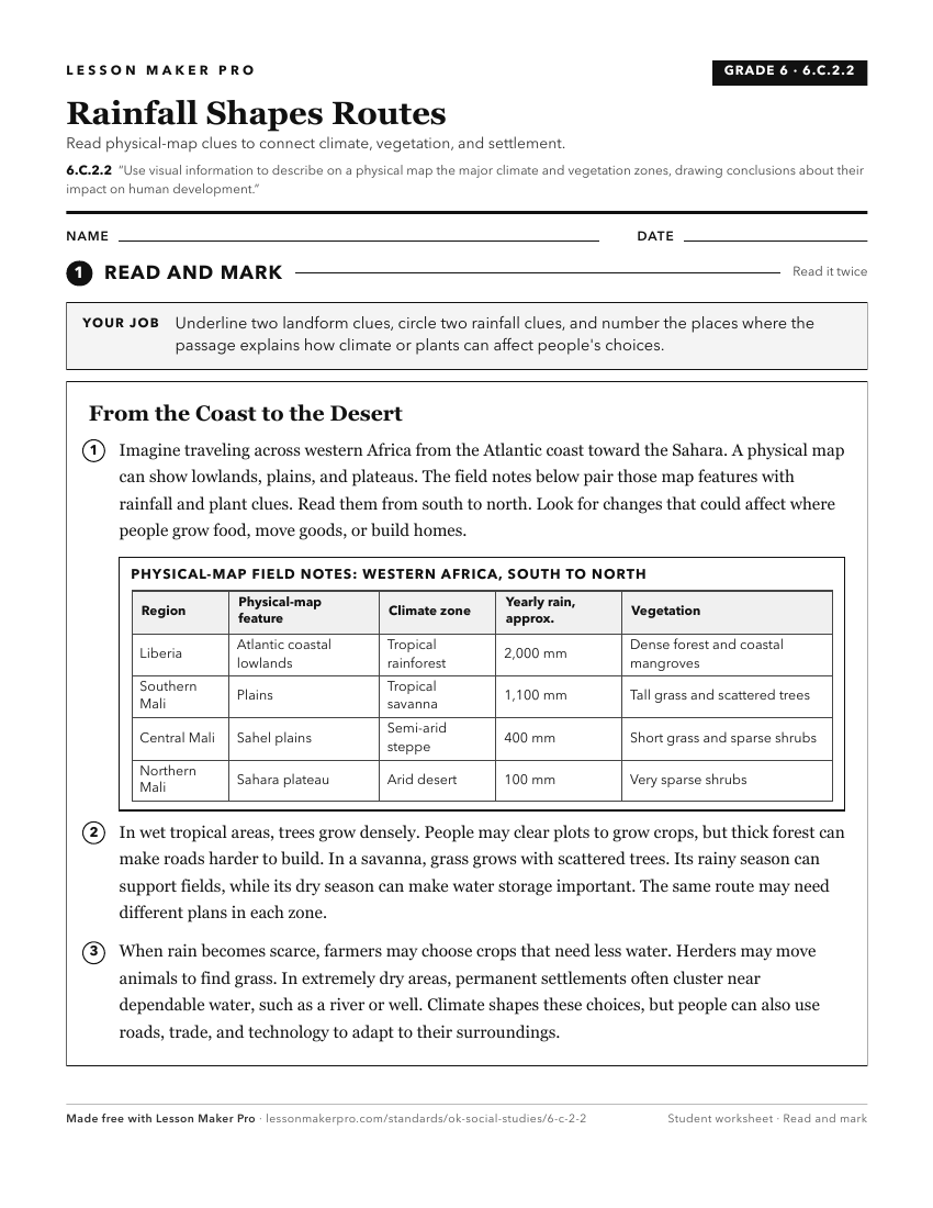
A ready-to-print activity worksheet aligned to 6.C.2.2, with an answer key for the teacher on its own page. No account needed.
PDF, US Letter, prints cleanly in black and white.
Download the worksheetKeep exploring
Related Standards
- 4.C.2.1.B
Use maps and other geographic representations (e.g., globes, charts, graphs) and geographic technologies to draw conclusions (e.g., settlement patterns, populat...
- 4.C.2.2.B
Describe the location of major climate zones (tropical, temperate, continental, polar) explaining how climate affects natural vegetation.
- 7.C.2.1
Identify on a physical map the major landforms and bodies of water of each region and compare climatic conditions, vegetation, and biomes using thematic maps an...
- 4.C.2.2.C
Draw conclusions from geographic data to explain how climate, vegetation, and bodies of water can affect the location and growth of settlements and the developm...
Turn this exact standard into a lesson
Grade, subject, topic, and the complete standard are prefilled. Create one free, no account needed.
Also for this standard:Make a WorksheetMake a QuizMake a Sub Lesson