Oklahoma Social Studies 4.C.2.2.C
The Standard
- 4.C.2
- Apply the tools and concepts of geography to examine the physical and human geography of the United States of America.
- 4.C.2.2
- Identify major physical regions of the United States of America and their unique features.
Draw conclusions from geographic data to explain how climate, vegetation, and bodies of water can affect the location and growth of settlements and the development of economic activities.
Oklahoma Academic Standards for Social Studies (2026) · 4.C.2.2
Teacher's field guide
What This Standard Means
What Students Need to Do
- Students compare maps and climate charts showing rainfall, vegetation, bodies of water, and towns. They use the data to explain where people settled, why a town might grow, and what work people could do there.
What Mastery Looks Like
- Given two sites, a student uses rainfall, vegetation, and water as evidence for where a town might grow. They explain how those conditions could support more people and jobs, such as farming or ranching.
Common Misconceptions
- Some students assume any place near water will grow, without considering rainfall or plant cover. Others mistake green shading for farmland without checking the map key.
How to Assess It
- Exit ticket: Show Site A beside a river in rainy grassland and Site B away from water in dry scrub. Ask, "Which town might grow faster, what job might develop there, and what two clues support your answer?"
Lesson moves
Ways to Teach It
Overlay a transparent town map on rainfall, vegetation, and river maps; circle a likely settlement site and label two reasons.
Show two town sites on a river and rainfall map; ask, "Which site would grow faster, and what map clues support your choice?"
Play a map-match game: pairs place farm, ranch, and marina cards on a river, grassland, and lake map, then explain each match.
On a map of Lake Eufaula, mark a marina and campground, then explain how the lake supports tourism jobs.
Free download
Printable 4.C.2.2.C Worksheet
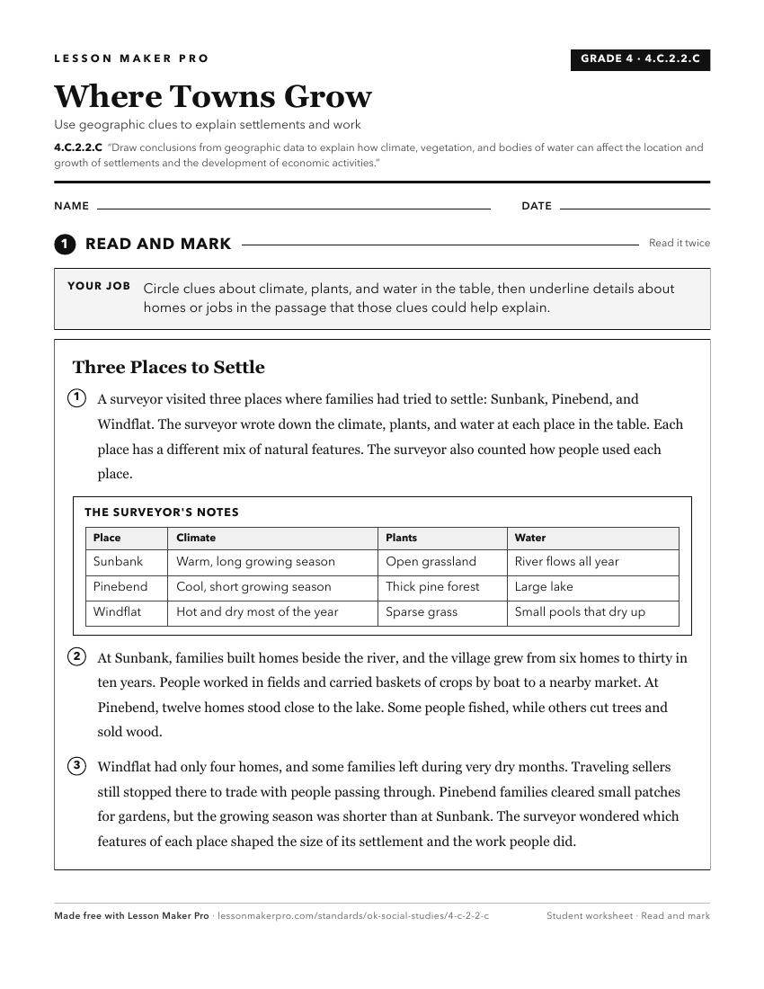
A ready-to-print activity worksheet aligned to 4.C.2.2.C, with an answer key for the teacher on its own page. No account needed.
PDF, US Letter, prints cleanly in black and white.
Download the worksheetKeep exploring
Related Standards
- 4.C.2.1.B
Use maps and other geographic representations (e.g., globes, charts, graphs) and geographic technologies to draw conclusions (e.g., settlement patterns, populat...
- WG.C.1.4
Utilize geographic technologies and geographical data including census data and imagery to draw conclusions about the influence of geography on the world’s peop...
- 6.C.2.2
Use visual information to describe on a physical map the major climate and vegetation zones, drawing conclusions about their impact on human development.
- 6.C.1.2.C
Use different types of maps, graphs, charts, and geographic tools, such as satellite imagery and Geographic Information System (GIS) technology to draw conclusi...
Turn this exact standard into a lesson
Grade, subject, topic, and the complete standard are prefilled. Create one free, no account needed.
Also for this standard:Make a WorksheetMake a QuizMake a Sub Lesson