Oklahoma Social Studies 2.C.3
Standard Cluster
Describe the physical and human characteristics of their environment. Construct and use basic physical and political maps, including a legend and compass rose; explain how symbols are used to represent physical features and man-made structures on a map. Describe the relative location of the student’s community to major metropolitan centers of the state, using cardinal and intermediate directions. Identify basic types of major landforms and bodies of water on physical maps. Construct basic physical maps indicating the continents and oceans of the world. Describe the location of places on a map and globe, using a basic grid system. Ask geographic questions about where places are located and why they are located there. Examine how weather patterns, seasons, climate, and the physical features of a place can affect where and how people live. Compare the characteristics of land use in urban and rural environments (e.g., agricultural and recreational purposes, manufacturing, shopping, community buildings, schools, modes of transportation). Explain and describe human interaction with the environment by describing how humans both adapt to (e.g., clothing, housing, food choices) and modify it (e.g., farming, irrigation, mining, water reservoirs, construction of homes, businesses, highways) to meet their needs. Examine cultural traits of families and communities, understanding that while culture makes us unique, all cultures share common features (e.g., language, customs, religious beliefs, economic activities, traditional clothing, shelter).
Oklahoma Academic Standards for Social Studies (2026)
Cluster contents
Standards in This Cluster
2.C.3 is a cluster heading. These are the individual standards under it.
- 2.C.3.1
Construct and use basic physical and political maps, including a legend and compass rose; explain how symbols are used to represent physical features and man-ma...
- 2.C.3.2
Describe the relative location of the student’s community to major metropolitan centers of the state, using cardinal and intermediate directions.
- 2.C.3.3
Identify basic types of major landforms and bodies of water on physical maps.
- 2.C.3.4
Construct basic physical maps indicating the continents and oceans of the world.
- 2.C.3.5
Describe the location of places on a map and globe, using a basic grid system.
- 2.C.3.6
Ask geographic questions about where places are located and why they are located there.
- 2.C.3.7
Examine how weather patterns, seasons, climate, and the physical features of a place can affect where and how people live.
- 2.C.3.8
Compare the characteristics of land use in urban and rural environments (e.g., agricultural and recreational purposes, manufacturing, shopping, community buildi...
- 2.C.3.9
Explain and describe human interaction with the environment by describing how humans both adapt to (e.g., clothing, housing, food choices) and modify it (e.g., ...
- 2.C.3.10
Examine cultural traits of families and communities, understanding that while culture makes us unique all cultures share common features (e.g., language, custom...
Teacher's field guide
What This Cluster Means
What Students Need to Do
- Students draw and read maps with symbols, a key, a compass rose, and a grid. They locate landforms, bodies of water, continents, oceans, and cities. They explain how weather, land, and culture affect how people live.
What Mastery Looks Like
- A student can make a map showing natural features, buildings, and a state line, then use grid squares and compass directions to describe locations. They can compare land use in a city and a rural area. They can explain why people settle near a river, how they adapt to floods, and how they change the land.
Common Misconceptions
- Students may reverse east and west or think a map symbol shows the actual size of a building. They may mistake a state line for a natural feature or think rural areas have no shops. Some confuse dressing for cold weather with changing the land, or assume all families have the same customs.
How to Assess It
- Give students a gridded Oklahoma map with a compass rose and symbols for a river and city hall. Ask them to name each symbol, give its grid location, mark their community's direction from Oklahoma City, and write one reason people might live near the river.
Lesson moves
Ways to Teach It
Have pairs draw a classroom-to-playground map with a grid, key, compass rose, and symbols for trees and buildings.
Ask students to write: Why might people build near a river, and how could they prepare for floods?
Play world map bingo: call out grid squares, continents, oceans, and compass moves to marked places.
Compare photos of a town market and a farm stand; mark land uses and discuss foods or customs families may share.
Free download
Printable 2.C.3 Worksheet
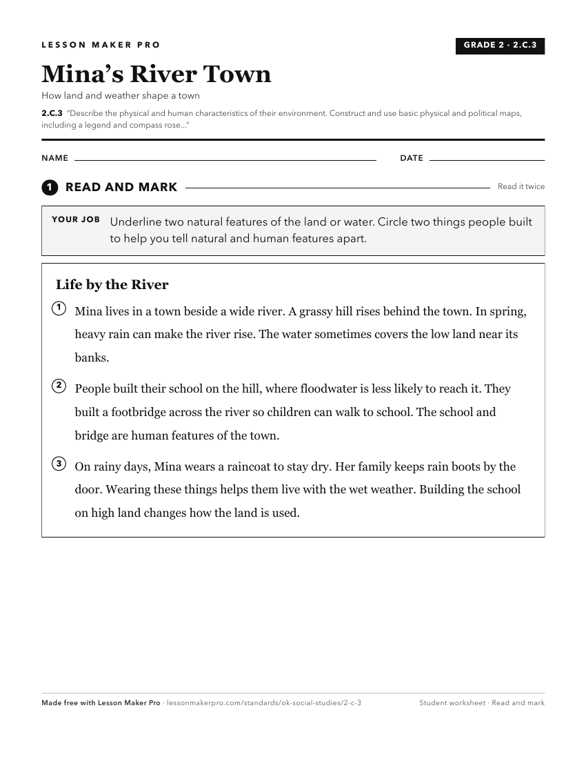
A ready-to-print activity worksheet aligned to 2.C.3, with an answer key for the teacher on its own page. No account needed.
PDF, US Letter, prints cleanly in black and white.
Download the worksheetKeep exploring
Related Standards
- K.P.2.3.C
Identify how the physical environment impacts our daily lives and affects human activities.
- 2.P.2.3.C
Identify and describe how humans modify and adapt to their physical environment, using its natural and human resources.
- 1.P.2.3.C
Identify how the physical environment impacts our daily lives and affects human activities.
- 3.P.2.3.C
Identify and describe how humans modify and adapt to their physical environment, using its natural and human resources.
Turn this cluster into a lesson
Grade, subject, topic, and the complete cluster are prefilled. Create one free, no account needed.
Also for this cluster:Make a WorksheetMake a QuizMake a Sub Lesson