Indiana Social Studies IS.3.3
The Standard
Explain how glaciers shaped Indiana’s landscape and the contribution that glaciers had in terms of geology, fertile soil, and accessible fresh water resources.
2026 Indiana Academic Standards: K-12 Social Studies
Teacher's field guide
What This Standard Means
What Students Need to Do
- Students use an Indiana map to connect glacial deposits with flatter land, soils, and fresh water. They explain how sand and gravel left by meltwater can hold groundwater.
What Mastery Looks Like
- A student can explain why much of northern Indiana is flatter than the hillier south-central region. They can trace a path from glacial sediment to soil and from buried sand and gravel to a well.
Common Misconceptions
- Students may think ice itself made soil fertile. They may also assume glaciers covered every part of Indiana or that all groundwater sits in open underground lakes.
How to Assess It
- On an exit ticket, ask: Why might a northern Indiana farm have relatively flat, productive land and a well drawing from buried sand and gravel? Name the glacier's role in each.
Lesson moves
Ways to Teach It
Drag an ice cube across a clay slab dusted with sand, then sketch the grooves and sediment left behind.
Show an Indiana relief map and ask students to write why the north and south-central regions look different.
Give pairs till, sand and gravel, and lake basin cards to match with soil, groundwater, or surface-water clues.
Show a local well record from the Indiana DNR and have students find the sand or gravel layer that supplies water.
Free download
Printable IS.3.3 Worksheet
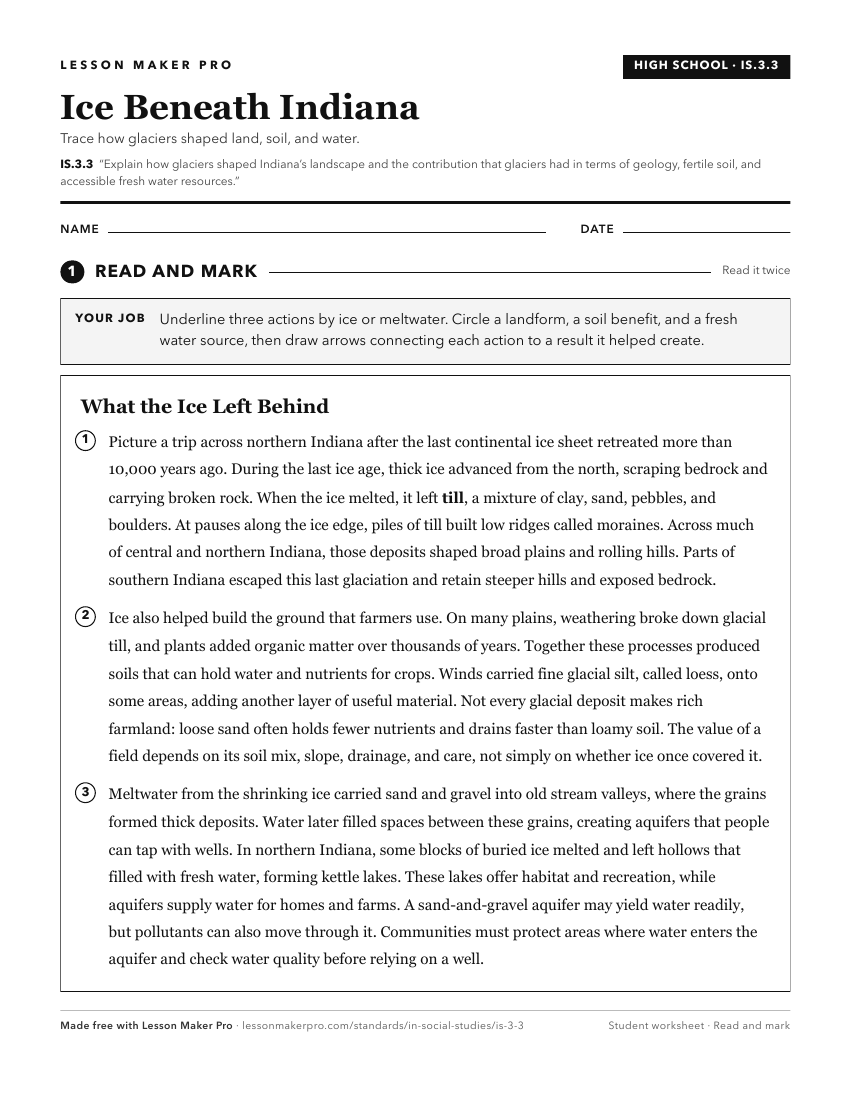
A ready-to-print activity worksheet aligned to IS.3.3, with an answer key for the teacher on its own page. No account needed.
PDF, US Letter, prints cleanly in black and white.
Download the worksheetKeep exploring
Related Standards
- 4.G.3
Map and describe the physical regions of Indiana and identify major natural resources and agricultural/crop regions.
- 4.G.5
Identify the challenges in the physical landscape of Indiana to early settlers and modern day economic development.
- IS.3.5
Explain the importance of major transportation routes, including rivers, in the exploration, settlement and growth of Indiana and in the state’s location within...
- 4.G.4
Explain how glaciers shaped Indiana’s landscape and environment.
Turn this exact standard into a lesson
Grade, subject, topic, and the complete standard are prefilled. Create one free, no account needed.
Also for this standard:Make a WorksheetMake a QuizMake a Sub Lesson