Idaho Social Studies 6-9.WG.6.2
The Standard
Explain and use the components of maps, compare different map projections, and explain the appropriate uses for each.
Idaho Content Standards: K-12 Social Studies
Teacher's field guide
What This Standard Means
What Students Need to Do
- Students use a map’s title, legend, scale, compass rose, and grid to find places and describe distances and directions. They compare world maps to see how each projection changes size or shape. They choose a map that fits the question they need to answer.
What Mastery Looks Like
- A student can find a place using a symbol or coordinates, estimate a distance, and give a direction. They can explain why a Mercator map makes places near the poles look too large and choose an equal-area map to compare country sizes.
Common Misconceptions
- Students may think Greenland is larger than Africa because it looks that way on a Mercator map. They may overlook the scale’s units or assume north is at the top without checking the compass rose.
How to Assess It
- Give students a town map with a marked school, a legend, a scale, and a compass rose, plus Mercator and equal-area world maps. Ask them to find the hospital, estimate its distance and direction from the school, then pick the world map that best compares country sizes and explain why.
Lesson moves
Ways to Teach It
Mark an X on an orange peel, then peel and flatten it; circle tears and gaps that show why flat maps distort Earth’s surface.
Show Mercator and equal-area world maps; ask, “Which would you choose to compare the sizes of Africa and Greenland, and why?”
Hand pairs a gridded map; call out coordinates, symbols, distances, and directions for them to find using its legend, scale, and compass rose.
Give students a trail map and an equal-area world map; ask which helps plan a hike and which compares country sizes fairly.
Free download
Printable 6-9.WG.6.2 Worksheet
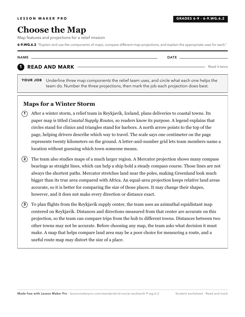
A ready-to-print activity worksheet aligned to 6-9.WG.6.2, with an answer key for the teacher on its own page. No account needed.
PDF, US Letter, prints cleanly in black and white.
Download the worksheetKeep exploring
Related Standards
- 6-9.WH.2.1
Develop and interpret different kinds of maps, globes, graphs, charts, databases, and models.
- 5.SS.2.1
Develop and use different kinds of maps, globes, graphs, charts, databases, and models to display and obtain information.
- K.SS.2.1
Demonstrate an understanding of maps and globes by:
- 5.SS.2.4
Read, analyze, and interpret maps, including the use of latitude and longitude aerial photography, satellite images, and other geospatial products.
Turn this exact standard into a lesson
Grade, subject, topic, and the complete standard are prefilled. Create one free, no account needed.
Also for this standard:Make a WorksheetMake a QuizMake a Sub Lesson