Idaho Social Studies 5.SS.2.1
The Standard
Develop and use different kinds of maps, globes, graphs, charts, databases, and models to display and obtain information.
Idaho Content Standards: K-12 Social Studies
Teacher's field guide
What This Standard Means
What Students Need to Do
- Students make simple maps, graphs, charts, place databases, and models from given information. They use those tools and a globe to find locations, compare numbers, and answer questions.
What Mastery Looks Like
- A student makes a map with a key and a graph with a labeled scale from the same town data. They use a globe to locate a place and search a town database for matching details. They can point to the evidence behind each answer.
Common Misconceptions
- Students may skip the map key or assume the top of every map is north. They may read the tallest bar as the largest land area when the bars show population. They may confuse a table's rows and columns.
How to Assess It
- Give students a map with Oak north of Pine and Elm south of Pine, plus a population table: Oak 20, Pine 40, Elm 10. Ask them to draw a labeled bar graph and name the town north of Pine.
Lesson moves
Ways to Teach It
Give pairs a globe, a paper world map, and sticky dots; mark the same three places on both and compare their positions.
Show a town map and population table; ask, 'Which helps you find a town, and which helps you compare populations?'
Give teams a six-row town database with direction and population columns; call 'north, under 5,000,' and have teams find matching rows.
Give students a sample bus route map and rider-count chart; use string and blocks to model the route and mark its busiest stop.
Free download
Printable 5.SS.2.1 Worksheet
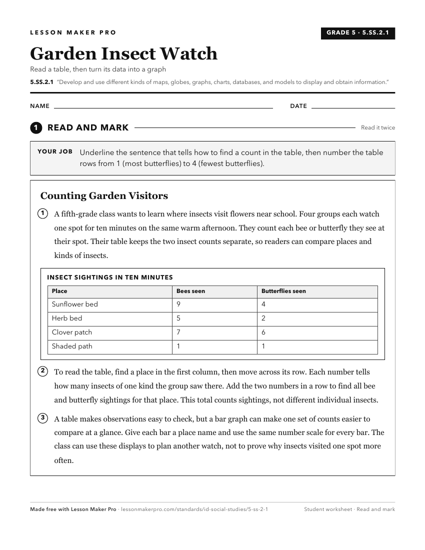
A ready-to-print activity worksheet aligned to 5.SS.2.1, with an answer key for the teacher on its own page. No account needed.
PDF, US Letter, prints cleanly in black and white.
Download the worksheetKeep exploring
Related Standards
- 6-9.WH.2.1
Develop and interpret different kinds of maps, globes, graphs, charts, databases, and models.
- K.SS.2.1
Demonstrate an understanding of maps and globes by:
- 2.SS.2.1
Develop geographic mapping skills using maps and globes by
- 5.SS.2.4
Read, analyze, and interpret maps, including the use of latitude and longitude aerial photography, satellite images, and other geospatial products.
Turn this exact standard into a lesson
Grade, subject, topic, and the complete standard are prefilled. Create one free, no account needed.
Also for this standard:Make a WorksheetMake a QuizMake a Sub Lesson