Idaho Social Studies 5.SS.2.4
The Standard
Read, analyze, and interpret maps, including the use of latitude and longitude aerial photography, satellite images, and other geospatial products.
Idaho Content Standards: K-12 Social Studies
Teacher's field guide
What This Standard Means
What Students Need to Do
- Students use latitude and longitude to find places on a map. They compare maps, aerial photos, and satellite images to describe an area and draw conclusions about it.
What Mastery Looks Like
- A student can find a marked place on a gridded map and give its coordinates. They can use details in an overhead image to explain something the map does not show.
Common Misconceptions
- Students often swap latitude and longitude or confuse north with south. They may expect every road to have a label in an overhead image, or forget that an older image may show changes that have since happened.
How to Assess It
- Give students a gridded map with a point marked at 40° N, 100° W and a satellite image of that spot. Ask for the coordinates and one feature visible in the image but not on the map.
Lesson moves
Ways to Teach It
Give pairs a street map, aerial photo, and satellite image of the same area; have them mark the same park on all three.
Ask, "Which view would help you choose a playground site, and what can you see that supports your choice?"
Post four coordinate pairs and a gridded world map; teams place dots, then check whether each falls on land or water.
Show a local weather map and satellite cloud image; ask students whether they would bring a raincoat tomorrow and why.
Free download
Printable 5.SS.2.4 Worksheet
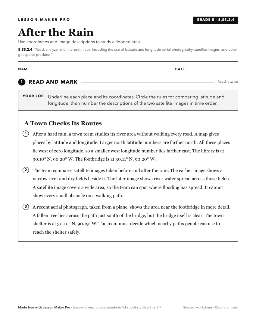
A ready-to-print activity worksheet aligned to 5.SS.2.4, with an answer key for the teacher on its own page. No account needed.
PDF, US Letter, prints cleanly in black and white.
Download the worksheetKeep exploring
Related Standards
- 3.SS.2.1
Develop an understanding of map reading by analyzing maps and globes using standard terms, including country, North Pole, Equator, Prime Meridian, hemisphere, r...
- 6-9.WH.2.1
Develop and interpret different kinds of maps, globes, graphs, charts, databases, and models.
- 5.SS.2.1
Develop and use different kinds of maps, globes, graphs, charts, databases, and models to display and obtain information.
- 2.SS.2.1
Develop geographic mapping skills using maps and globes by
Turn this exact standard into a lesson
Grade, subject, topic, and the complete standard are prefilled. Create one free, no account needed.
Also for this standard:Make a WorksheetMake a QuizMake a Sub Lesson