Idaho Social Studies 3.SS.2.1
The Standard
Develop an understanding of map reading by analyzing maps and globes using standard terms, including country, North Pole, Equator, Prime Meridian, hemisphere, region, latitude, South Pole, longitude, and time zones.
Idaho Content Standards: K-12 Social Studies
Teacher's field guide
What This Standard Means
What Students Need to Do
- Students use maps and globes to find countries, regions, poles, and the lines that divide Earth into hemispheres. They use latitude and longitude to describe locations and a time zone map to compare clock times.
What Mastery Looks Like
- A student can point to the Equator, Prime Meridian, North Pole, and South Pole on a globe. They can name a country's hemispheres, find a place using latitude and longitude, and compare its time with another place.
Common Misconceptions
- Students may think the Equator divides east from west or mistake a region for a country. They may swap latitude and longitude or assume every place has the same clock time.
How to Assess It
- Give students a globe grid and a time zone chart showing London at noon and New York five hours behind. Ask them to plot 20°N, 30°E, name its hemispheres, and write the time in New York.
Lesson moves
Ways to Teach It
Wrap yarn around a classroom globe to mark the Equator and Prime Meridian, then add sticky notes for both poles and four hemispheres.
Show a map of South America and ask, 'Is Brazil a country or a region? What is South America?'
Play coordinate bingo: call out latitude and longitude pairs, and have students cover matching squares on a numbered world map grid.
Using a time zone chart, find London's clock time when a New York class starts a video call at 9 a.m.
Free download
Printable 3.SS.2.1 Worksheet
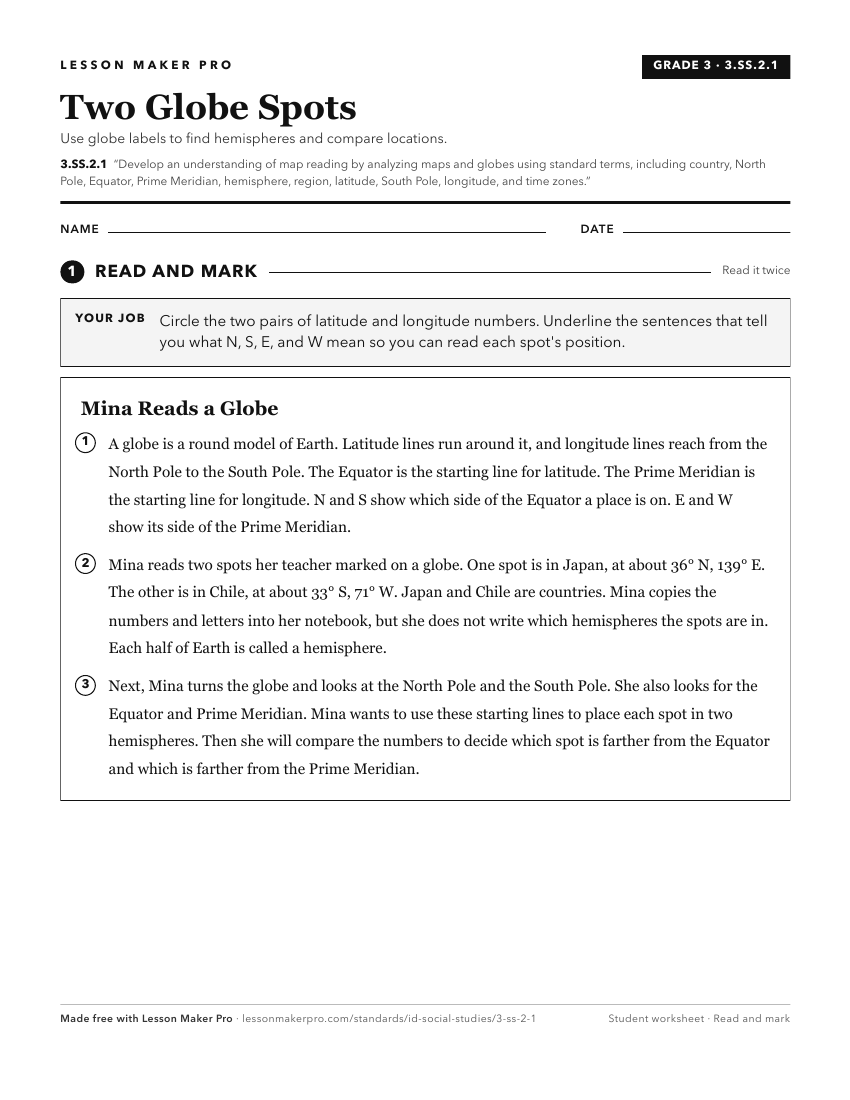
A ready-to-print activity worksheet aligned to 3.SS.2.1, with an answer key for the teacher on its own page. No account needed.
PDF, US Letter, prints cleanly in black and white.
Download the worksheetKeep exploring
Related Standards
- 6-9.WH.2.1
Develop and interpret different kinds of maps, globes, graphs, charts, databases, and models.
- K.SS.2.1
Demonstrate an understanding of maps and globes by:
- 2.SS.2.1
Develop geographic mapping skills using maps and globes by
- 5.SS.2.4
Read, analyze, and interpret maps, including the use of latitude and longitude aerial photography, satellite images, and other geospatial products.
Turn this exact standard into a lesson
Grade, subject, topic, and the complete standard are prefilled. Create one free, no account needed.
Also for this standard:Make a WorksheetMake a QuizMake a Sub Lesson