Idaho Social Studies 6-9.WG.2.2
The Standard
Describe the uses of technology, such as Global Positioning Systems (GPS) Geographic Information Systems (GIS), and satellite and aerial imaging.
Idaho Content Standards: K-12 Social Studies
Teacher's field guide
What This Standard Means
What Students Need to Do
- Students explain how GPS finds a location, GIS combines map layers, and aerial or satellite images show places from above. They choose a tool for a geographic question and explain their choice.
What Mastery Looks Like
- Given a flood scenario, students choose GPS to locate a rescue crew, GIS to compare roads with flood zones, and recent images to see where water has spread. They can say what each tool shows and what it does not.
Common Misconceptions
- Students may think GPS takes overhead photos or that GIS is just another name for a digital map. They may assume an aerial image shows current conditions, even if it was taken weeks ago.
How to Assess It
- Exit ticket: A town needs to locate a rescue crew, compare roads with flood zones, and see which fields are underwater. Match each job to GPS, GIS, or a recent aerial image, and explain why.
Lesson moves
Ways to Teach It
Give pairs a town map and clear overlays showing roads and flood zones; have them mark a safe evacuation route.
Show a GPS pin on a road and a recent aerial photo; ask which could show whether the road is flooded and why.
Read three scenarios aloud: locating a bus, comparing bus stops with homes, and checking new construction; students raise GPS, GIS, or image cards.
Open a satellite view of the school; have students mark trees near the playground and explain how the image could guide shade planning.
Free download
Printable 6-9.WG.2.2 Worksheet
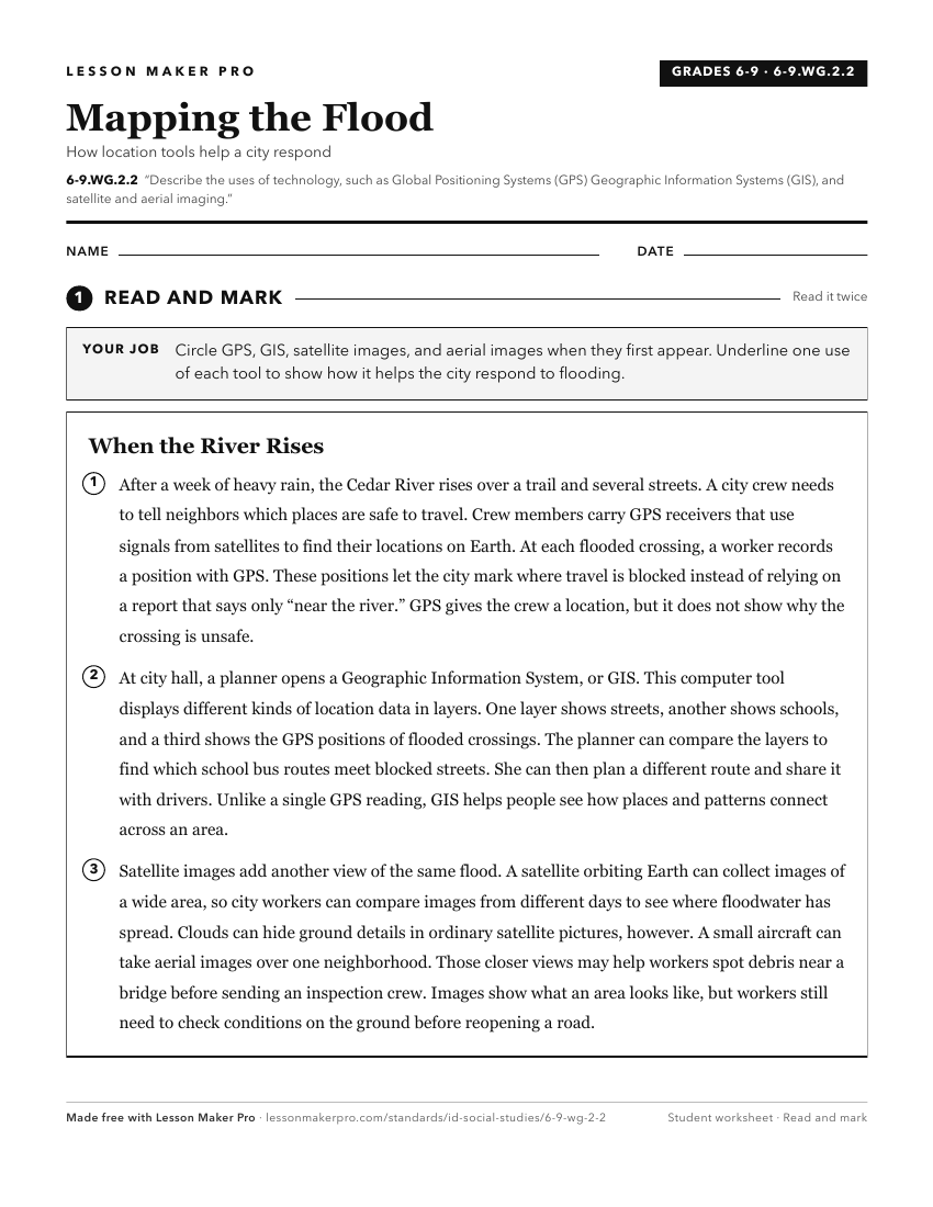
A ready-to-print activity worksheet aligned to 6-9.WG.2.2, with an answer key for the teacher on its own page. No account needed.
PDF, US Letter, prints cleanly in black and white.
Download the worksheetKeep exploring
Related Standards
- 6-9.WG.6.2
Explain and use the components of maps, compare different map projections, and explain the appropriate uses for each.
- 5.SS.2.1
Develop and use different kinds of maps, globes, graphs, charts, databases, and models to display and obtain information.
- 2.SS.2.1
Develop geographic mapping skills using maps and globes by
- 5.SS.2.4
Read, analyze, and interpret maps, including the use of latitude and longitude aerial photography, satellite images, and other geospatial products.
Turn this exact standard into a lesson
Grade, subject, topic, and the complete standard are prefilled. Create one free, no account needed.
Also for this standard:Make a WorksheetMake a QuizMake a Sub Lesson