Georgia SS8G1.c
The Standard
- SS8G1
- Describe Georgia's geography and climate.
Locate key physical features of Georgia and explain their importance; include the Fall Line, Okefenokee Swamp, Appalachian Mountains, Chattahoochee and Savannah Rivers, and barrier islands.
Georgia Standards of Excellence for Social Studies · Describe Georgia's geography and climate.
Teacher's field guide
What This Standard Means
What Students Need to Do
- Students find six major land and water features on a Georgia map. They explain how each feature affects settlement, transportation, jobs, water, wildlife, or protection from storms.
What Mastery Looks Like
- Students accurately label the features on a blank state map. They connect each feature to a specific effect, such as river trade, mountain tourism, wetland habitat, or coastal protection.
Common Misconceptions
- Students may mistake the Fall Line for a political border or mountain ridge. They often switch the Chattahoochee and Savannah Rivers or place the Okefenokee Swamp along the ocean. Some place the barrier islands on the mainland.
How to Assess It
- Give students a blank Georgia map. Ask them to label all six features and write one sentence explaining the importance of any two.
Lesson moves
Ways to Teach It
On a printed Georgia map, students use yarn for rivers, clay for mountains, sponge for swamp, and foil for barrier islands.
Ask, "Which feature most shaped where Georgians settled or worked? Use its location and one historical or economic effect."
Teams draw feature clue cards, point to each place on a wall map, and earn a point for explaining one effect.
Compare a Savannah hurricane map with a barrier island map, then explain how the islands reduce wave energy before it reaches the mainland.
Free download
Printable SS8G1.c Worksheet
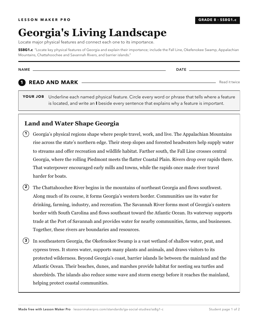
A ready-to-print activity worksheet aligned to SS8G1.c, with an answer key for the teacher on its own page. No account needed.
PDF, US Letter, prints cleanly in black and white.
Download the worksheetKeep exploring
Related Standards
- SS2G1.a
Locate and compare the geographic regions of Georgia: Blue Ridge, Piedmont, Coastal Plain, Ridge and Valley, and Appalachian Plateau.
- SS2G1.b
Locate on a physical map the major rivers: Savannah, Flint, and Chattahoochee.
- SS8G1.b
Distinguish among the five geographic regions of Georgia in terms of location, climate, agriculture, and economic contribution.
- SS2G1
Locate and compare major topographical features of Georgia and describe how these features define Georgia's surface.
Turn this exact standard into a lesson
Grade, subject, topic, and the complete standard are prefilled. Create one free, no account needed.
Also for this standard:Make a WorksheetMake a QuizMake a Sub Lesson