Georgia SS6G7.b
The Standard
- SS6G7
- Locate selected features of Europe.
Locate on a world and regional political-physical map the countries of France, Germany, Italy, Russia, Spain, Ukraine, and United Kingdom.
Georgia Standards of Excellence for Social Studies · Locate selected features of Europe.
Teacher's field guide
What This Standard Means
What Students Need to Do
- Students point to and label each target country on a world map and a closer map of Europe. They use borders, coastlines, shapes, and nearby countries to verify locations.
What Mastery Looks Like
- A student correctly labels all seven countries on an unmarked map, even when the scale or style changes. The student gives accurate clues, such as Italy’s boot shape or Spain’s location beside Portugal.
Common Misconceptions
- Students often label England instead of the United Kingdom or treat the entire British Isles as one country. They may overlook Russia because it spans two continents or confuse the positions of France, Germany, and Ukraine.
How to Assess It
- Give students an unlabeled map of Europe and a small world map. Ask them to label all seven target countries and write one location clue for any two.
Lesson moves
Ways to Teach It
Give pairs country-shaped cutouts and a blank Europe outline; students place and label the seven targets, then check with an atlas.
Ask students to write which coastline, border, shape, or neighboring country best helps them find each target and explain why.
Play Map Relay: teams draw a country card, point to it on a projected blank map, and earn a point for accuracy.
Match a familiar landmark or news dateline to its country, then pin each country on a classroom wall map.
Free download
Printable SS6G7.b Worksheet
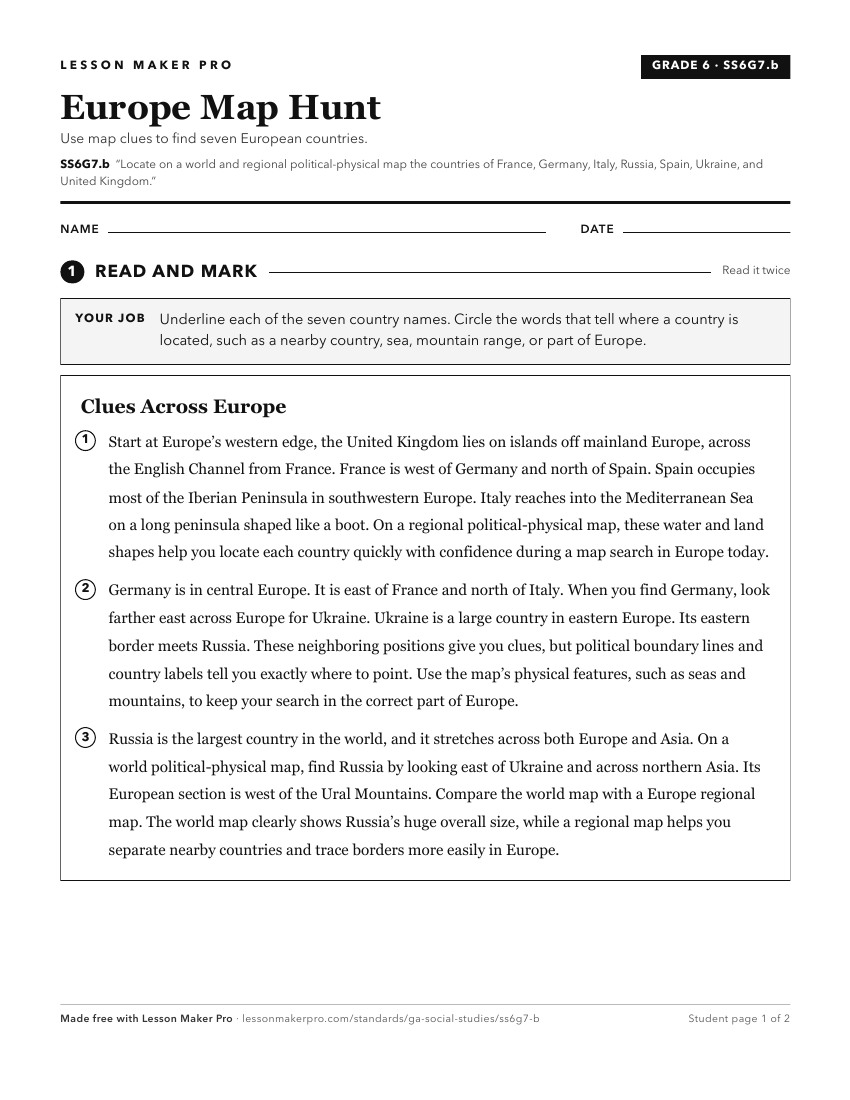
A ready-to-print activity worksheet aligned to SS6G7.b, with an answer key for the teacher on its own page. No account needed.
PDF, US Letter, prints cleanly in black and white.
Download the worksheetKeep exploring
Related Standards
- SS6G1.b
Locate on a world and regional political-physical map the countries of Brazil, Chile, Colombia, Cuba, Mexico, and Panama.
- SS6G7.a
Locate on a world and regional political-physical map: the Danube River, Rhine River, English Channel, Mediterranean Sea, European Plain, the Alps, Pyrenees, Ur...
- SS7G9.b
Locate on a world and regional political-physical map the countries of China, India, Japan, North Korea, South Korea, and Vietnam.
- SS7G5.b
Locate on a world and regional political-physical map: Afghanistan, Iran, Iraq, Israel, Kuwait, Saudi Arabia, Syria, Turkey, Gaza Strip, and West Bank.
Turn this exact standard into a lesson
Grade, subject, topic, and the complete standard are prefilled. Create one free, no account needed.
Also for this standard:Make a WorksheetMake a QuizMake a Sub Lesson