Georgia SS5G2.b
The Standard
- SS5G2
- Explain the reasons for the spatial patterns of economic activities.
Locate primary agricultural and industrial locations since the turn of the 20th century and explain how factors such as population, transportation, and resources have influenced these areas (e.g., Chicago's rapid growth at the turn of the century).
Georgia Standards of Excellence for Social Studies · Explain the reasons for the spatial patterns of economic activities.
Teacher's field guide
What This Standard Means
What Students Need to Do
- Students locate major U.S. farming and manufacturing areas that developed after 1900. They explain how workers, markets, transportation routes, and nearby resources shaped each location.
What Mastery Looks Like
- Students accurately label places such as Chicago, the Great Plains, and California’s Central Valley on a map. They support each location with a specific geographic or economic factor.
Common Misconceptions
- Students may confuse places that produce raw materials with places that manufacture goods. They may assume resources alone determine location or treat current patterns as unchanged since 1900.
How to Assess It
- Give students a blank U.S. map and ask them to mark Chicago or the Great Plains. Have them explain one factor that shaped economic growth there.
Lesson moves
Ways to Teach It
Layer population, railroad, resource, and production maps on tracing paper, then have groups circle places where several factors overlap.
Ask students to write which mattered most to Chicago’s growth, population, transportation, or resources, and defend their choice with two details.
Play a location match game using place cards, economic activity cards, and factor cards such as railroads, workers, water, and fertile soil.
Trace a cereal box from grain-growing regions to a processing city, then map the transportation routes used to reach local stores.
Free download
Printable SS5G2.b Worksheet
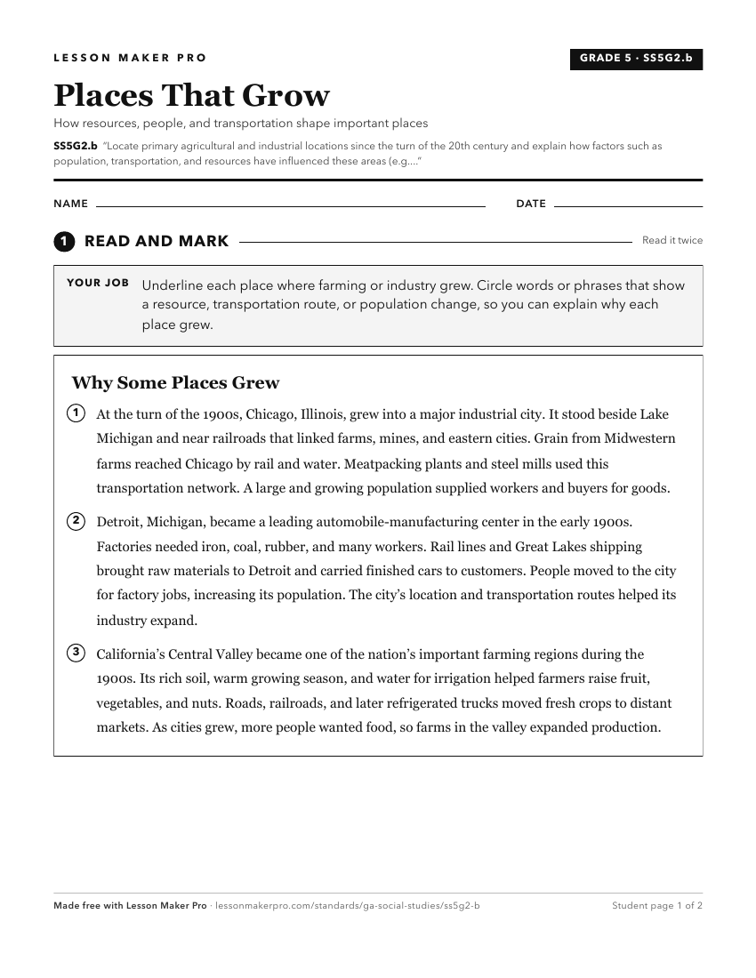
A ready-to-print activity worksheet aligned to SS5G2.b, with an answer key for the teacher on its own page. No account needed.
PDF, US Letter, prints cleanly in black and white.
Download the worksheetKeep exploring
Related Standards
- SS5H1
Describe how life changed in America at the turn of the century.
- SS5G2.a
Locate primary agricultural and industrial locations between the end of the Civil War and 1900 and explain how factors such as population, transportation, and r...
- SS8H10.a
Explain how technology transformed agriculture and created a population shift within the state.
- SS6G9
Explain the impact of location, climate, natural resources, and population distribution on Europe.
Turn this exact standard into a lesson
Grade, subject, topic, and the complete standard are prefilled. Create one free, no account needed.
Also for this standard:Make a WorksheetMake a QuizMake a Sub Lesson