Georgia SS5G2.a
The Standard
- SS5G2
- Explain the reasons for the spatial patterns of economic activities.
Locate primary agricultural and industrial locations between the end of the Civil War and 1900 and explain how factors such as population, transportation, and resources have influenced these areas (e.g., Pittsburgh's rapid growth in the late nineteenth century).
Georgia Standards of Excellence for Social Studies · Explain the reasons for the spatial patterns of economic activities.
Teacher's field guide
What This Standard Means
What Students Need to Do
- Students identify major farming and manufacturing regions on a U.S. map from 1865 to 1900. They explain how resources, workers, markets, railroads, rivers, and ports shaped each location.
What Mastery Looks Like
- Students can locate Pittsburgh steel, Chicago meatpacking, Southern cotton, and Great Plains grain and cattle. They connect each place to at least two factors using map evidence.
Common Misconceptions
- Students may think factories developed randomly or only near customers. They may confuse where raw materials were produced with where goods were processed, or apply modern economic patterns to the 1800s.
How to Assess It
- Give students a blank U.S. map. Ask them to mark one agricultural region and one industrial city, then explain two location factors for each.
Lesson moves
Ways to Teach It
Place resource, product, city, and transportation cards on a large floor map, then connect related cards with string.
Write a short response explaining why Pittsburgh became a steel center rather than another randomly chosen city.
Play a card matching game that pairs Pittsburgh, Chicago, the South, and the Great Plains with products and location factors.
Compare an 1890 railroad map with a current shipping map, then identify routes that still connect farms, resources, cities, and markets.
Free download
Printable SS5G2.a Worksheet
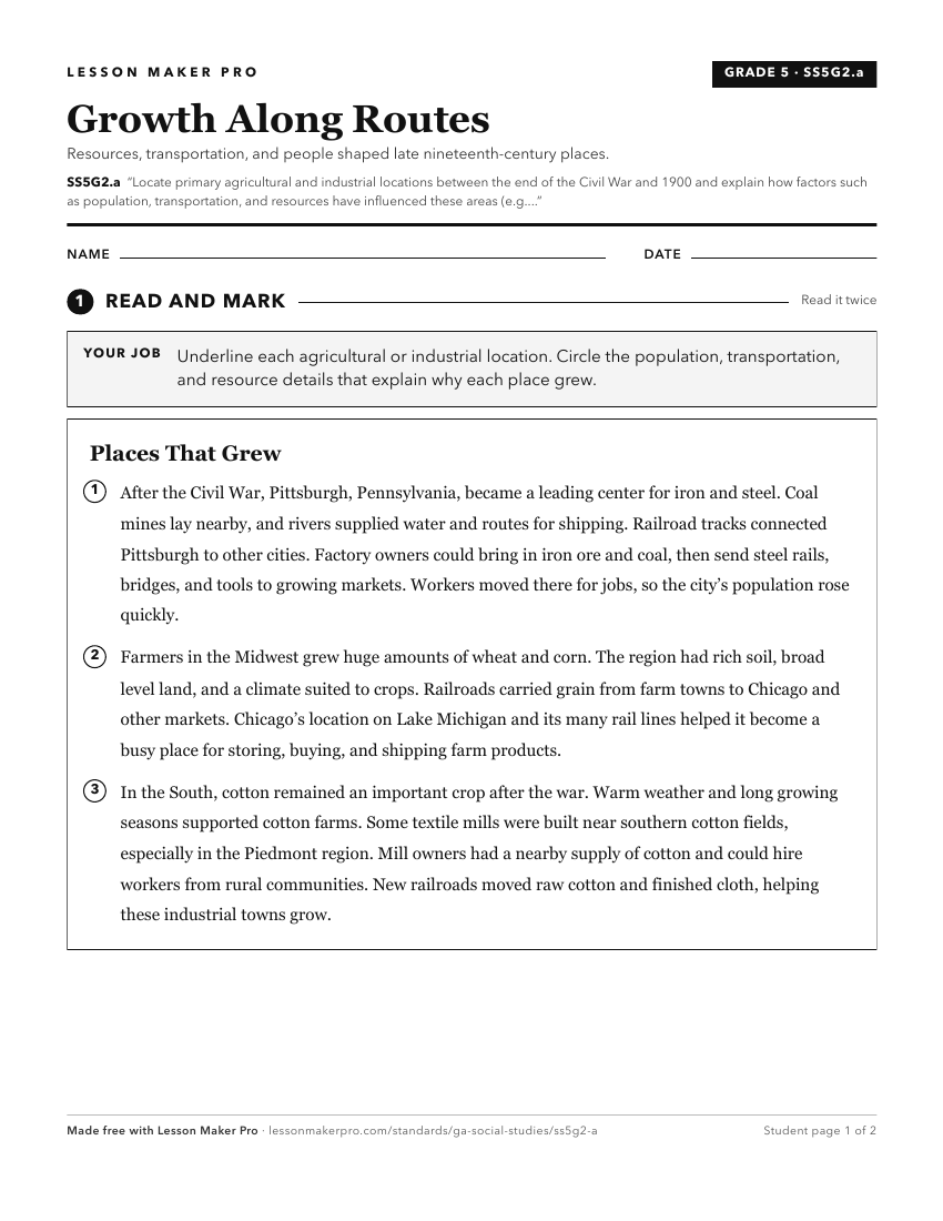
A ready-to-print activity worksheet aligned to SS5G2.a, with an answer key for the teacher on its own page. No account needed.
PDF, US Letter, prints cleanly in black and white.
Download the worksheetKeep exploring
Related Standards
- SS8H4.c
Explain how technological developments, including the cotton gin and railroads, had an impact on Georgia's growth.
- SS5G2.b
Locate primary agricultural and industrial locations since the turn of the 20th century and explain how factors such as population, transportation, and resource...
- SS5G1.a
Locate important man-made places; include the Chisholm Trail; Pittsburgh, PA; Kitty Hawk, NC; Pearl Harbor, HI; Montgomery, AL.; and Chicago, IL.
- SS8H10.a
Explain how technology transformed agriculture and created a population shift within the state.
Turn this exact standard into a lesson
Grade, subject, topic, and the complete standard are prefilled. Create one free, no account needed.
Also for this standard:Make a WorksheetMake a QuizMake a Sub Lesson