Florida SS.8.G.4.6
The Standard
- SS.8.G.4
- Understand the characteristics, distribution, and migration of human populations.
Use political maps to describe changes in boundaries and governance throughout American history.
Florida Next Generation Sunshine State Standards for Social Studies
Teacher's field guide
What This Standard Means
What Students Need to Do
- Students compare dated political maps and track where borders moved, territories changed hands, or states formed. They explain how each change affected who controlled a place and support their explanation with map evidence.
What Mastery Looks Like
- Given two dated maps, a student accurately identifies land gained, lost, or reorganized. The student names the governing power before and after, using borders, labels, dates, or legends as evidence.
Common Misconceptions
- Students may project modern state lines onto earlier periods. They may assume acquired territory became states immediately or that every boundary shift followed a war. They may notice a border moved but miss the change in governing authority.
How to Assess It
- Show two dated maps of the same region. Ask students to name the boundary change, identify who governed before and after, and cite one piece of map evidence.
Lesson moves
Ways to Teach It
Layer transparent maps from 1783, 1803, and 1848, then shade land gained and label the governing nation before each change.
Ask students to write: How did the Louisiana Purchase change both national boundaries and who governed the people living there?
Play map sequence cards, with teams arranging dated maps chronologically and earning points for correctly explaining each boundary change.
Use county history sources to identify which governments controlled the local area over time, then mark those changes on a map.
Free download
Printable SS.8.G.4.6 Worksheet
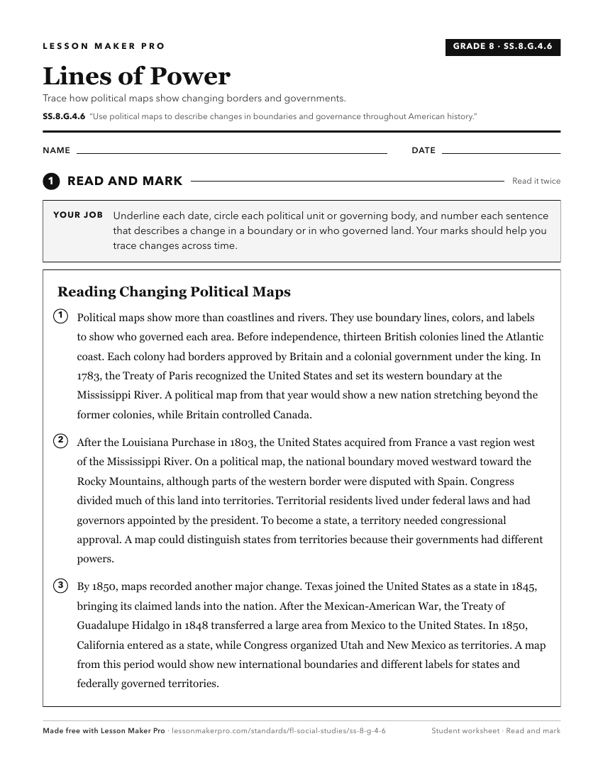
A ready-to-print activity worksheet aligned to SS.8.G.4.6, with an answer key for the teacher on its own page. No account needed.
PDF, US Letter, prints cleanly in black and white.
Download the worksheetKeep exploring
Related Standards
- SS.8.G.6.1
Use appropriate maps and other graphic representations to analyze geographic problems and changes over time throughout American history.
- SS.7.G.1.3
Interpret maps to identify geopolitical divisions and boundaries of places in North America.
- SS.7.G.4.2
Use maps and other geographic tools to examine the importance of demographics within political divisions of the United States.
- SS.8.G.1.1
Use maps to explain physical and cultural attributes of major regions throughout American history.
Turn this exact standard into a lesson
Grade, subject, topic, and the complete standard are prefilled. Create one free, no account needed.
Also for this standard:Make a WorksheetMake a QuizMake a Sub Lesson