Florida SS.8.G.1.1
The Standard
- SS.8.G.1
- Understand how to use maps and other geographic representations, tools, and technology to report information.
Use maps to explain physical and cultural attributes of major regions throughout American history.
Florida Next Generation Sunshine State Standards for Social Studies
Teacher's field guide
What This Standard Means
What Students Need to Do
- Students read historical and thematic maps to identify a region’s landforms, climate, resources, settlement patterns, and cultural features. They use map evidence to explain regional differences and changes over time.
What Mastery Looks Like
- Students can compare two regions during a given period and cite specific symbols, labels, or patterns from maps. They can explain how geography influenced settlement, work, movement, or culture.
Common Misconceptions
- Students may apply current borders or cultural patterns to earlier periods. They may confuse physical features with human-made features, overlook the legend, or treat nearby patterns as proof of cause.
How to Assess It
- Give students a physical map and a settlement map from the same period. Ask: What geographic feature shaped settlement in one region, and what map evidence supports your answer?
Lesson moves
Ways to Teach It
Place tracing paper over physical and settlement maps of the colonies, then mark where rivers, ports, and towns overlap.
Write: How did one physical feature shape work, movement, or culture in the Great Plains, Northeast, South, or West?
Play a map-evidence match game by pairing region cards with map clues, then defend each match using the legend.
Compare a current Census language map with a historical migration map, then explain one pattern visible in your state.
Free download
Printable SS.8.G.1.1 Worksheet
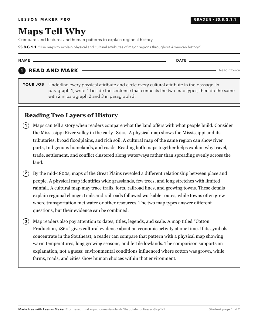
A ready-to-print activity worksheet aligned to SS.8.G.1.1, with an answer key for the teacher on its own page. No account needed.
PDF, US Letter, prints cleanly in black and white.
Download the worksheetKeep exploring
Related Standards
- SS.8.G.6.1
Use appropriate maps and other graphic representations to analyze geographic problems and changes over time throughout American history.
- SS.7.G.3.1
Use maps to describe the location, abundance, and variety of natural resources in North America.
- SS.8.G.4.4
Interpret databases, case studies and maps to describe the role that regions play in influencing trade, migration patterns, and cultural or political interactio...
- SS.8.G.1.2
Use appropriate geographic tools and terms to identify and describe significant places, and regions in American history.
Turn this exact standard into a lesson
Grade, subject, topic, and the complete standard are prefilled. Create one free, no account needed.
Also for this standard:Make a WorksheetMake a QuizMake a Sub Lesson