Florida SS.8.G.4.4
The Standard
- SS.8.G.4
- Understand the characteristics, distribution, and migration of human populations.
Interpret databases, case studies and maps to describe the role that regions play in influencing trade, migration patterns, and cultural or political interaction in the United States throughout time.
Florida Next Generation Sunshine State Standards for Social Studies
Teacher's field guide
What This Standard Means
What Students Need to Do
- Students use maps, data tables, and short historical cases to identify regional patterns in trade, migration, and interaction. They explain how location, resources, transportation, borders, and settlement shaped those patterns across different periods.
What Mastery Looks Like
- A student can compare two regions or periods and explain why people, goods, ideas, or political influence moved. The explanation cites specific source details and connects them to a regional factor.
Common Misconceptions
- Students may treat regions as fixed areas that never change. They may assume movement has one cause, confuse correlation with causation, or describe a pattern without citing evidence.
How to Assess It
- Display an 1860 railroad map beside an 1850 to 1860 regional population table. Ask: Which region likely gained the most trade or migration, and what two source details support your claim?
Lesson moves
Ways to Teach It
Students place resource, city, port, and railroad cards on a blank U.S. map, then connect likely trade and migration routes with yarn.
After reading two regional case studies, ask: How did location shape who moved, what was traded, and which groups interacted?
Run a source-match game where teams pair map and database clues with Northeast, South, Midwest, or West, then defend each match.
Have students trace one current product from origin to local store and explain how regional resources and transport links shape its route.
Free download
Printable SS.8.G.4.4 Worksheet
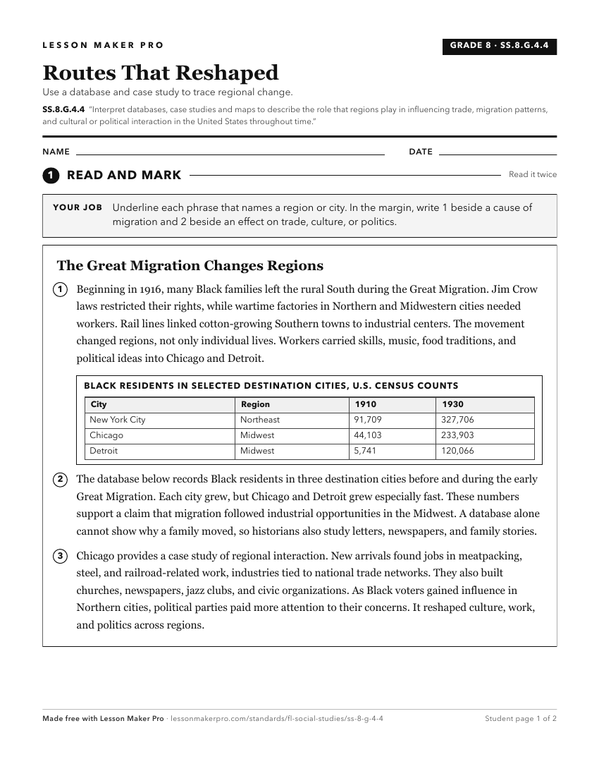
A ready-to-print activity worksheet aligned to SS.8.G.4.4, with an answer key for the teacher on its own page. No account needed.
PDF, US Letter, prints cleanly in black and white.
Download the worksheetKeep exploring
Related Standards
- SS.8.G.4.2
Use geographic terms and tools to analyze the effects throughout American history of migration to and within the United States, both on the place of origin and ...
- SS.7.G.1.3
Interpret maps to identify geopolitical divisions and boundaries of places in North America.
- SS.8.G.1.1
Use maps to explain physical and cultural attributes of major regions throughout American history.
- SS.8.G.2.3
Use geographic terms and tools to analyze case studies of how selected regions of the United States have changed over time.
Turn this exact standard into a lesson
Grade, subject, topic, and the complete standard are prefilled. Create one free, no account needed.
Also for this standard:Make a WorksheetMake a QuizMake a Sub Lesson