Florida SS.7.G.6.1
The Standard
- SS.7.G.6
- Understand how to apply geography to interpret the past and present, and plan for the future.
Use Geographic Information Systems (GIS) or other technology to view maps of current information about the United States.
Florida Next Generation Sunshine State Standards for Social Studies
Teacher's field guide
What This Standard Means
What Students Need to Do
- Students open a digital map, select layers, and use the legend, scale, labels, and data tools. They identify and explain geographic patterns in current U.S. data.
What Mastery Looks Like
- Students can find a location, turn layers on and off, and compare information across states or regions. They support one conclusion with map evidence and name the data source and date.
Common Misconceptions
- Students may confuse GIS with GPS or treat a digital map as a static picture. They may overlook the legend, assume all data are live, or mistake larger areas for larger values.
How to Assess It
- Give students a current U.S. weather, population, or election map. Ask: “Name one regional pattern, cite two map details, and record the source date.”
Lesson moves
Ways to Teach It
Use an online GIS viewer to toggle population and weather layers, then record two patterns that appear when the layers overlap.
Show a current U.S. map and ask, “What claim can you make, and which map details support it?”
Play Layer Detective by revealing one GIS layer at a time while teams predict the data type and justify each guess.
Use a current wildfire, drought, or storm map to choose where emergency supplies should go and explain the choice with map evidence.
Free download
Printable SS.7.G.6.1 Worksheet
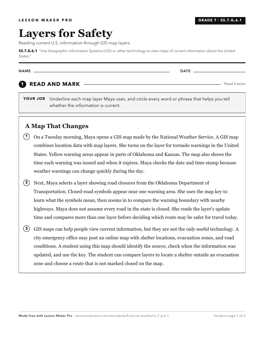
A ready-to-print activity worksheet aligned to SS.7.G.6.1, with an answer key for the teacher on its own page. No account needed.
PDF, US Letter, prints cleanly in black and white.
Download the worksheetKeep exploring
Related Standards
- SS.8.G.6.1
Use appropriate maps and other graphic representations to analyze geographic problems and changes over time throughout American history.
- SS.8.G.1
Understand how to use maps and other geographic representations, tools, and technology to report information.
- SS.6.G.1
Understand how to use maps and other geographic representations, tools, and technology to report information.
- SS.7.G.1
Understand how to use maps and other geographic representations, tools, and technology to report information.
Turn this exact standard into a lesson
Grade, subject, topic, and the complete standard are prefilled. Create one free, no account needed.
Also for this standard:Make a WorksheetMake a QuizMake a Sub Lesson