Florida SS.6.G.6.2
The Standard
- SS.6.G.6
- Understand how to apply geography to interpret the past and present and plan for the future.
Compare maps of the world in ancient times with current political maps.
Florida Next Generation Sunshine State Standards for Social Studies
Teacher's field guide
What This Standard Means
What Students Need to Do
- Students compare ancient territories with modern countries, borders, and place names. They identify what changed, what remained, and which present-day countries occupy former regions or empires.
What Mastery Looks Like
- Students accurately match an ancient civilization or empire to its present-day location. They use map evidence to explain changes in borders, names, and political control.
Common Misconceptions
- Students may treat ancient borders as exact lines or assume ancient and modern place names match one-to-one. They may also confuse physical features, which often remain, with political boundaries, which change.
How to Assess It
- Give students maps of the Roman Empire and modern Europe. Ask them to name three current countries within Roman territory and describe one major boundary change.
Lesson moves
Ways to Teach It
Place a transparent modern map over an ancient empire map, then mark areas of overlap and changed borders with colored pencils.
Ask students to write: Why do political borders change while rivers, seas, and mountains usually remain in the same places?
Run a map matching game where students pair ancient regions with modern countries and justify each match using location clues.
Compare ancient Mesopotamia with a current Middle East map, then identify the modern countries that contain the Tigris and Euphrates Rivers.
Free download
Printable SS.6.G.6.2 Worksheet
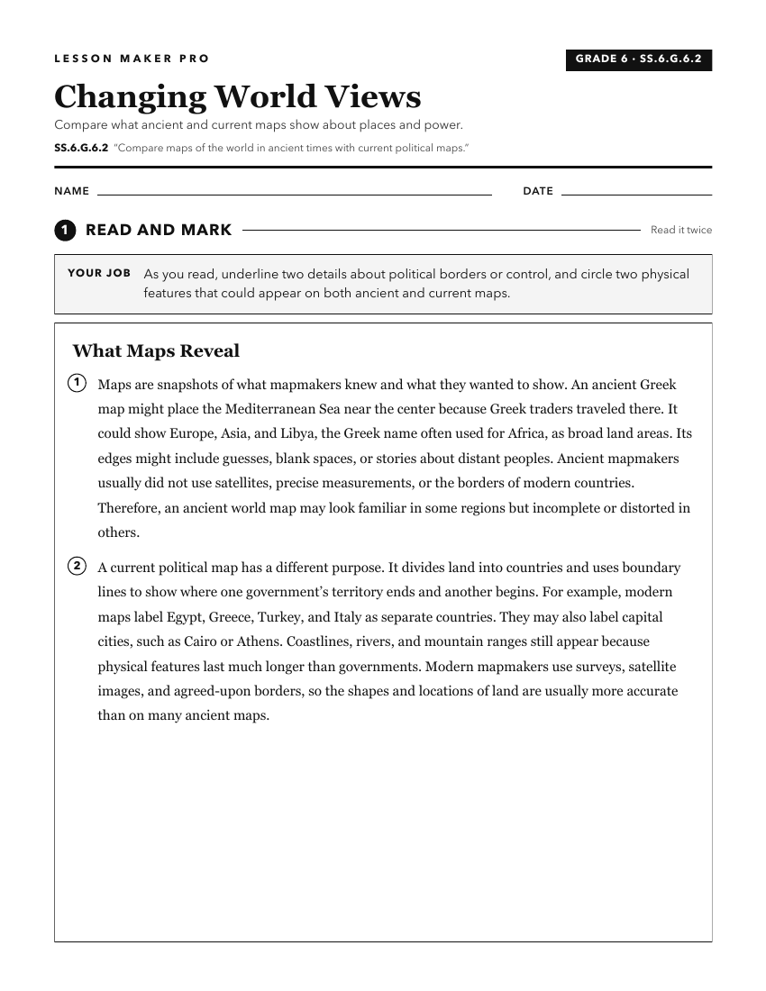
A ready-to-print activity worksheet aligned to SS.6.G.6.2, with an answer key for the teacher on its own page. No account needed.
PDF, US Letter, prints cleanly in black and white.
Download the worksheetKeep exploring
Related Standards
- SS.8.G.4.6
Use political maps to describe changes in boundaries and governance throughout American history.
- SS.6.G.1.7
Use maps to identify characteristics and boundaries of ancient civilizations that have shaped the world today.
- SS.6.G.4.4
Map and analyze the impact of the spread of various belief systems in the ancient world.
- SS.6.G.2.7
Interpret choropleths or dot-density maps to explain the distribution of population in the ancient world.
Turn this exact standard into a lesson
Grade, subject, topic, and the complete standard are prefilled. Create one free, no account needed.
Also for this standard:Make a WorksheetMake a QuizMake a Sub Lesson