Florida SS.6.G.5.3
The Standard
- SS.6.G.5
- Understand how human actions can impact the environment.
Use geographic tools and terms to analyze how famine, drought, and natural disasters plagued many ancient civilizations.
Florida Next Generation Sunshine State Standards for Social Studies
Teacher's field guide
What This Standard Means
What Students Need to Do
- Students read maps, climate graphs, timelines, and physical features to identify environmental threats faced by ancient societies. They use terms such as drought, famine, floodplain, and migration to explain the effects.
What Mastery Looks Like
- Students use evidence from a geographic tool to connect an environmental event with changes in food supply, settlement, trade, or migration. They avoid claiming that one disaster alone ended a civilization.
Common Misconceptions
- Students may treat famine as a weather event instead of a severe food shortage with several possible causes. They may assume every flood was harmful or that a single disaster caused a civilization to collapse.
How to Assess It
- Give students a river map and a short rainfall graph. Ask them to identify one threat and explain two likely effects on a nearby ancient settlement.
Lesson moves
Ways to Teach It
Have pairs place drought, flood, earthquake, and volcanic eruption cards on a printed ancient world map, then label likely human responses.
Ask students to write: How could the same river help an ancient city one year and harm it the next?
Play an evidence match game where students pair map symbols, climate data, and disaster descriptions with likely effects on ancient communities.
Compare an ancient drought case with a current drought news report, focusing on food supply, migration, and available technology.
Free download
Printable SS.6.G.5.3 Worksheet
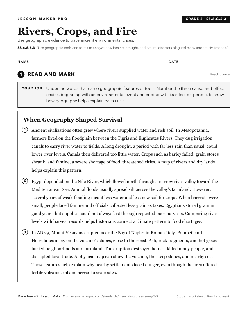
A ready-to-print activity worksheet aligned to SS.6.G.5.3, with an answer key for the teacher on its own page. No account needed.
PDF, US Letter, prints cleanly in black and white.
Download the worksheetKeep exploring
Related Standards
- SS.6.G.5.2
Use geographic terms and tools to explain why ancient civilizations developed networks of highways, waterways, and other transportation linkages.
- SS.6.G.1.7
Use maps to identify characteristics and boundaries of ancient civilizations that have shaped the world today.
- SS.6.G.2.1
Explain how major physical characteristics, natural resources, climate, and absolute and relative locations have influenced settlement, interactions, and the ec...
- SS.6.G.2.3
Analyze the relationship of physical geography to the development of ancient river valley civilizations.
Turn this exact standard into a lesson
Grade, subject, topic, and the complete standard are prefilled. Create one free, no account needed.
Also for this standard:Make a WorksheetMake a QuizMake a Sub Lesson